Mountains & hills · Central Scotland
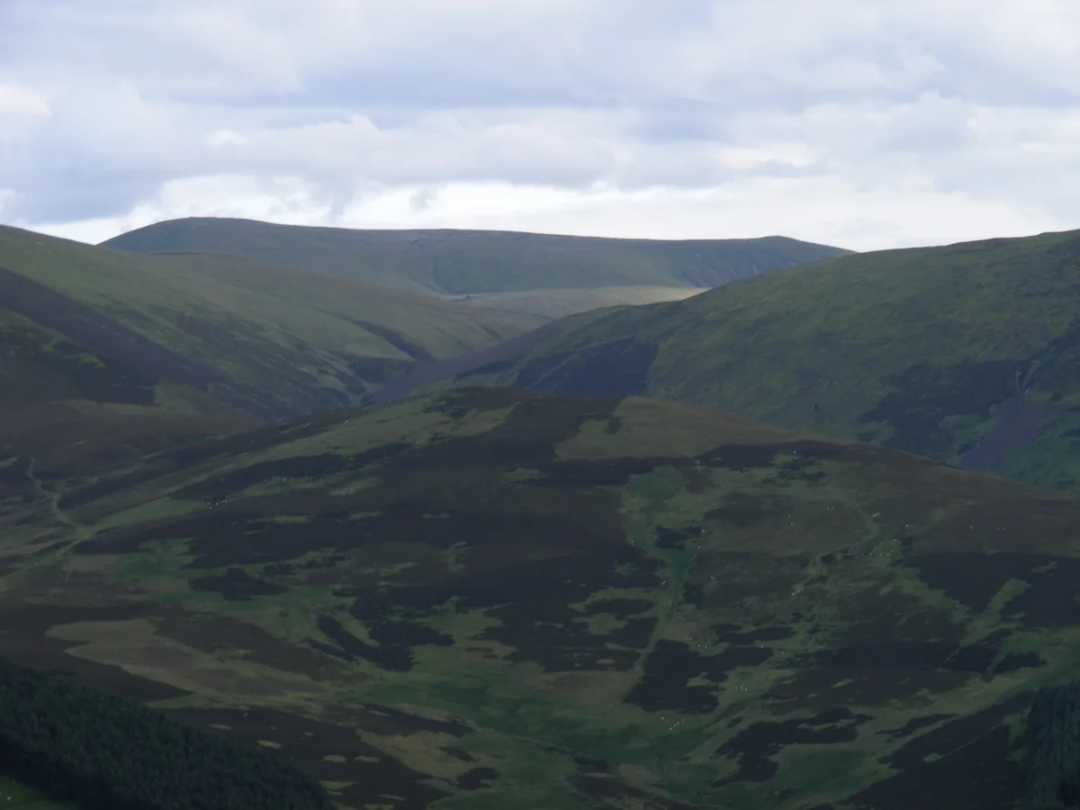
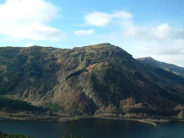
Chaplegill Hill
Chaplegill Hill — mountain in scotland central. Elevation: 696 m.

Alan O'Dowd — CC BY-SA 2.0 via Wikimedia Commons licence
Plan your visit
- Typical visit
- 3 h–8 h
- Best time of year
- Late spring – early autumn (May–Oct)
About
Chaplegill Hill is a mountain located in scotland central. Elevation: 696 m. A named British peak recorded in OpenStreetMap. Peaks are typically named on Ordnance Survey 1:50k mapping.
Photo gallery
Place summary
Chaplegill Hill is a mountain located in central Scotland. It offers a natural landscape typical of the region, with opportunities for walking and exploring the surrounding terrain. The area is characterised by its rugged features and scenic views, appealing to those interested in outdoor activities and nature photography. Visitors can expect a tranquil environment, ideal for hiking and enjoying the local flora and fauna.
AI-generated from the structured facts on this page (operator, designation, listing, era). Not a substitute for visiting.
- Coordinates
- 55.5581, -3.4807
Sources
- osm: n339879871 (ODbL)
- wikidata: Q96374764 (CC0)
Other places nearby
Loading nearby places…
Nearby
📷 5Mountains & hills · Central Scotland
Chapelgill Hill
Chapelgill Hill — a hill or mountain in scotland central.
📷 5Mountains & hills · Central Scotland
Birnies Bowrock
Birnies Bowrock — mountain in scotland central. Elevation: 673 m.
 📷 5
📷 5Mountains & hills · Central Scotland
Cardon Hill
Cardon Hill — mountain in scotland central. Elevation: 675 m.
 📷 5
📷 5Mountains & hills · Central Scotland
Congrie Hill
Congrie Hill — mountain in scotland central. Elevation: 428 m.
 📷 3
📷 3Natural landmarks · Central Scotland
Culter Fell
Culter Fell — 748m high mountain in Scotland.
 📷 3
📷 3Mountains & hills · Central Scotland
Culter Fell
Culter Fell — Named summit at 747 m.
More mountains in this region
 📷 3
📷 3Mountains & hills · Central Scotland
Abbey Hill
Abbey Hill — Named summit at 278 m.
 📷 3
📷 3Mountains & hills · Central Scotland
Aberlady Bay
Aberlady Bay — bay on the north coast of East Lothian, Scotland, UK.
 📷 3
📷 3Mountains & hills · Central Scotland
Allermuir Hill
Allermuir Hill — Named summit at 493 m.
 📷 3
📷 3Mountains & hills · Central Scotland
Ardnandave
Ardnandave — Named summit at 715 m.
Frequently asked questions
- Where is Chaplegill Hill?
- Chaplegill Hill is in central Scotland, United Kingdom.
- What is Chaplegill Hill?
- Chaplegill Hill — mountain in scotland central. Elevation: 696 m.
- How do I get to Chaplegill Hill?
- Its coordinates are 55.5581°, -3.4807°.