
Villages · South West England
Chapel Allerton
In or near Mark.
Chapel Allerton — a village in england south west.

PAUL FARMER — CC BY-SA 2.0 via Wikimedia Commons licence

Plan your visit
- Typical visit
- 1 h–2 h
- Nearest railway station
- Highbridge and Burnham · 9.3 km
About
A British village — settlements of this size traditionally cluster a green, parish church, pub and post office around historic land routes.
Photo gallery
Protected designations
- National Nature Reserve: SOMERSET WETLANDS
- National Nature Reserve: MENDIP
- Area of Outstanding Natural Beauty: Mendip Hills
- Ramsar wetland: Severn Estuary
Designations sourced from Natural England open data under OGL v3.
Place summary
Chapel Allerton is a village located in South-West England, with a population of approximately 340 residents. This small community is characterised by its rural setting and local amenities. The village offers a glimpse into traditional English village life, with a focus on community and local engagement.
AI-generated from the structured facts on this page (operator, designation, listing, era). Not a substitute for visiting.
- Coordinates
- 51.2486, -2.8481
- District
- Somerset
- Parish
- Chapel Allerton
- Postcode
- BS26 2PQ
- Parliamentary constituency
- Wells and Mendip Hills
- Population
- 340
- Nearest railway station
- Highbridge and Burnham — 9.3 km
Sources
- manual: geonames-2653371 (CC BY 4.0)
Other places nearby

Ashton Drove Motorhome Park
Caravan parks · 0.5 km

Chapel Allerton, Somerset
Museums · 0.5 km

Ashton Windmill
Windmills · 0.6 km
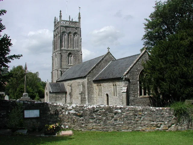
Church of St Gregory, Weare
Historic churches · 2.5 km

Weare
Villages · 2.5 km

Wedmore First School Academy
Natural landmarks · 3.3 km

Wedmore War Memorial
Memorials & monuments · 3.5 km

Wedmore
Villages · 3.5 km

Watersmeet farm campsite
Campsites · 3.5 km
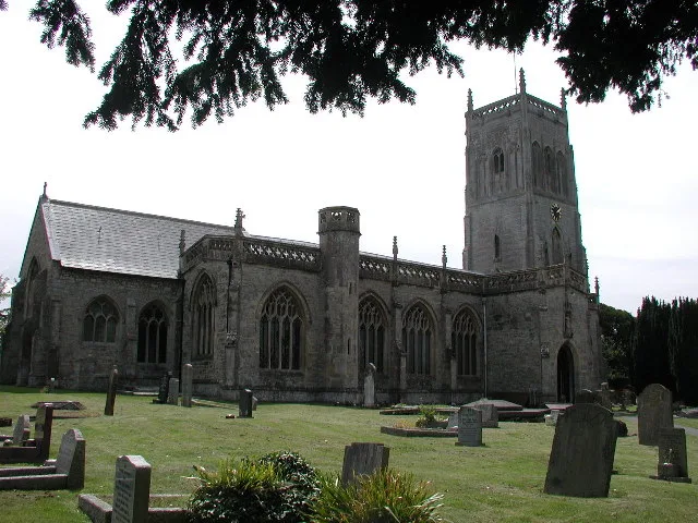
Church of St Mark, Mark
Historic churches · 3.7 km

Mark
Towns & cities · 4.1 km

Rooks Bridge
Villages · 4.5 km
Nearby
📷 5Caravan parks · South West England
Ashton Drove Motorhome Park
Ashton Drove Motorhome Park — a caravan park in england south west.
📷 5Museums · South West England
Chapel Allerton, Somerset
Chapel Allerton is a village and civil parish, south of Cheddar in the English county of Somerset. The parish includes the hamlets of Ashton and Stone Allerton.
📷 5Windmills · South West England
Ashton Windmill
Ashton Windmill is a windmill in the United Kingdom.
📷 5Historic churches · South West England
Church of St Gregory, Weare
Church of St Gregory, Weare — church in Weare, Somerset, England, UK.
📷 5📷 5Natural landmarks · South West England
Wedmore First School Academy
Wedmore First School Academy — a school heritage in england-south-west, United Kingdom.
Where to eat & stay near Chapel Allerton
Places to stay
📷 5Caravan parks · South West England
Ashton Drove Motorhome Park
Ashton Drove Motorhome Park — a caravan park in england south west.
📷 5Campsites · South West England
Watersmeet farm campsite
Watersmeet farm campsite — a campsite in england south west.
 📷 7
B&Bs · South West England
Old Manor House B&B
Old Manor House B&B — a bed-and-breakfast in england south west.
 📷 7
Hotels · South West England
The Lamb Inn
The Lamb Inn — a hotel in england south west.
 📷 5
Caravan parks · South West England
Coombes Cider Mill Caravan & Camping Park
Coombes Cider Mill Caravan & Camping Park — a caravan park in england south west.
 📷 5
Caravan parks · South West England
Lost Hope Farm
Lost Hope Farm — a caravan park in england south west.
Places to eat & drink
 📷 5
 📷 7
Historic pubs · South West England
King William Inn
King William Inn in England South West, United Kingdom.
 📷 5
 📷 5
Restaurants · South Wales
The Pavilion
The Pavilion — a restaurant in wales south.
 📷 5
Restaurants · South Wales
Muffins Tea Room & Brasserie
Muffins Tea Room & Brasserie — a restaurant in wales south.
 📷 5
More places in this region
 📷 5
 📷 5
 📷 5
 📷 5
Frequently asked questions
- Where is Chapel Allerton?
- Chapel Allerton is in South-West England, United Kingdom (postcode BS26 2PQ), in the parish of Chapel Allerton.
- What is Chapel Allerton?
- Chapel Allerton — a village in england south west.
- How do I get to Chapel Allerton?
- The nearest railway station is Highbridge and Burnham, about 9.3 km away. The nearest town is Mark. Drivers can use postcode BS26 2PQ.
- Is Chapel Allerton a protected site?
- Yes — Chapel Allerton is part of the SOMERSET WETLANDS National Nature Reserve and the MENDIP National Nature Reserve.
- How do I get to Chapel Allerton?
- Drivers can navigate to postcode BS26 2PQ. It sits within the Wells and Mendip Hills parliamentary constituency.