
Mountains & hills · South East England
Chanctonbury Ring
In or near Washington.
Chanctonbury Ring — Named summit at 242 m.

Wikimedia Commons contributors — see linked file page for photographer and licence licence

Plan your visit
- Typical visit
- 3 h–8 h
- Best time of year
- Late spring – early autumn (May–Oct)
- Nearest railway station
- East Worthing · 8.6 km
- Free entry
- Dog-friendly
Getting there & planning your visit
To visit Chanctonbury Ring, the nearest railway station is East Worthing, located 8.6 km away. The postcode for sat-nav is BN44 3DP. Entry to the site is free.
About
Chanctonbury Ring is a named summit in the United Kingdom. Wikidata describes it as: "Named summit at 242 m.". Coordinates: 50.8969°, -0.3813°.
Photo gallery
360° view
Imagery © Mapillary contributors, CC BY-SA 4.0
Protected designations
- Site of Special Scientific Interest: Chanctonbury Hill SSSI
Designations sourced from Natural England open data under OGL v3.
From the Wikipedia article
Chanctonbury Ring is a prehistoric hill fort atop Chanctonbury Hill on the South Downs, on the border of the civil parishes of Washington and Wiston in the English county of West Sussex. A ridgeway, now part of the South Downs Way, runs along the hill. It forms part of an ensemble of associated historical features created over a span of more than 2,000 years, including round barrows dating from the Bronze Age to the Saxon periods and dykes dating from the Iron Age and Roman periods. Consisting of a roughly circular low earthen rampart surrounded by a ditch, Chanctonbury Ring is thought to date to the late Bronze Age or early Iron Age. The purpose of the structure is unknown but it could have filled a variety of roles, including a defensive position, a cattle enclosure or even a religious shrine. After a few centuries of usage, it was abandoned for about five hundred years until it was reoccupied during the Roman period. Two Romano-British temples were built in the hill fort's interior, one of which may have been dedicated to a boar cult. After its final abandonment around the late fourth century AD, the hill fort remained unoccupied save for grazing cattle until a mid-18th-century landowner planted a ring of beech trees around its perimeter to beautify the site. They became a famous local landmark until largely being destroyed in the Great Storm of 1987. Periodic replanting on a number of occasions to replace old or destroyed trees has afforded archaeologists the opportunity to carry out a series of excavations which have revealed much about the history of the site.
Excerpt from Wikipedia under CC BY-SA 4.0. See the source article linked in Sources below.
Background
History
Chanctonbury Ring was investigated by archeologists in excavations carried out in 1869, 1909, 1977 and 1988–91. Evidence for human activity in the Neolithic and early Bronze Age has been found, but not settlement or occupation. The finds consisted of tools likely to have been used for exploiting woodland. The construction of a number of barrows on the top of Chanctonbury Hill suggests that the hilltop was seen as an area of special significance, perhaps because of its high visibility. It is conceivable that the domed summit now occupied by Chanctonbury Ring was used as a site for ritual activity on account of its prominent position along the South Downs ridgeway. If so, it is conceivable…
Description
Chanctonbury Ring is in a commanding position looking across the Sussex Weald to the north, on the edge of a steep natural escarpment to the northwest and northeast. It is at the middle point of a long, narrow and otherwise treeless plateau, approached via ridges to the east and west. A trig point is located about 400 m west of the Ring, recorded by the Ordnance Survey as 238 m above sea level. Although this was originally recorded as the top of Chanctonbury Hill and thus the Marilyn summit, recent measurements suggest that the area of the Ring is higher, about 241 m above sea level. The fort is defined by archaeologists as a "slight univallate hill fort", indicating a single-walled…
Visiting
There are two car parks at the base of the hill: to the north-east on Chanctonbury Ring Road off the A283 Washington Road, and to the west on Washington Bostal just off the A24 road. The hill is located just off the South Downs Way and enjoys extensive views to the north.
Sourced from Wikipedia under CC BY-SA 4.0.
- Coordinates
- 50.8969, -0.3813
- County
- West Sussex
- District
- Horsham
- Parish
- Wiston
- Postcode
- BN44 3DP
- Parliamentary constituency
- Arundel and South Downs
- Nearest railway station
- East Worthing — 8.6 km
Sources
- osm: n29543228 (ODbL)
- wikipedia: Chanctonbury Ring (CC BY-SA 4.0)
- commons: Chanctonbury Ring bank south-west view.jpg (CC BY-SA 4.0)
Other places nearby

Chanctonbury Ring
Vineyards · 0.0 km

Chanctonbury Hill
Mountains & hills · 0.1 km

Pair of hlaews 150m south east of Chanctonbury Ring hillfort
Vineyards · 0.2 km

Chanctonbury Ring Picnic Site
Natural landmarks · 0.8 km

Wiston House
Manor houses · 1.6 km
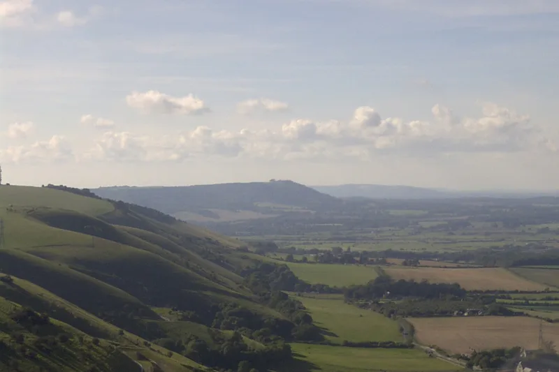
South Downs National Park
National parks · 1.9 km
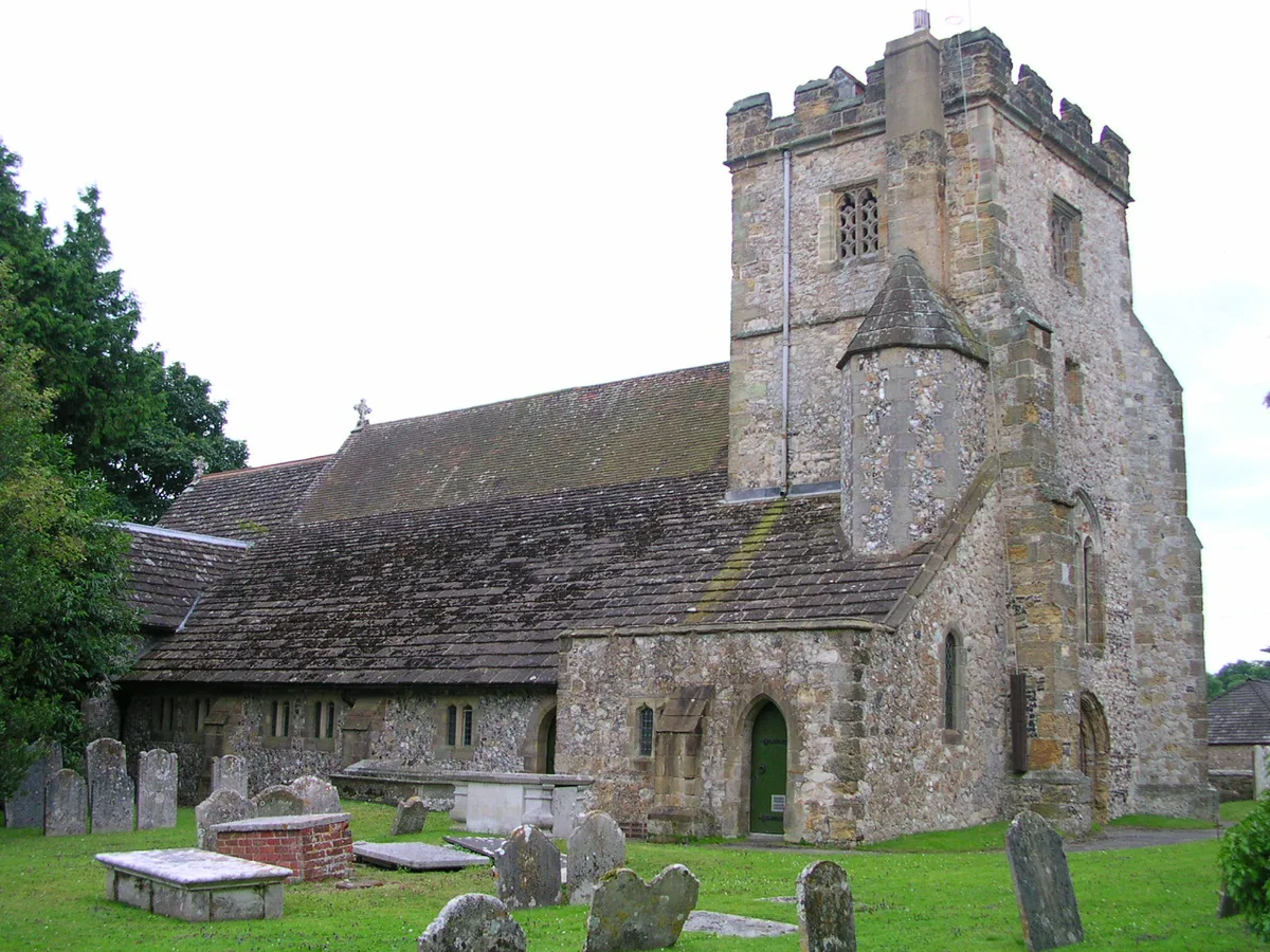
Washington
Towns & cities · 1.9 km

The Frankland Arms Public House
Historic pubs · 1.9 km
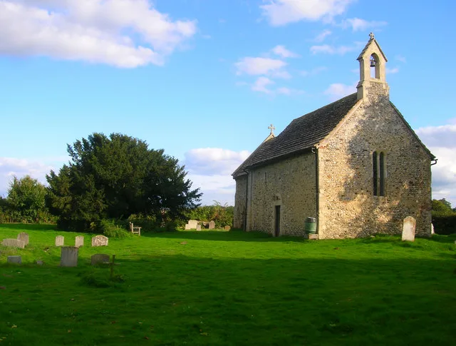
All Saints Church, Buncton
Historic churches · 1.9 km

Washington Caravan & Camping Park
Caravan parks · 2.1 km

Windlesham House School
Historic houses · 2.7 km

Picnic Field Steyning Downland Scheme (SDS)
Natural landmarks · 2.9 km
Nearby
📷 5Vineyards · South East England
Chanctonbury Ring
Chanctonbury Ring — a UK vineyard in england south east, producing English or Welsh wine from cool-climate grape varieties.
📷 5Mountains & hills · South East England
Chanctonbury Hill
Chanctonbury Hill — a hill or mountain in england south east.
📷 5Vineyards · South East England
Pair of hlaews 150m south east of Chanctonbury Ring hillfort
Pair of hlaews 150m south east of Chanctonbury Ring hillfort — a UK vineyard in england south east, producing English or Welsh wine from cool-climate grape varieties.
📷 5Natural landmarks · South East England
Chanctonbury Ring Picnic Site
Chanctonbury Ring Picnic Site — a other in england-south-east, United Kingdom.
📷 5Manor houses · South East England
Wiston House
Wiston House — a manor in england-south-east, United Kingdom.
Flagship📷 10National parks · South East England
South Downs National Park
South Downs National Park is a National park in South East England.
Where to eat & stay near Chanctonbury Ring
Places to stay
📷 5Caravan parks · South East England
Washington Caravan & Camping Park
Washington Caravan & Camping Park — a caravan park in england south east.
 📷 5
📷 5 📷 5
📷 5Caravan parks · South East England
Wild Heart Hill Camp
Wild Heart Hill Camp — a caravan park in england south east.
 📷 5
📷 5Campsites · South East England
New Wharf Campsite
New Wharf Campsite — a campsite in england south east.
 📷 7
📷 7 📷 5
📷 5Caravan parks · South East England
Honeybridge Park
Honeybridge Park — a caravan park in england south east.
Places to eat & drink
📷 5Historic pubs · South East England
The Frankland Arms Public House
The Frankland Arms Public House in England South East, United Kingdom.
 📷 5
📷 5Historic pubs · South East England
The Star Public House
The Star Public House in England South East, United Kingdom.
 📷 5
📷 5 📷 7
📷 7 📷 5
📷 5Historic pubs · South East England
The Rising Sun Inn
The Rising Sun Inn in England South East, United Kingdom.
 📷 5
📷 5Historic pubs · South East England
Thieves Kitchen
Thieves Kitchen in England South East, United Kingdom.
More mountains in this region
 📷 5
📷 5 📷 5
📷 5Mountains & hills · South East England
Reigate Caves
Reigate Caves is a mountain or hill in the United Kingdom.
 📷 5
📷 5Mountains & hills · South East England
North Downs
North Downs — a hill or mountain in england london.
 📷 5
📷 5Mountains & hills · South East England
Blue Bell Hill
Blue Bell Hill — a hill or mountain in england london.
Frequently asked questions
- Where is Chanctonbury Ring?
- Chanctonbury Ring is in West Sussex, South-East England, United Kingdom (postcode BN44 3DP), in the parish of Wiston.
- What is Chanctonbury Ring?
- Chanctonbury Ring — Named summit at 242 m.
- How do I get to Chanctonbury Ring?
- The nearest railway station is East Worthing, about 8.6 km away. Drivers can use postcode BN44 3DP.
- Is Chanctonbury Ring a protected site?
- Yes — Chanctonbury Ring is part of the Chanctonbury Hill SSSI Site of Special Scientific Interest.
- Is Chanctonbury Ring free to visit?
- Yes, Chanctonbury Ring is free to enter.
- How do I get to Chanctonbury Ring?
- Drivers can navigate to postcode BN44 3DP. It sits within the Arundel and South Downs parliamentary constituency.