Castles · North East England
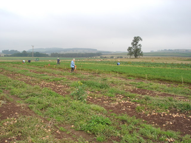
Cessford Burn
In or near Jedburgh.
Cessford Burn in England North East, United Kingdom.

James Denham — CC BY-SA 2.0 via Wikimedia Commons licence
Plan your visit
- Typical visit
- 1.5 h–3 h
- Family-friendly
- Limited wheelchair access
About
Cessford Burn is a place of interest in England North East, United Kingdom — drawn from open-data sources for visitor reference. See the linked Wikipedia article for the full description.
Photo gallery
See it from the streetimagery from 2019
Imagery © Mapillary contributors, CC BY-SA 4.0
From the Wikipedia article
Cessford Burn is a small stream which eventually runs to meet the Kale Water and then joins the River Teviot, finally entering the River Tweed at Kelso, Scotland. A site at Cessford Burn has the remains of an ancient farmstead attached to Cessford Castle in the historic county of Roxburghshire (now an administrative area of Scottish Borders Region), between Kelso and Morebattle, in the parish of Eckford. The extant foundation stones of the dwellings, which can be seen to this day, are situated on the north bank of the Cessford Burn. Seven shiels, or thatched cottages, once housed the families of the farm steward, the shepherd and the ploughman. The farmstead was burned to the ground by the English many times, including the border campaign of the Earl of Surrey in May, 1523 and again by the Earl of Hertford in 1545, and during the Rough Wooing of Mary, Queen of Scots, by Henry VIII of England. The families living in these shiels were in the service of the Kers of Cessford, latterly the Dukes of Roxburghe, who were granted by Royal Charters of both James I of Scotland and James II of Scotland, to hold these lands of the Crown. This encompassed Cessford (or Kerr) Castle, the dwellings at Cessford Burn, and the castleton of Cessford, lying just outside the north gate to the castle. Cessford Castle, in ruins today, stands upon the ridge opposite Cessford Burn on the south bank. The castleton is no longer extant, but aerial photographs and Matthew Stobie's 1770 map of Roxburghshire show that the village lay hard by the castle to the northwest on the Morebattle road; about 140 souls lived in Cessford village during those times. Along the quiet, green banks of Cessford Burn is Habbie Kerr's cave, where local citizens had sought safety and shelter since the fifth century CE. Just south of Cessford Castle, there once stood an ancient ash tree known as the "Crow Tree", where summary Jeddart Justice was carried out. A branch of the old Border family Nisbet were shepherds in…
Excerpt from Wikipedia under CC BY-SA 4.0. See the source article linked in Sources below.
- Coordinates
- 55.5236, -2.4050
- District
- Scottish Borders
- Postcode
- TD5 8EF
- Parliamentary constituency
- Berwickshire, Roxburgh and Selkirk
Sources
- wikidata: Q5065557 (CC0)
- wikipedia: Cessford Burn (CC BY-SA 4.0)
Featured in this guide
Other places nearby

Bridge, Caverton Mill
Historic bridges · 0.4 km

Old Burial Ground
Archaeological sites · 1.8 km
Crookhouse Farm Campsite
Caravan parks · 1.8 km
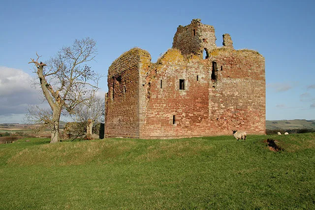
Cessford Castle
Castles · 1.9 km

Clifton Park House
Historic houses · 2.3 km

Cessford
Castles · 2.3 km

Morebattle
Other places · 2.5 km

Linton
Villages · 2.5 km

Caverton Hill
Mountains & hills · 2.6 km

Hoby Hall Memorial
Memorials & monuments · 2.6 km

Parish Church of St Lawrence, Morebattle
Historic churches · 2.7 km

Templehall Hotel
Hotels · 2.8 km
Nearby
📷 5Historic bridges · North East England
Bridge, Caverton Mill
Bridge, Caverton Mill — category C listed building-listed bridge in scotland-central, United Kingdom.
📷 3Archaeological sites · North East England
Old Burial Ground
Old Burial Ground — a archaeological in scotland-central, United Kingdom.
📷 5Caravan parks · North East England
Crookhouse Farm Campsite
Crookhouse Farm Campsite — a caravan park in scotland central.
📷 3Castles · North East England
Cessford Castle
Cessford Castle — castle in Scottish Borders, Scotland, UK.
📷 3Historic houses · North East England
Clifton Park House
Clifton Park House — a historic house in scotland-central, United Kingdom.
📷 4Where to eat & stay near Cessford Burn
Places to stay
📷 5Caravan parks · North East England
Crookhouse Farm Campsite
Crookhouse Farm Campsite — a caravan park in scotland central.
📷 7 📷 5
📷 5Hotels · Scottish Lowlands
SCHLOSS Roxburghe
SCHLOSS Roxburghe — a hotel in scotland central. 5-star. Brand: Destination by Hyatt.
 📷 7
📷 7Hotels · North East England
The Plough Hotel
The Plough Hotel — a hotel in scotland central.
 📷 5
📷 5Caravan parks · North East England
Kirkfield Caravan Site
Kirkfield Caravan Site — a caravan park in scotland central.
 📷 5
📷 5Caravan parks · Scottish Lowlands
Springwood Estate Caravan Park
Springwood Estate Caravan Park — a caravan park in scotland central.
Places to eat & drink
 📷 4
📷 4Historic pubs · Scottish Lowlands
Newcastle Arms
Newcastle Arms — Historic pub — listed building or notable heritage status.
 📷 7
📷 7More castles in this region
 📷 3
📷 3Castles · North East England
Scargill Castle
Scargill Castle — house in Scargill, County Durham, England, UK.
 📷 3
📷 3Castles · North East England
Roper Castle or Round Table (Roman Signal Station)
Roper Castle or Round Table (Roman Signal Station) — a castle in england-north-west, United Kingdom.
 📷 5
📷 5 📷 5
📷 5Castles · North East England
Appleby Castle
Appleby Castle — Grade I listed English country house in Appleby-in-Westmorland, United Kingdom.
Frequently asked questions
- Where is Cessford Burn?
- Cessford Burn is in North-East England, United Kingdom (postcode TD5 8EF).
- What is Cessford Burn?
- Cessford Burn in England North East, United Kingdom.
- How do I get to Cessford Burn?
- Drivers can use postcode TD5 8EF.
- Does Cessford Burn charge admission?
- Cessford Burn typically charges admission. Check the official site for current ticket prices and opening hours.
- How do I get to Cessford Burn?
- Drivers can navigate to postcode TD5 8EF. It sits within the Berwickshire, Roxburgh and Selkirk parliamentary constituency.