
Archaeological sites · North West England
Celtic Walls
In or near Stainforth.
Celtic Walls — a archaeological in england-north-west, United Kingdom.

Karl and Ali — CC BY-SA 2.0 via Wikimedia Commons licence

Plan your visit
- Typical visit
- 45 min–1.5 h
- Nearest railway station
- Settle · 4.2 km
- Free entry
- Dog-friendly
About
Celtic Walls is a archaeological located in england-north-west, United Kingdom. Sourced from OpenStreetMap (ODbL licence); see local listings for visitor information, opening hours and admission details.
Photo gallery
Protected designations
- Area of Outstanding Natural Beauty: Forest Of Bowland
Designations sourced from Natural England open data under OGL v3.
Place summary
Celtic Walls are archaeological remains located in North-West England. These structures are significant for their representation of ancient Celtic fortifications, providing insights into the early inhabitants of the region.
AI-generated from the structured facts on this page (operator, designation, listing, era). Not a substitute for visiting.
- Coordinates
- 54.1022, -2.3058
- District
- North Yorkshire
- Parish
- Austwick
- Postcode
- LA2 8DF
- Parliamentary constituency
- Skipton and Ripon
- Nearest railway station
- Settle — 4.2 km
Sources
- osm: node/2133493169 (ODbL)
Other places nearby

Feizor Thwaite
Mountains & hills · 0.2 km

Dead Man's Cave
Caves · 0.4 km

Smearsett Scar
Mountains & hills · 0.4 km

tumuli
Archaeological sites · 1.3 km

Knight Stainforth Hall Camping & Caravan Park
Caravan parks · 1.5 km

Knight Stainforth Bridge
Historic bridges · 1.7 km

Kinsey Cave
Caves · 1.7 km

Kinsey Cave
Caves · 1.8 km
Kinsey Cave
Archaeological sites · 1.8 km

Stainforth Foss
Natural landmarks · 1.8 km

Stainforth Force
Waterfalls · 1.8 km
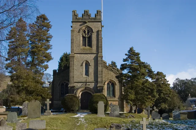
St Peter's Church, Stainforth
Historic churches · 2.0 km
Nearby
📷 5Mountains & hills · North West England
Feizor Thwaite
Feizor Thwaite — a hill or mountain in england north west.
📷 5📷 5Mountains & hills · North West England
Smearsett Scar
Smearsett Scar — a hill or mountain in england north west.
📷 5📷 5Caravan parks · North West England
Knight Stainforth Hall Camping & Caravan Park
Knight Stainforth Hall Camping & Caravan Park — a caravan park in england north west.
📷 5Historic bridges · North West England
Knight Stainforth Bridge
Knight Stainforth Bridge is a historic bridge in the United Kingdom.
Where to eat & stay near Celtic Walls
Places to stay
📷 5Caravan parks · North West England
Knight Stainforth Hall Camping & Caravan Park
Knight Stainforth Hall Camping & Caravan Park — a caravan park in england north west.
 📷 5
📷 5Hostels · North West England
Yorkshire Subterranean Society (YSS)
Yorkshire Subterranean Society (YSS) — a hostel in england north west.
 📷 5
📷 5Caravan parks · North West England
Stackhouse Farm Campsite
Stackhouse Farm Campsite — a caravan park in england north west.
 📷 5
📷 5Caravan parks · North West England
Langcliffe Park
Langcliffe Park — a caravan park in england north west.
 📷 5
📷 5Campsites · North West England
Silloth House Campsite
Silloth House Campsite — a campsite in england north west.
 📷 5
📷 5Hotels · North West England
The Traddock
The Traddock — a hotel in england north west.
Places to eat & drink
 📷 5
📷 5Restaurants · North West England
The Game Cock Inn
The Game Cock Inn — a restaurant in england north west. Cuisine: french;english.
 📷 6
📷 6Historic pubs · North West England
Falcon Manor Hotel
Falcon Manor Hotel in England North West, United Kingdom.
 📷 5
📷 5Cafés · North West England
Lakehouse Food & Drink
Lakehouse Food & Drink — a café in england north west.
 📷 7
📷 7 📷 5
📷 5Historic pubs · North West England
Crow Trees Inn
Crow Trees Inn in England North West, United Kingdom.
 📷 5
📷 5Historic pubs · North West England
Horse And Farrier Inn
Horse And Farrier Inn in England North West, United Kingdom.
More archaeological sites in this region
 📷 3
📷 3Archaeological sites · North West England
Early medieval sculptural fragments in St Mary's churchyard
Early medieval sculptural fragments in St Mary's churchyard — archaeological site in Sandbach, Cheshire East, England, UK.
 📷 3
📷 3Archaeological sites · North West England
Gaddum's Wood
Gaddum's Wood is a archaeological site in the United Kingdom.
 📷 3
📷 3Archaeological sites · North West England
Marton moated monastic grange, three fishponds, connecting channels and base of stone cross
Marton moated monastic grange, three fishponds, connecting channels and base of stone cross — archaeological site in Whitegate and Marton, Cheshire West and Chester, England, UK.
 📷 3
📷 3Archaeological sites · North West England
St Oswalds Well
St Oswalds Well — a archaeological in england-west-midlands, United Kingdom.
Frequently asked questions
- Where is Celtic Walls?
- Celtic Walls is in North-West England, United Kingdom (postcode LA2 8DF), in the parish of Austwick.
- What is Celtic Walls?
- Celtic Walls — a archaeological in england-north-west, United Kingdom.
- How do I get to Celtic Walls?
- The nearest railway station is Settle, about 4.2 km away. Drivers can use postcode LA2 8DF.
- Is Celtic Walls a protected site?
- Yes — Celtic Walls is part of the Forest Of Bowland National Landscape (AONB).
- Is Celtic Walls free to visit?
- Yes, Celtic Walls is free to enter.
- How do I get to Celtic Walls?
- The nearest railway station is Settle, about 4.2 km away. Drivers can navigate to postcode LA2 8DF.