Mountains & hills · North Wales
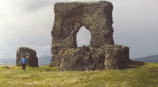
Castell Deganwy
Castell Deganwy — Named summit at 107 m.

Wikimedia Commons contributors — see linked file page for photographer and licence licence
Plan your visit
- Typical visit
- 3 h–8 h
- Best time of year
- Late spring – early autumn (May–Oct)
- Nearest railway station
- Deganwy · 0.4 km
- Free entry
- Dog-friendly
About
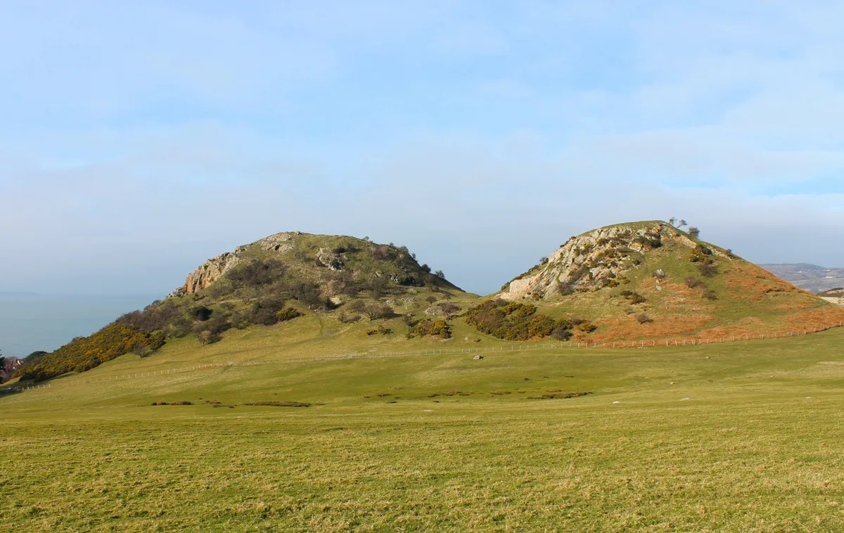
Castell Deganwy is a named summit in the United Kingdom. Records date its origin to 1080. Wikidata describes it as: "Named summit at 107 m.". Coordinates: 53.2978°, -3.8296°.
Photo gallery
From the Wikipedia article
Deganwy Castle (Medieval Latin: Arx Deganhui; Middle Welsh: Caer Ddegannwy; Modern Welsh: Castell Degannwy) was an early stronghold of Gwynedd in Deganwy, at the mouth of the River Conwy, now in Conwy county borough, north Wales. It sits at an elevation of 110 m (361 ft) on a volcanic plug in an area of limestone known as the Vardre (Welsh: Y Fardre).
Excerpt from Wikipedia under CC BY-SA 4.0. See the source article linked in Sources below.
- Coordinates
- 53.2978, -3.8296
- District
- Conwy
- Parish
- Conwy
- Postcode
- LL31 9PJ
- Parliamentary constituency
- Bangor Aberconwy
- Established
- 1080
- Nearest railway station
- Deganwy — 0.4 km
Sources
- osm: n3498187971 (ODbL)
- wikipedia: Deganwy Castle (CC BY-SA 4.0)
- commons: Castell Degannwy Deganwy Castle Sir Ddinbych Wales 09.JPG (CC BY-SA 4.0)
Other places nearby
Loading nearby places…
Nearby
 📷 3
📷 3Mountains & hills · North Wales
Degannwy Castle
Degannwy Castle — a mountain in wales-north, United Kingdom, 110 m.
 📷 5
📷 5Castles · North Wales
Deganwy Castle
Deganwy Castle is a castle in the United Kingdom.
 📷 3
📷 3Historic houses · North Wales
Castell Degannwy
Castell Degannwy — a historic house in wales-north, United Kingdom.
 📷 3
📷 3Historic churches · North Wales
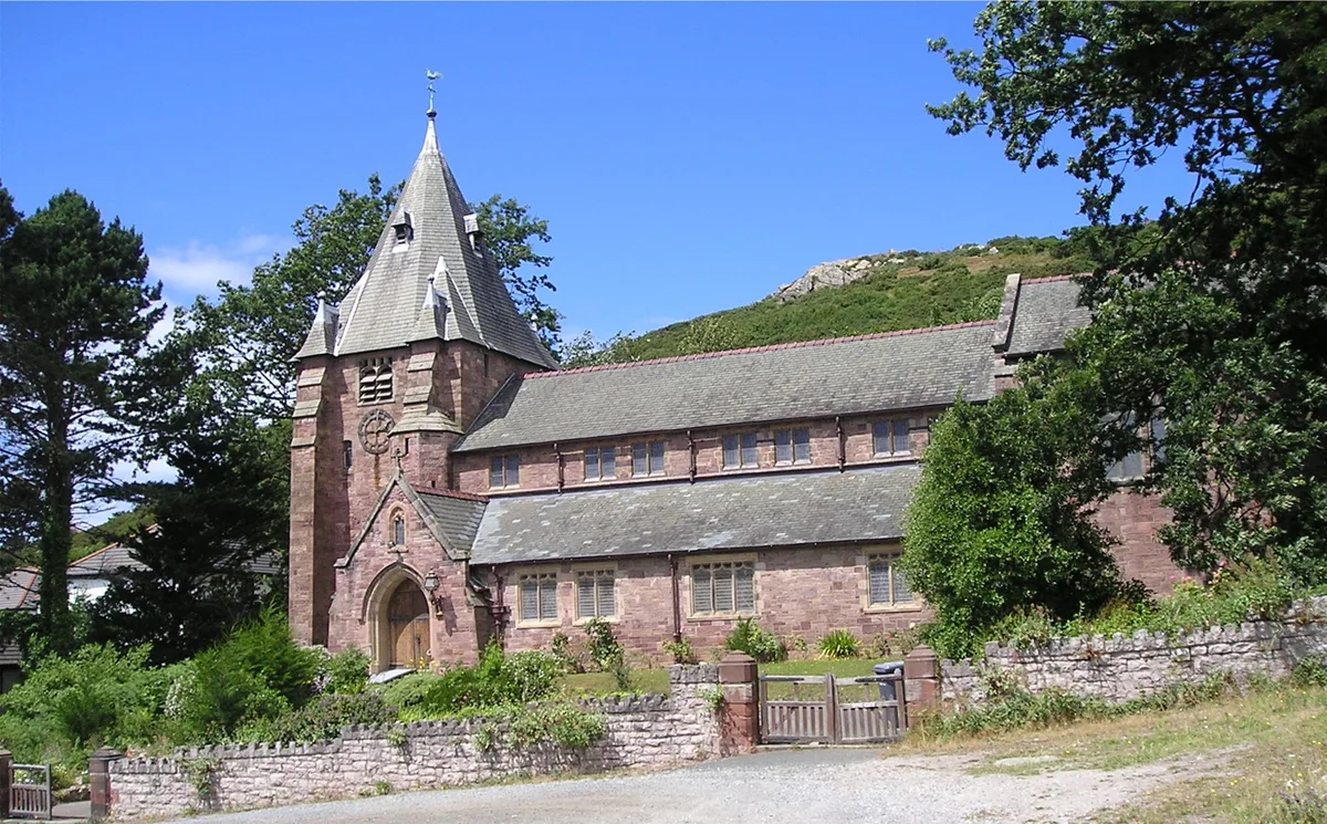
All Saints Church
All Saints Church — Anglican church in Deganwy, Wales.
Hotels · North Wales
The Quay Hotel and Spa
The Quay Hotel and Spa — a hotel in wales north.
Caravan parks · North Wales
Maes Dolau Farm Caravan Park
Maes Dolau Farm Caravan Park — a caravan park in wales north.
Other mountains from this era
More mountains in this region
 📷 5
📷 5Mountains & hills · North Wales
Cemlyn Bay and lagoon
Cemlyn Bay and lagoon — Site of Special Scientific Interest in Wales.
 📷 3
📷 3Mountains & hills · North Wales
Aberffraw Bay
Aberffraw Bay — bay on the west coast of Anglesey, in Wales, UK.
 📷 3
📷 3Mountains & hills · North Wales
Allt-fawr
Allt-fawr — Named summit at 698 m.
 📷 3
📷 3Mountains & hills · North Wales
Aran Benllyn
Aran Benllyn — Named summit at 884 m.
Frequently asked questions
- Where is Castell Deganwy?
- Castell Deganwy is in North Wales, United Kingdom (postcode LL31 9PJ), in the parish of Conwy.
- When was Castell Deganwy built?
- Built or established in 1080.
- Is Castell Deganwy free to visit?
- Yes, Castell Deganwy is free to enter.
- How do I get to Castell Deganwy?
- The nearest railway station is Deganwy, about 0.4 km away. Drivers can navigate to postcode LL31 9PJ.