
Archaeological sites · East Midlands
Carsington Pasture, Nickalum, Perserverance, West Head, Break Hollow and other small mines and medieval field boundaries
In or near Hopton.
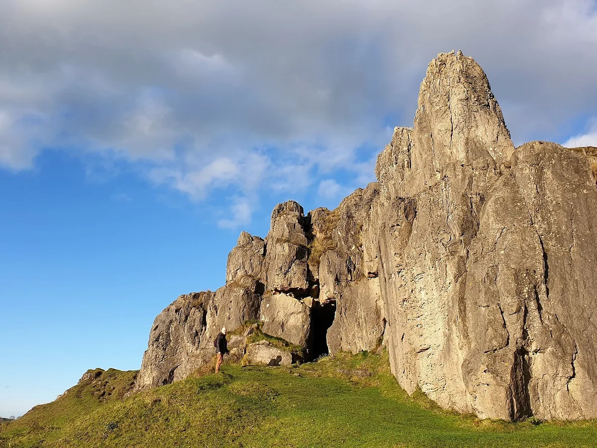
Carsington Pasture, Nickalum, Perserverance, West Head, Break Hollow and other small mines and medieval field boundaries — archaeological site in Carsington, Derbyshire Dales, England, UK.

Wikimedia Commons contributors — see linked file page for photographer and licence licence

Plan your visit
- Typical visit
- 45 min–1.5 h
- Nearest railway station
- Recreation Ground Halt · 4.2 km
- Free entry
- Dog-friendly
About
Carsington Pasture, Nickalum, Perserverance, West Head, Break Hollow and other small mines and medieval field boundaries is an archaeological site in the United Kingdom. Heritage designation: scheduled monument. Wikidata describes it as: "archaeological site in Carsington, Derbyshire Dales, England, UK". Coordinates: 53.0825°, -1.6361°.
Photo gallery
Place summary
Carsington Pasture, Nickalum, Perseverance, West Head, Break Hollow and other small mines and medieval field boundaries are located in the East Midlands. This archaeological site is designated as a scheduled monument, highlighting its significance in understanding historical land use and mining practices in the region.
AI-generated from the structured facts on this page (operator, designation, listing, era). Not a substitute for visiting.
- Coordinates
- 53.0825, -1.6361
- County
- Derbyshire
- District
- Derbyshire Dales
- Parish
- Carsington
- Postcode
- DE4 4PX
- Parliamentary constituency
- Derbyshire Dales
- Nearest railway station
- Recreation Ground Halt — 4.2 km
Sources
- wikidata: Q17664690 (CC0)
- commons: Nickalum Mine - geograph.org.uk - 5048024.jpg (CC BY-SA 4.0)
Other places nearby

Hopton Windmill
Windmills · 0.9 km

Miner's Arms Inn
Historic pubs · 1.0 km
Harboro' Cave
Mountains & hills · 1.3 km

Hopton Hall
Historic houses · 1.3 km

Harboro Rocks
Mountains & hills · 1.4 km
Harboro Rocks
Mountains & hills · 1.4 km

Hopton
Towns & cities · 1.4 km

Hopton Manor
Manor houses · 1.7 km

Knockerdown Caravan & Camping
Campsites · 2.4 km

Carsington Water Visitor Centre
Natural landmarks · 2.4 km

Carsington Water Cycle Route
Mountain bike trails · 2.4 km

Stainsbro Hill
Mountains & hills · 2.5 km
Nearby
📷 3Windmills · East Midlands
Hopton Windmill
Hopton Windmill — Grade II listed building-listed windmill in england-east-midlands, United Kingdom.
📷 5Historic pubs · East Midlands
Miner's Arms Inn
Miner's Arms Inn in England East Midlands, United Kingdom.
📷 3Mountains & hills · East Midlands
Harboro' Cave
Harboro' Cave — cave and scheduled monument in the parish of Brassington, Derbyshire, England, UK.
📷 4Historic houses · East Midlands
Hopton Hall
Hopton Hall — a Grade II-listed historic house in england-east-midlands, United Kingdom.
📷 5Mountains & hills · East Midlands
Harboro Rocks
Harboro Rocks — a hill or mountain in england east midlands.
📷 5Mountains & hills · East Midlands
Harboro Rocks
Harboro Rocks — mountain in england east midlands. Elevation: 379 m.
Where to eat & stay near Carsington Pasture, Nickalum, Perserverance, West Head, Break Hollow and other small mines and medieval field boundaries
Places to stay
📷 5Campsites · East Midlands
Knockerdown Caravan & Camping
Knockerdown Caravan & Camping — a campsite in england east midlands.
 📷 5📷 5
 📷 5
📷 5Campsites · East Midlands
Peak View Caravan Site
Peak View Caravan Site — a campsite in england east midlands.
 📷 5
📷 5Campsites · East Midlands
Middleton Top Campsite (Caravan & Camping Club)
Middleton Top Campsite (Caravan & Camping Club) — a campsite in england east midlands.
 📷 5
📷 5Places to eat & drink
📷 5Historic pubs · East Midlands
Miner's Arms Inn
Miner's Arms Inn in England East Midlands, United Kingdom.
 📷 5
📷 5 📷 5
📷 5 📷 5📷 5
Restaurants · East Midlands
Le Mistral
Le Mistral — a restaurant in england east midlands.
 📷 5
📷 5More archaeological sites in this region
 📷 4
📷 4Archaeological sites · East Midlands
Roman site, Priors Meadow
Roman site, Priors Meadow — archaeological site in Deeping St James, South Kesteven, England, UK.
 📷 5
📷 5Archaeological sites · East Midlands
Site of St Peter's Church
Site of St Peter's Church — site of former church in Stamford, Lincolnshire, England, UK.
 📷 5
📷 5Archaeological sites · East Midlands
Stamford East railway station
Stamford East railway station — an archaeological site in East Midlands, United Kingdom.
 📷 5
📷 5Archaeological sites · East Midlands
Stamford East railway sheds (now residential)
Stamford East railway sheds (now residential) — an archaeological site in East Midlands, United Kingdom.
Frequently asked questions
- Where is Carsington Pasture, Nickalum, Perserverance, West Head, Break Hollow and other small mines and medieval field boundaries?
- Carsington Pasture, Nickalum, Perserverance, West Head, Break Hollow and other small mines and medieval field boundaries is in Derbyshire, the East Midlands, United Kingdom (postcode DE4 4PX), in the parish of Carsington.
- What is Carsington Pasture, Nickalum, Perserverance, West Head, Break Hollow and other small mines and medieval field boundaries?
- Carsington Pasture, Nickalum, Perserverance, West Head, Break Hollow and other small mines and medieval field boundaries — archaeological site in Carsington, Derbyshire Dales, England, UK.
- How do I get to Carsington Pasture, Nickalum, Perserverance, West Head, Break Hollow and other small mines and medieval field boundaries?
- The nearest railway station is Recreation Ground Halt, about 4.2 km away. The nearest town is Hopton. Drivers can use postcode DE4 4PX.
- Is Carsington Pasture, Nickalum, Perserverance, West Head, Break Hollow and other small mines and medieval field boundaries a listed building?
- Carsington Pasture, Nickalum, Perserverance, West Head, Break Hollow and other small mines and medieval field boundaries is officially recognised as scheduled monument listed.
- Is Carsington Pasture, Nickalum, Perserverance, West Head, Break Hollow and other small mines and medieval field boundaries free to visit?
- Yes, Carsington Pasture, Nickalum, Perserverance, West Head, Break Hollow and other small mines and medieval field boundaries is free to enter.
- How do I get to Carsington Pasture, Nickalum, Perserverance, West Head, Break Hollow and other small mines and medieval field boundaries?
- The nearest railway station is Recreation Ground Halt, about 4.2 km away. Drivers can navigate to postcode DE4 4PX.