
Historic churches · East Midlands
Carrington, Lincolnshire
In or near Mareham le Fen.
Carrington is a village in the civil parish of Carrington and New Bolingbroke, in the East Lindsey district of Lincolnshire, England. It is situated approximately 7 miles (11 km) north from the market

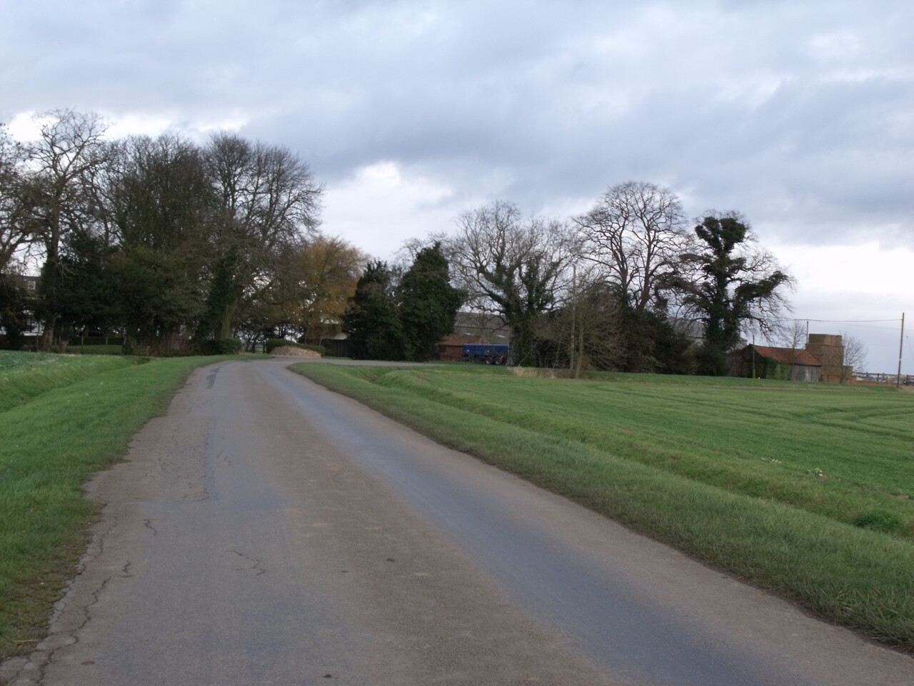
Jonathan Thacker — CC BY-SA 2.0 via Wikimedia Commons licence

Plan your visit
- Typical visit
- 30 min–1 h
- Free entry
About
Carrington is a village in the civil parish of Carrington and New Bolingbroke, in the East Lindsey district of Lincolnshire, England. It is situated approximately 7 miles (11 km) north from the market town of Boston. It lies within The Fens and was largely uninhabited marshland until the early nineteenth century. Drainage of an area known as West Fen began in 1802, and in 1812 a township called Carrington was created covering some of the drained land, named after Robert Smith, 1st Baron Carrington, the main landowner. The township became a civil parish in 1858. The civil parish of Carrington also included New Bolingbroke, 1.5 miles (2.4 km) to the north. The parish was renamed "Carrington and New Bolingbroke" in November 2022, at which point the parish council also declared the parish to be a town, allowing it to take the style "town council" and appoint a mayor. The parish also contains the hamlet of Medlam. The parish has a population of 564 according to the 2001 census, reducing slightly to 554 at the 2011 Census. Carrington church is dedicated to St Paul, and was built of red brick in 1816 under the Fen Chapel Act (1816), with its chancel being added in 1872. It is a Grade II listed building. Carrington and New Bolingbroke were separate ecclesiastical parishes until 1961 when they were united. Carrington's school, the Medlam School, was opened in February 1881 by the West Fen United District School Board which existed from 1879 to 1903. By the time of its closure in 1987
Photo gallery
From the Wikipedia article
Carrington is a village in the civil parish of Carrington and New Bolingbroke, in the East Lindsey district of Lincolnshire, England. It is situated approximately 7 miles (11 km) north from the market town of Boston. It lies within The Fens and was largely uninhabited marshland until the early nineteenth century. Drainage of an area known as West Fen began in 1802, and in 1812 a township called Carrington was created covering some of the drained land, named after Robert Smith, 1st Baron Carrington, the main landowner. The township became a civil parish in 1858. The civil parish of Carrington also included New Bolingbroke, 1.5 miles (2.4 km) to the north. The parish was renamed "Carrington and New Bolingbroke" in November 2022, at which point the parish council also declared the parish to be a town, allowing it to take the style "town council" and appoint a mayor. The parish also contains the hamlet of Medlam. The parish has a population of 564 according to the 2001 census, reducing slightly to 554 at the 2011 Census. Carrington church is dedicated to St Paul, and was built of red brick in 1816 under the Fen Chapel Act (1816), with its chancel being added in 1872. It is a Grade II listed building. Carrington and New Bolingbroke were separate ecclesiastical parishes until 1961 when they were united. Carrington's school, the Medlam School, was opened in February 1881 by the West Fen United District School Board which existed from 1879 to 1903. By the time of its closure in 1987 it was known as Carrington County Primary School. Children now attend school in nearby Stickney. Carrington Rally is an annual event which has taken place each spring for over 50 years, and is a steam and tractor show which supports local charities. The Carrington Glasshouse of Dyson Farming is based in Carrington. It is six hectares in size and 424 meters in length, with 700,000 strawberry plants.
Excerpt from Wikipedia under CC BY-SA 4.0. See the source article linked in Sources below.
- Coordinates
- 53.0803, -0.0447
- County
- Lincolnshire
- District
- East Lindsey
- Parish
- Carrington and New Bolingbroke
- Postcode
- PE22 7HZ
- Parliamentary constituency
- Boston and Skegness
Sources
- wikipedia: Carrington, Lincolnshire (CC BY-SA 4.0)
Other places nearby

War Memorial Carrington
Memorials & monuments · 0.2 km

Windmill Next Watkinson's Bridge
Windmills · 2.4 km

New Bolingbroke
Villages · 2.5 km

Bridge Over Twenty Foot Drain
Historic bridges · 2.8 km

Stickney Car Boot Sale
Farmers’ markets · 3.1 km

ARK Wildlife & Dinosaur Park
Zoos & aquariums · 3.5 km

Stickney, Lincolnshire
Historic churches · 3.5 km

Stickney
Villages · 3.5 km
Stickney War Memorial
Memorials & monuments · 3.6 km

Bridge Farm Caravan Park
Caravan parks · 4.0 km

Northlands Bridge
Historic bridges · 4.0 km

Greenacres Lakes
Campsites · 4.5 km
Nearby
📷 3Memorials & monuments · East Midlands
War Memorial Carrington
War Memorial Carrington — Grade II listed building-listed memorial in england-east-midlands, United Kingdom.
📷 3Windmills · East Midlands
Windmill Next Watkinson's Bridge
Windmill Next Watkinson's Bridge — Grade II listed building-listed windmill in england-east-midlands, United Kingdom.
📷 5📷 3Historic bridges · East Midlands
Bridge Over Twenty Foot Drain
Bridge Over Twenty Foot Drain — Grade II listed building-listed bridge in england-east-midlands, United Kingdom.
📷 5Farmers’ markets · East Midlands
Stickney Car Boot Sale
Stickney Car Boot Sale — a UK farmers' market in england east midlands.
📷 3Zoos & aquariums · East Midlands
ARK Wildlife & Dinosaur Park
ARK Wildlife & Dinosaur Park — a zoo aquarium in england-east-midlands, United Kingdom.
Where to eat & stay near Carrington, Lincolnshire
Places to stay
📷 5Caravan parks · East Midlands
Bridge Farm Caravan Park
Bridge Farm Caravan Park — a caravan park in england east midlands.
📷 5Campsites · East Midlands
Greenacres Lakes
Greenacres Lakes — a campsite in england east midlands.
 📷 5
📷 5Campsites · East Midlands
Freedom Camping Club
Freedom Camping Club — a campsite in england east midlands.
 📷 5
📷 5Campsites · East Midlands
Clover Farm
Clover Farm — a campsite in england east midlands.
 📷 5
📷 5Caravan parks · East Midlands
Long Acres Touring Park
Long Acres Touring Park — a caravan park in england east midlands.
 📷 5
📷 5Caravan parks · East Midlands
Midville Holiday Park
Midville Holiday Park — a caravan park in england east midlands.
Places to eat & drink
 📷 5
📷 5Historic pubs · East Midlands
Lea Gate Public House
Lea Gate Public House in England East, United Kingdom.
 📷 5
📷 5Historic pubs · East Midlands
Fortescue Arms And Coach House
Fortescue Arms And Coach House in England East, United Kingdom.
 📷 5
📷 5Restaurants · East Midlands
Captain Cod Fish and Chip Restaurant
Captain Cod Fish and Chip Restaurant — a restaurant in england east midlands.
 📷 5
📷 5 📷 5
📷 5 📷 5
📷 5Historic pubs · East Midlands
Abbey Lodge Inn
Abbey Lodge Inn in England East, United Kingdom.
More places in this region
 📷 5
📷 5Historic churches · East Midlands
All Saints' Church, Stamford
All Saints' Church, Stamford — church in Stamford, Lincolnshire, England, UK.
 📷 5
📷 5Historic churches · East Midlands
Church of All Saints
Church of All Saints — church in Little Casterton, Rutland, United Kingdom.
 📷 5
📷 5Historic churches · East Midlands
Church of All Saints
Church of All Saints — church in Fenland, UK.
 📷 5
📷 5Historic churches · East Midlands
Church of St Leonard
Church of St Leonard — church in Fenland, UK.
Frequently asked questions
- Where is Carrington, Lincolnshire?
- Carrington, Lincolnshire is in Lincolnshire, the East Midlands, United Kingdom (postcode PE22 7HZ), in the parish of Carrington and New Bolingbroke.
- What is Carrington, Lincolnshire?
- Carrington is a village in the civil parish of Carrington and New Bolingbroke, in the East Lindsey district of Lincolnshire, England. It is situated approximately 7 miles (11 km) north from the market
- How do I get to Carrington, Lincolnshire?
- The nearest town is Mareham le Fen. Drivers can use postcode PE22 7HZ.
- Is Carrington, Lincolnshire free to visit?
- Yes, Carrington, Lincolnshire is free to enter.
- How do I get to Carrington, Lincolnshire?
- Drivers can navigate to postcode PE22 7HZ. It sits within the Boston and Skegness parliamentary constituency.