
Historic bridges · West Midlands
Cantlop Bridge
In or near Wroxeter.
Cantlop Bridge is a historic bridge in the United Kingdom.

Wikimedia Commons contributors — see linked file page for photographer and licence licence

Plan your visit
- Typical visit
- 15 min–30 min
- Nearest railway station
- Shrewsbury · 7.1 km
- Free entry
- Dog-friendly
Getting there & planning your visit
To visit Cantlop Bridge, the nearest railway station is Shrewsbury, located 7.1 km away. The postcode for navigation is SY5 7DD, and entry to the bridge is free.
About
Cantlop Bridge is a named historic bridge in the United Kingdom. Coordinates: 52.6518°, -2.7148°. This entry is part of The Great Britain Guide, a free, ad-free, open-data tourist directory.
Photo gallery
Heritage listing
Cantlop Bridge is a single span cast-iron road bridge over the Cound Brook, located to the north of Cantlop in the parish of Berrington, Shropshire. It was constructed in 1818 to a design possibly by Thomas Telford, having at least been approved by him, and replaced an unsuccessful cast iron coach bridge constructed in 1812. The design of the bridge was innovative for the period, using a light-weight design of cast-iron lattice ribs to support the road deck in a single span, and appears to be a scaled-down version of a Thomas Telford bridge at Meole Brace, Shropshire. The bridge is the only surviving Telford-approved cast-iron bridge in Shropshire, and is a Grade II* listed building and scheduled monument.
From the Historic England List Entry under OGL v3.
From English Heritage
Built in 1813, this innovative, single-span, cast-iron road bridge over the Cound Brook was possibly designed and certainly approved by the great engineer Thomas Telford.
Read more on the official property page.
Protected designations
- Area of Outstanding Natural Beauty: Shropshire Hills
Designations sourced from Natural England open data under OGL v3.
From the Wikipedia article
Cantlop Bridge is a single span cast-iron road bridge over the Cound Brook, located to the north of Cantlop in the parish of Berrington, Shropshire. It was constructed in 1818 to a design possibly by Thomas Telford, having at least been approved by him, and replaced an unsuccessful cast iron coach bridge constructed in 1812. The design of the bridge was innovative for the period, using a light-weight design of cast-iron lattice ribs to support the road deck in a single span, and appears to be a scaled-down version of a Thomas Telford bridge at Meole Brace, Shropshire. The bridge is the only surviving Telford-approved cast-iron bridge in Shropshire, and is a Grade II* listed building and scheduled monument. It originally carried the turnpike road from Shrewsbury to Acton Burnell.
Excerpt from Wikipedia under CC BY-SA 4.0. See the source article linked in Sources below.
Background
History
Thomas Telford worked as the county surveyor of Shropshire between 1787 and 1834, and the bridge is reported to have once held a cast iron plate above the centre of the arch inscribed with "Thomas Telford Esqr - Engineer - 1818", which is apparently visible in historic photographs, but has not been in place since at least 1985. The bridge design incorporates dressed red and grey sandstone abutments with ashlar dressings, these are slightly curved and ramped, with chamfered ashlar quoins, string courses, and moulded cornices. The structural cast-iron consists of a single segmental span with four arched lattice ribs, braced by five transverse cast-ironmembers. The road deck is formed from…
Sourced from Wikipedia under CC BY-SA 4.0.
- Coordinates
- 52.6518, -2.7148
- District
- Shropshire
- Parish
- Berrington
- Postcode
- SY5 7DD
- Parliamentary constituency
- South Shropshire
- Nearest railway station
- Shrewsbury — 7.1 km
- Opening
- |life =
Sources
- osm: w239139875 (ODbL)
- wikipedia: Cantlop Bridge (CC BY-SA 4.0)
- commons: Cantlop Bridge. An early example of bridge building by Thomas Telford - geograph.org.uk - 678044.jpg (CC BY-SA 4.0)
Other places nearby

Boreton Bridge
Historic bridges · 0.6 km

Berrington War Memorial
Memorials & monuments · 1.4 km
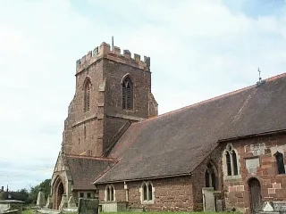
All Saints Church, Berrington
Historic churches · 1.4 km

Pitchford Bridge
Historic bridges · 2.2 km

Pitchford Hall
Manor houses · 2.3 km

Condover Hall
Historic houses · 2.3 km
Estate Bridge Approximately 100 Metres To East Of Pitchford Hall
Historic bridges · 2.3 km

Reservoir
Reservoirs & lochs · 2.3 km

Condover
Villages · 2.4 km

Iron Age settlement site in Bomere Wood
Vineyards · 2.5 km

Condover Bridge
Historic bridges · 2.5 km
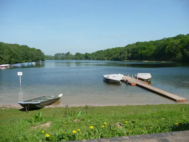
Bomere Pool
Natural landmarks · 2.6 km
Nearby
📷 3Historic bridges · West Midlands
Boreton Bridge
Boreton Bridge — Grade II listed building-listed bridge in wales-mid, United Kingdom.
📷 3Memorials & monuments · West Midlands
Berrington War Memorial
Berrington War Memorial — Grade II listed building-listed memorial in wales-mid, United Kingdom.
📷 3Historic churches · West Midlands
All Saints Church, Berrington
All Saints Church, Berrington — church in the village of Berrington, Shropshire, England, UK.
📷 3Historic bridges · West Midlands
Pitchford Bridge
Pitchford Bridge — Grade II listed building-listed bridge in wales-mid, United Kingdom.
📷 3Manor houses · West Midlands
Pitchford Hall
Pitchford Hall — a manor in wales-mid, United Kingdom.
📷 3Historic houses · West Midlands
Condover Hall
Condover Hall — Grade I listed building in Shropshire, England, UK.
Where to eat & stay near Cantlop Bridge
Places to stay

Caravan parks · West Midlands
Condover Park Touring Caravan Site
Condover Park Touring Caravan Site — a caravan park in wales mid.
 📷 5
📷 5 📷 5
📷 5Caravan parks · West Midlands
The Shepherd's Loft
The Shepherd's Loft — a caravan park in wales mid.
 📷 5
📷 5Caravan parks · West Midlands
Stoney Acres
Stoney Acres — a caravan park in wales mid.
 📷 5
📷 5Hotels · West Midlands
Abbots Mead Hotel
Abbots Mead Hotel — a hotel in wales north.
 📷 6
📷 6Hotels · West Midlands
Lion & Pheasant
Lion & Pheasant — a hotel in wales north.
Places to eat & drink
 📷 5
📷 5Historic pubs · West Midlands
The Dun And Cow Public House
The Dun And Cow Public House in Wales North, United Kingdom.
 📷 7
📷 7 📷 5
📷 5Historic pubs · West Midlands
Admiral Benbow Public House
Admiral Benbow Public House in Wales North, United Kingdom.
 📷 7
📷 7Historic pubs · West Midlands
The Hole In The Wall Public House
The Hole In The Wall Public House in Wales North, United Kingdom.
 📷 7
📷 7Historic pubs · West Midlands
Yorkshire House Public House
Yorkshire House Public House in Wales North, United Kingdom.
 📷 7
📷 7Historic pubs · West Midlands
The Castle Vaults Public House
The Castle Vaults Public House in Wales North, United Kingdom.
More bridges in this region
 📷 3
📷 3Historic bridges · West Midlands
Wolseley Bridge
Wolseley Bridge is a historic bridge in the United Kingdom.
 📷 3
📷 3Historic bridges · West Midlands
Bridge, Gatepiers, Walls And Ha Ha South Of Blithfield Hall
Bridge, Gatepiers, Walls And Ha Ha South Of Blithfield Hall — Grade II listed building-listed bridge in england-east-midlands, United Kingdom.
 📷 3
📷 3Historic bridges · West Midlands
Bridge Over River Swarbourn At West End Of Town Hill
Bridge Over River Swarbourn At West End Of Town Hill — Grade II listed building-listed bridge in england-east-midlands, United Kingdom.
 📷 3
📷 3Historic bridges · West Midlands
Viaduct over Trent and Mersey Canal at SK 0485 1780
Viaduct over Trent and Mersey Canal at SK 0485 1780 — Grade II listed building-listed bridge in england-east-midlands, United Kingdom.
Frequently asked questions
- Where is Cantlop Bridge?
- Cantlop Bridge is in Mid Wales, United Kingdom (postcode SY5 7DD), in the parish of Berrington.
- What is Cantlop Bridge?
- Cantlop Bridge is a historic bridge in the United Kingdom.
- How do I get to Cantlop Bridge?
- The nearest railway station is Shrewsbury, about 7.1 km away. Drivers can use postcode SY5 7DD.
- Is Cantlop Bridge a listed building?
- Cantlop Bridge is officially recognised as scheduled monument listed.
- Is Cantlop Bridge a protected site?
- Yes — Cantlop Bridge is part of the Shropshire Hills National Landscape (AONB).
- Is Cantlop Bridge free to visit?
- Yes, Cantlop Bridge is free to enter.
- How do I get to Cantlop Bridge?
- The nearest railway station is Shrewsbury, about 7.1 km away. Drivers can navigate to postcode SY5 7DD.