Country parks · London
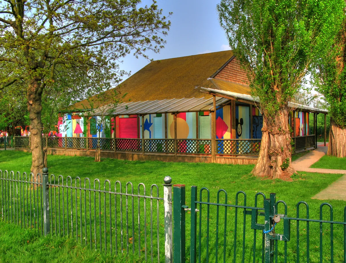
Canterbury Road Recreation Ground
Canterbury Road Recreation Ground — urban park in London Borough of Croydon, United Kingdom.

Wikimedia Commons contributors — see linked file page for photographer and licence licence
Plan your visit
- Typical visit
- 1.5 h–3 h
- Nearest railway station
- West Croydon · 1.2 km
- Free entry
- Family-friendly
- Dog-friendly
About
Canterbury Road Recreation Ground is a country park in the United Kingdom. It covers approximately 5 km². Wikidata describes it as: "urban park in London Borough of Croydon, United Kingdom". Coordinates: 51.3844°, -0.1173°.
Photo gallery
Place summary
Canterbury Road Recreation Ground is a country park located in the London region, specifically within the unparished area of Croydon. This recreational space offers a variety of facilities for outdoor activities and leisure.
AI-generated from the structured facts on this page (operator, designation, listing, era). Not a substitute for visiting.
- Coordinates
- 51.3844, -0.1173
- District
- Croydon
- Parish
- Croydon, unparished area
- Postcode
- CR0 3JN
- Parliamentary constituency
- Croydon West
- Nearest railway station
- West Croydon — 1.2 km
Sources
- wikidata: Q115689146 (CC0)
- commons: Canterbury Road Recreation Ground - geograph.org.uk - 3033860.jpg (CC BY-SA 4.0)
Other places nearby
Loading nearby places…
Nearby
 📷 5
📷 5Historic churches · London
Shahjalal masjid
Shahjalal masjid — a church in england-london, United Kingdom.
 📷 5
📷 5Historic churches · London
Croydon Mosque & Islamic Centre
Croydon Mosque & Islamic Centre — a church in england-london, United Kingdom.
📷 5Historic churches · London
Croydon Mosque
Croydon Mosque — a mosque in england-london, United Kingdom.
 📷 5
📷 5Theatres · London
Safari Cinema
Safari Cinema in England London, United Kingdom.
 📷 5
📷 5Theatres · London
Vue Purley Way
Vue Purley Way in England London, United Kingdom.
 📷 5
📷 5Chapels · London
Broad Green
Broad Green — a methodist chapel in england-london, United Kingdom.
More places in this region
 Flagship📷 10
Country parks · London
Brockwell Park
Brockwell Park — park in south London, England, UK.
 Flagship📷 10
Country parks · London
Clissold Park
Clissold Park — park in Stoke Newington, London.
 Flagship📷 10
Country parks · London
Coombe Wood
Coombe Wood — woodland and garden area in the London Borough of Croydon.
 Flagship📷 10
Country parks · London
Croham Hurst
Croham Hurst — woodland in Croydon, Greater London, England, United Kingdom.
Frequently asked questions
- Where is Canterbury Road Recreation Ground?
- Canterbury Road Recreation Ground is in London, United Kingdom (postcode CR0 3JN), in the parish of Croydon, unparished area.
- Is Canterbury Road Recreation Ground free to visit?
- Yes, Canterbury Road Recreation Ground is free to enter.
- How do I get to Canterbury Road Recreation Ground?
- The nearest railway station is West Croydon, about 1.2 km away. Drivers can navigate to postcode CR0 3JN.