
Natural landmarks · Scottish Highlands
Cairn Gorm
Also known as: An Càrn Gorm, Comhairle na Gàidhealtachd, An Càrn Gorm
Cairn Gorm is a natural landmark in the United Kingdom.

Wikimedia Commons contributors — see linked file page for photographer and licence licence

Plan your visit
- Typical visit
- 1 h–2 h
- Nearest railway station
- Ptarmigan Station · 0.8 km
- Free entry
- Dog-friendly
Getting there & planning your visit
To visit Cairn Gorm in the Scottish Highlands, the nearest railway station is Ptarmigan Station, located 0.8 km away. Entry to the site is free.
About
Cairn Gorm is a named natural landmark in the United Kingdom. Part of Grampian Mountains. Coordinates: 57.1167°, -3.6445°. This entry is part of The Great Britain Guide, a free, ad-free, open-data tourist directory.
Photo gallery
360° viewimagery from 2022
Imagery © Mapillary contributors, CC BY-SA 4.0
Official information
Cairn Gorm is a prominent mountain in the Cairngorms National Park, known for its stunning views and diverse walking routes. Visitors can explore various paths leading to the summit and enjoy the natural beauty of the surrounding landscape.
From the Wikipedia article
Cairn Gorm (Scottish Gaelic: An Càrn Gorm) is a mountain in the Scottish Highlands. It is part of the Cairngorms range and wider Grampian Mountains. With a summit elevation of 1,245 m (4,085 ft) above sea level, Cairn Gorm is classed as a Munro and is the sixth-highest mountain in the British Isles. The high, broad domed summit overlooking Strathspey is one of the most readily identifiable mountains from the nearby town and regional centre of Aviemore. Although it shares its name with the Cairngorm mountains, Ben Macdui is the highest mountain in the range. The highest official wind speed in the UK was in 1986 when a 173 mph (278 km/h) gust was recorded at Cairn Gorm. Since the 1960s over 600 hectares (1,500 acres) of the north-western slopes of the mountain in Coire Cas and Coire na Ciste have been developed for alpine skiing. The ski lift infrastructure includes a funicular railway in Coire Cas. The corrie south of Coire Cas, Coire an t-Sneachda, is separated from the ski area by a ridge known as Fiacaill a' Choire Chais. The southern slopes of Cairn Gorm overlook the remote Loch Avon (pronounced Loch A'an).
Excerpt from Wikipedia under CC BY-SA 4.0. See the source article linked in Sources below.
Background
History
The alpine ski area was developed on Cairn Gorm from 1960 onwards. A chairlift and chalet opened in December 1961. In the summer of 1968 a new half mile of road was built that improved access for skiing in the Coire-na-Ciste area. It is the second largest in Scotland (after Glenshee). By the 1980s, thousands of skiers were using the slopes on busy weekends, which could often become very crowded. By the 2000s, the number of skiers at Cairngorm and Scotland's other ski areas had dropped, partly as a consequence of budget airline travel making access to the Alps more attractive. Snow conditions in the Scottish Highlands are unpredictable and Global Warming has emerged as a potential threat to…
Sourced from Wikipedia under CC BY-SA 4.0.
- Coordinates
- 57.1167, -3.6445
- Address
- Cairngorms, Scotland
- Nearest railway station
- Ptarmigan Station — 0.8 km
- Official site
- www.hill-bagging.co.uk
Sources
- wikidata: Q1025927 (CC0)
- wikipedia: Cairn Gorm (CC BY-SA 4.0)
- commons: Cairn gorm.jpg (CC BY-SA 4.0)
Other places nearby
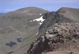
Cairn Gorm
Mountains & hills · 0.0 km

1141m
Mountains & hills · 0.6 km

Fiacaill a' Choire Chais
Mountains & hills · 0.6 km

Cnap Coire na Spreidhe
Mountains & hills · 1.2 km

Cnap Coire na Spreidhe
Mountains & hills · 1.2 km

Stob Coire an t-Sneachda
Mountains & hills · 1.4 km

Stob Coire an t-Sneachda
Mountains & hills · 1.4 km

Fiacaill Coire an t-Sneachda
Mountains & hills · 1.8 km
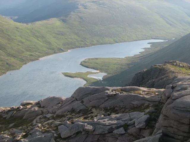
Loch Avon
Natural landmarks · 1.9 km

Loch Avon
Lakes · 2.0 km

Sron A'Cha No
Mountains & hills · 2.2 km

Sròn a' Cha-no
Mountains & hills · 2.3 km
Nearby
📷 3Mountains & hills · Scottish Highlands
Cairn Gorm
Cairn Gorm — Named summit at 1244 m.
📷 5Mountains & hills · Scottish Highlands
1141m
1141m — mountain in scotland highlands. Elevation: 1141m m.
📷 3Mountains & hills · Scottish Highlands
Fiacaill a' Choire Chais
Fiacaill a' Choire Chais — a mountain in scotland-highlands, United Kingdom.
📷 3Mountains & hills · Scottish Highlands
Cnap Coire na Spreidhe
Cnap Coire na Spreidhe — a mountain in scotland-highlands, United Kingdom.
📷 5Mountains & hills · Scottish Highlands
Cnap Coire na Spreidhe
Cnap Coire na Spreidhe — mountain in scotland highlands. Elevation: 1150 m.
📷 5Mountains & hills · Scottish Highlands
Stob Coire an t-Sneachda
Stob Coire an t-Sneachda — a hill or mountain in scotland highlands.
Where to eat & stay near Cairn Gorm
Places to stay
 📷 5
📷 5Campsites · Scottish Highlands
Glenmore Camp Site
Glenmore Camp Site — a campsite in scotland highlands.
📷 5Hostels · Scottish Highlands
Cairngorm Lodge Youth Hostel
Cairngorm Lodge Youth Hostel — a hostel in scotland highlands.
 📷 5
📷 5Campsites · Scottish Highlands
Rothiemurchus Camp and Caravan
Rothiemurchus Camp and Caravan — a campsite in scotland highlands.
 📷 5
📷 5Hotels · Scottish Highlands
Coylumbridge Aviemore Hotel
Coylumbridge Aviemore Hotel — a hotel in scotland highlands.
 📷 5
📷 5 📷 5
📷 5Hostels · Scottish Highlands
Aviemore Youth Hostel
Aviemore Youth Hostel — a hostel in scotland highlands.
More natural landmarks in this region
 Flagship📷 3
Natural landmarks · Scottish Highlands
Dunalastair Water
Dunalastair Water — lake in Perth and Kinross, Scotland, UK, on the River Tummel.
 Flagship📷 3
Natural landmarks · Scottish Highlands
Loch Arkaig
Loch Arkaig — lake in Highland, Scotland, UK, outflows east to River Arkaig.
 Flagship📷 3
Natural landmarks · Scottish Highlands
Loch Assynt
Loch Assynt — lake in Highland, Scotland, UK, outflows to the River Inver and Loch na Garbh Uidhe.
 Flagship📷 5
Natural landmarks · Scottish Highlands
Loch Eilt
Loch Eilt — lake in Highland, Scotland, UK, outflows west to River Ailort.
Frequently asked questions
- Where is Cairn Gorm?
- Cairn Gorm is in the Scottish Highlands, United Kingdom.
- What is Cairn Gorm?
- Cairn Gorm is a natural landmark in the United Kingdom.
- How do I get to Cairn Gorm?
- The nearest railway station is Ptarmigan Station, about 0.8 km away. Its coordinates are 57.1167°, -3.6445°.
- Is Cairn Gorm free to visit?
- Yes, Cairn Gorm is free to enter.
- How do I get to Cairn Gorm?
- The nearest railway station is Ptarmigan Station, about 0.8 km away.