Mountains & hills · Scottish Highlands
Cairds Hill
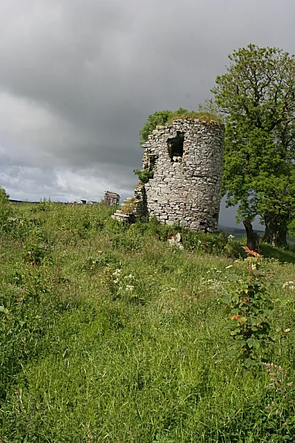
Cairds Hill — a hill or mountain in scotland highlands.

Steven Brown — CC BY-SA 2.0 via Wikimedia Commons licence
Plan your visit
- Typical visit
- 3 h–8 h
- Best time of year
- Late spring – early autumn (May–Oct)
About
A British hill or mountain, named on Ordnance Survey maps and walked by hill-baggers. Cairds Hill is a named hill or mountain in scotland highlands, recorded in the GeoNames UK gazetteer. British landmarks of this type are typically marked on Ordnance Survey maps and recorded in the national gazetteer for cartographic and navigational reference. Coordinates and feature classification are sourced from the GeoNames open dataset.
Photo gallery
Place summary
Cairds Hill is a mountain located in the Scottish Highlands. Known for its rugged terrain and scenic views, it offers a range of outdoor activities for visitors. The area is suitable for hiking and exploring the natural beauty of the Highlands. This mountain is part of a landscape characterised by its dramatic elevations and diverse wildlife.
AI-generated from the structured facts on this page (operator, designation, listing, era). Not a substitute for visiting.
- Coordinates
- 57.5095, -2.9613
Sources
- manual: geonames-12610842 (CC BY 4.0)
Other places nearby
Loading nearby places…
Nearby
 📷 5
📷 5Mountains & hills · Scottish Highlands
Cairds Hill
Cairds Hill — mountain in scotland highlands. Elevation: 301 m.
 📷 4
📷 4Mills · Scottish Highlands
Mill Of Towie
Mill Of Towie — mill in Moray, Scotland, UK.
 📷 3
📷 3Castles · Scottish Highlands
Pitlurg Castle
Pitlurg Castle — tower house in Moray, Scotland, UK.
 📷 5
📷 5Historic bridges · Scottish Highlands
Bridge of Auchindachy
Bridge of Auchindachy — category B listed building-listed bridge in scotland-highlands, United Kingdom.
 📷 5
📷 5Villages · Scottish Highlands
Fife Keith
Fife Keith — a village in scotland highlands.
 📷 5
📷 5Mountains & hills · Scottish Highlands
Hill of Greenwood
Hill of Greenwood — mountain in scotland highlands. Elevation: 274 m.
Where to eat & stay near Cairds Hill
Places to stay
 📷 5
📷 5Caravan parks · Scottish Highlands
Huntly Castle Caravan Park
Huntly Castle Caravan Park — a caravan park in scotland highlands.
 📷 5
📷 5Caravan parks · Scottish Highlands
Burnside Caravan Park
Burnside Caravan Park — a caravan park in scotland highlands.
 📷 5
📷 5Hotels · Scottish Highlands
Craigellachie Hotel
Craigellachie Hotel — a hotel in scotland highlands.
 📷 3
📷 3Campsites · Scottish Highlands
Aberlour Gardens Camping Park
Aberlour Gardens Camping Park — a campsite in scotland highlands.
 📷 5
📷 5Campsites · Scottish Highlands
Greencraig Pods, Caravan & Camping
Greencraig Pods, Caravan & Camping — a campsite in scotland highlands.
 📷 5
📷 5Campsites · Scottish Highlands
Speyside by Craigellachie
Speyside by Craigellachie — a campsite in scotland highlands.
Places to eat & drink
 📷 5
📷 5Historic pubs · Scottish Highlands
Seafield Arms Hotel, 84, 86 Mid Street, Keith
Seafield Arms Hotel, 84, 86 Mid Street, Keith in Scotland Highlands, United Kingdom.
 📷 5
📷 5Historic pubs · Scottish Highlands
Forbes Arms Hotel, Milltown of Rothiemay
Forbes Arms Hotel, Milltown of Rothiemay in Scotland Highlands, United Kingdom.
More mountains in this region
 📷 3
📷 3Mountains & hills · Scottish Highlands
A' Bhuidheanach Bheag
A' Bhuidheanach Bheag — Named summit at 936 m.
 📷 3
📷 3Mountains & hills · Scottish Highlands
A' Chailleach
A' Chailleach — Named summit at 997 m.
 📷 3
📷 3Mountains & hills · Scottish Highlands
A' Chailleach
A' Chailleach — Named summit at 930 m.
 📷 3
📷 3Mountains & hills · Scottish Highlands
A' Chaoirnich
A' Chaoirnich — Named summit at 875 m.
Frequently asked questions
- Where is Cairds Hill?
- Cairds Hill is in the Scottish Highlands, United Kingdom.
- What is Cairds Hill?
- Cairds Hill — a hill or mountain in scotland highlands.
- How do I get to Cairds Hill?
- Its coordinates are 57.5095°, -2.9613°.