Mountains & hills · Scottish Highlands
Cìoch a' Chùil Bhig
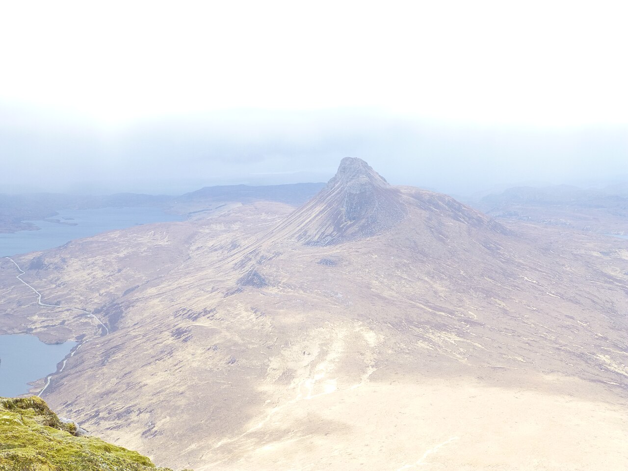
Cìoch a' Chùil Bhig — mountain in scotland highlands. Elevation: 566 m.
L Cowieson — CC BY-SA 2.0 via Wikimedia Commons licence
Plan your visit
- Typical visit
- 3 h–8 h
- Best time of year
- Late spring – early autumn (May–Oct)
About
Cìoch a' Chùil Bhig is a mountain located in scotland highlands. Elevation: 566 m. A named British peak recorded in OpenStreetMap. Peaks are typically named on Ordnance Survey 1:50k mapping.
Photo gallery
Place summary
Cìoch a' Chùil Bhig is a mountain located in the Scottish Highlands. It features rugged terrain typical of the region, appealing to walkers and climbers. The mountain offers striking views and is part of the diverse landscape that characterises the Highlands. Visitors can expect a challenging but rewarding experience in this remote and scenic area.
AI-generated from the structured facts on this page (operator, designation, listing, era). Not a substitute for visiting.
- Coordinates
- 58.0337, -5.1514
Sources
- osm: n2363207676 (ODbL)
Other places nearby
Loading nearby places…
Nearby
 📷 5
📷 5Mountains & hills · Scottish Highlands
Cul Beag
Cul Beag — a hill or mountain in scotland highlands.
 📷 5
📷 5Mountains & hills · Scottish Highlands
Cùl Beag
Cùl Beag — Named summit at 769 m.
 📷 5
📷 5Natural landmarks · Scottish Highlands
Cùl Beag
Cùl Beag — mountain in Highland, Scotland, UK.
 📷 5
📷 5Mountains & hills · Scottish Highlands
Meall Dearg
Meall Dearg — a hill or mountain in scotland highlands.
📷 5Mountains & hills · Scottish Highlands
Meall Dearg
Meall Dearg — mountain in scotland highlands. Elevation: 657 m.
 📷 4
📷 4Reservoirs & lochs · Scottish Highlands
Loch an Doire Dhuibh
Loch an Doire Dhuibh in Scotland Islands, United Kingdom.
Where to eat & stay near Cìoch a' Chùil Bhig
Places to stay
 📷 5
📷 5Hostels · Scottish Highlands
Acheninver Hostel
Acheninver Hostel — a hostel in scotland highlands.
 📷 5
📷 5Campsites · Scottish Highlands
Ardmair Point Touring Park
Ardmair Point Touring Park — a campsite in scotland highlands.
 📷 5
📷 5Hostels · Scottish Highlands
Ullapool Youth Hostel
Ullapool Youth Hostel — a hostel in scotland highlands.
 📷 5
📷 5Hostels · Scottish Highlands
Ullapool Youth Hostel
Ullapool Youth Hostel — a hostel in scotland highlands.
 📷 5
📷 5Campsites · Scottish Highlands
Port A Bhaigh Campsite
Port A Bhaigh Campsite — a campsite in scotland highlands.
 📷 5
📷 5Campsites · Scottish Highlands
Broomfield Holiday Park
Broomfield Holiday Park — a campsite in scotland highlands.
More mountains in this region
 📷 3
📷 3Mountains & hills · Scottish Highlands
A' Bhuidheanach Bheag
A' Bhuidheanach Bheag — Named summit at 936 m.
 📷 3
📷 3Mountains & hills · Scottish Highlands
A' Chailleach
A' Chailleach — Named summit at 997 m.
 📷 3
📷 3Mountains & hills · Scottish Highlands
A' Chailleach
A' Chailleach — Named summit at 930 m.
 📷 3
📷 3Mountains & hills · Scottish Highlands
A' Chaoirnich
A' Chaoirnich — Named summit at 875 m.
Frequently asked questions
- Where is Cìoch a' Chùil Bhig?
- Cìoch a' Chùil Bhig is in the Scottish Highlands, United Kingdom.
- What is Cìoch a' Chùil Bhig?
- Cìoch a' Chùil Bhig — mountain in scotland highlands. Elevation: 566 m.
- How do I get to Cìoch a' Chùil Bhig?
- Its coordinates are 58.0337°, -5.1514°.