Mountains & hills · North Wales
Bwrdd Arthur
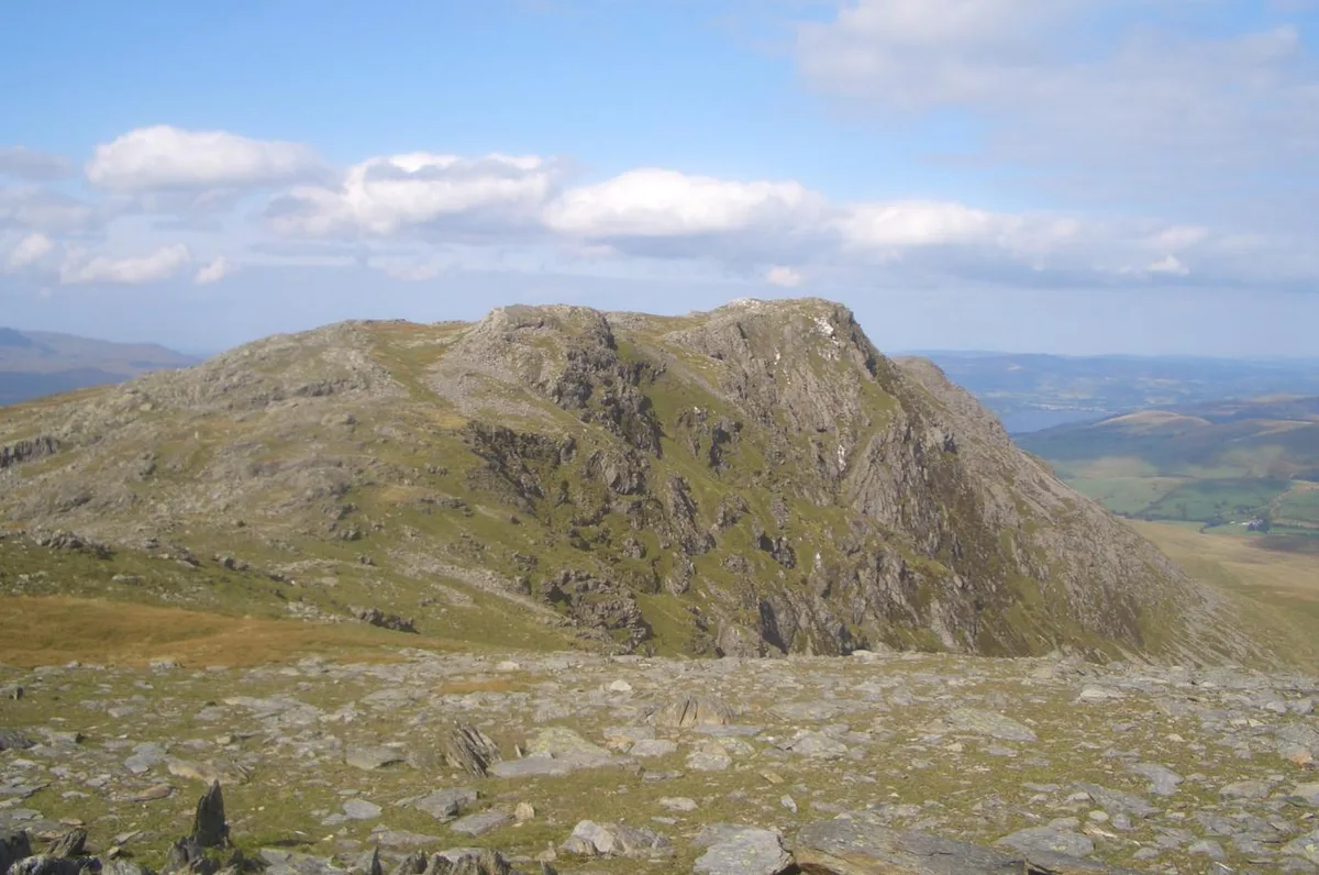
Bwrdd Arthur — Named summit at 164 m.

Wikimedia Commons contributors — see linked file page for photographer and licence licence
Plan your visit
- Typical visit
- 3 h–8 h
- Best time of year
- Late spring – early autumn (May–Oct)
- Nearest railway station
- Bangor · 9.7 km
- Free entry
- Dog-friendly
About
Bwrdd Arthur is a named summit in the United Kingdom. Wikidata describes it as: "Named summit at 164 m.". Coordinates: 53.3097°, -4.1240°.
Photo gallery
From the Wikipedia article
Bwrdd Arthur (Welsh for 'Arthur's Table'), also known as Din Sylwy, is a 164-metre (538 ft) flat-topped limestone hill on the island of Anglesey, in Wales. Located on the eastern end of Red Wharf Bay, some 3 kilometres north west of Llangoed, it is noteworthy from the evidence of pre-historic occupation and as a Site of Special Scientific Interest designated for its botanical interest. The tiny medieval church of St Michael is on the eastern side of the hill fort.
Excerpt from Wikipedia under CC BY-SA 4.0. See the source article linked in Sources below.
- Coordinates
- 53.3097, -4.1240
- District
- Isle of Anglesey
- Parish
- Llanddona
- Postcode
- LL58 8YB
- Parliamentary constituency
- Ynys Môn
- Nearest railway station
- Bangor — 9.7 km
Sources
- osm: n3685632810 (ODbL)
- wikipedia: Bwrdd Arthur (CC BY-SA 4.0)
- commons: Bwrdd Arthur trig - geograph.org.uk - 184992.jpg (CC BY-SA 4.0)
Other places nearby
Loading nearby places…
Nearby
Vineyards · North Wales
Bwrdd Arthur
Bwrdd Arthur — a UK vineyard in wales north, producing English or Welsh wine from cool-climate grape varieties.
 📷 3
📷 3Hill forts · North Wales
Bwrdd Arthur Hillfort
Bwrdd Arthur Hillfort — a hill fort in wales-north, United Kingdom.
📷 5Historic churches · North Wales
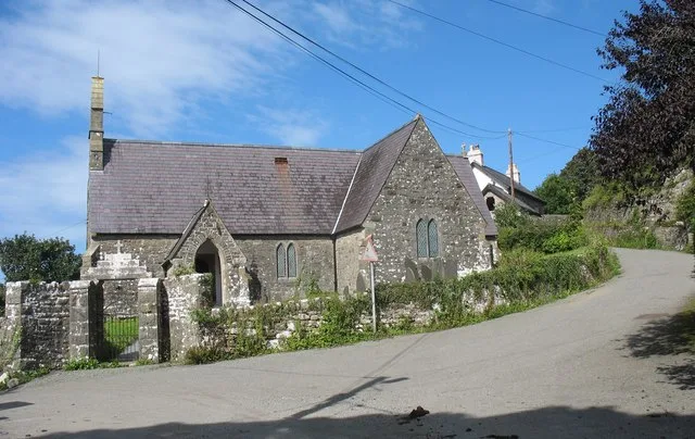
Llanfihangel Din Sylwy
Llanfihangel Din Sylwy (spelling variants include Llanfihangel Din Silwy and Llanfihangel Tyn Sylwy) is a small, coastal (former) parish in the commote of Dindaethwy in north-east Anglesey, three mile
📷 5Historic churches · North Wales
St Michael's Church, Llanfihangel Din Sylwy
St Michael's Church, Llanfihangel Din Sylwy — a church in wales-north, United Kingdom.
 📷 3
📷 3Historic churches · North Wales
St Dona's Church, Llanddona
St Dona's Church, Llanddona — church in Anglesey, UK.
 📷 3
📷 3Archaeological sites · North Wales
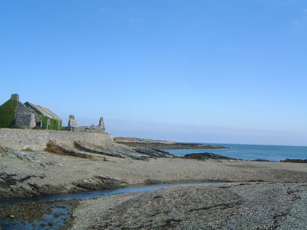
Llanddona fish weir
Llanddona fish weir — a archaeological in wales-north, United Kingdom.
More mountains in this region
 📷 5
📷 5Mountains & hills · North Wales
Cemlyn Bay and lagoon
Cemlyn Bay and lagoon — Site of Special Scientific Interest in Wales.
 📷 3
📷 3Mountains & hills · North Wales
Aberffraw Bay
Aberffraw Bay — bay on the west coast of Anglesey, in Wales, UK.
 📷 3
📷 3Mountains & hills · North Wales
Allt-fawr
Allt-fawr — Named summit at 698 m.
 📷 3
📷 3Mountains & hills · North Wales
Aran Benllyn
Aran Benllyn — Named summit at 884 m.
Frequently asked questions
- Where is Bwrdd Arthur?
- Bwrdd Arthur is in North Wales, United Kingdom (postcode LL58 8YB), in the parish of Llanddona.
- Is Bwrdd Arthur free to visit?
- Yes, Bwrdd Arthur is free to enter.
- How do I get to Bwrdd Arthur?
- Drivers can navigate to postcode LL58 8YB. It sits within the Ynys Môn parliamentary constituency.