Reservoirs & lochs · North East England
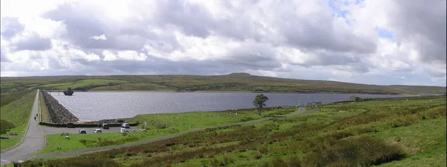
Burnhope Burn
In or near Castleside.
Burnhope Burn in England North East, United Kingdom.

Oliver Dixon — CC BY-SA 2.0 via Wikimedia Commons licence
Plan your visit
- Typical visit
- 1 h–2.5 h
- Free entry
- Dog-friendly
About
Burnhope Burn is a place of interest in England North East, United Kingdom — drawn from open-data sources for visitor reference. See the linked Wikipedia article for the full description.
Photo gallery
Official information
Burnhope Burn is a natural site managed under the MAGIC initiative, which provides geographic information about various environments across Great Britain. Visitors can explore over 400 datasets through an interactive mapping tool that covers rural, urban, coastal, and marine areas.
Protected designations
- Site of Special Scientific Interest: Burnhope Burn SSSI
- Site of Special Scientific Interest: Muggleswick, Stanhope and Edmundbyers Commons and Blanchland Moor SSSI
- Area of Outstanding Natural Beauty: North Pennines
Designations sourced from Natural England open data under OGL v3.
From the Wikipedia article
Burnhope Burn is a Site of Special Scientific Interest in the Wear Valley district of north County Durham, England. It consists of a 12.6-acre (5.1 ha) area of woodland, carr, fen and mire in the valley of Burnhope Burn, just below the dam of the Derwent Reservoir, a mile (1.6 km) north-east of the village of Edmundbyers. It contains a range of habitats that are characteristic of poorly drained soils and that are rare or local in County Durham; such as smooth-stalked sedge (Carex levigata), bogbean (Menyanthes) and globeflower (Trollius). In a small basin-mire in the northern part of the site, there are abundant communities of a number of species that have a localised distribution elsewhere in the county.
Excerpt from Wikipedia under CC BY-SA 4.0. See the source article linked in Sources below.
- Coordinates
- 54.8517, -1.9556
- District
- Northumberland
- Parish
- Shotley Low Quarter
- Postcode
- DH8 9TT
- Parliamentary constituency
- Hexham
- Established
- 1987
- Official site
- magic.defra.gov.uk
Sources
- wikidata: Q4999765 (CC0)
- wikipedia: Burnhope Burn (CC BY-SA 4.0)
Other places nearby

Struthers Farm Caravan Site
Caravan parks · 1.4 km
Edmundbyers Youth Hostel at Low House Haven
Hostels · 1.4 km

Burnhope Linn
Waterfalls · 1.4 km

Edmundbyers
Reservoirs & lochs · 1.5 km

Muggleswick
Other places · 1.5 km

Edmondbyers
Villages · 1.5 km

Remains of Monastic Grange
Historic houses · 1.7 km

Remains of Monastic Grange
Archaeological sites · 1.7 km

Muggleswick War Memorial
Memorials & monuments · 1.7 km

Carterway Heads
Reservoirs & lochs · 1.7 km

The Burnside
B&Bs · 1.9 km

Derwent View
Campsites · 1.9 km
Nearby
📷 5Caravan parks · North East England
Struthers Farm Caravan Site
Struthers Farm Caravan Site — a caravan park in scotland lowlands.
📷 5Hostels · North East England
Edmundbyers Youth Hostel at Low House Haven
Edmundbyers Youth Hostel at Low House Haven — a hostel in scotland lowlands. Brand: Youth Hostels Association.
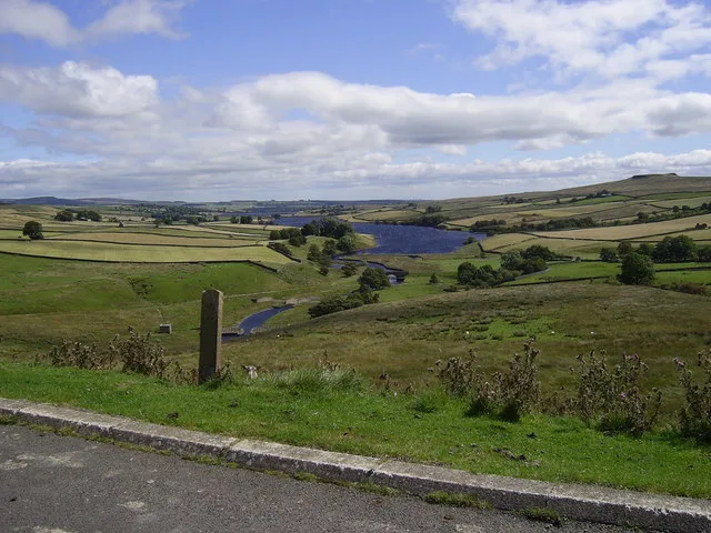
📷 5📷 5Reservoirs & lochs · North East England
Edmundbyers
Edmundbyers in England North East, United Kingdom.
📷 4Other places · North East England
Muggleswick
Muggleswick in England North East, United Kingdom.
📷 5Where to eat & stay near Burnhope Burn
Places to stay
📷 5Caravan parks · North East England
Struthers Farm Caravan Site
Struthers Farm Caravan Site — a caravan park in scotland lowlands.
📷 5Hostels · North East England
Edmundbyers Youth Hostel at Low House Haven
Edmundbyers Youth Hostel at Low House Haven — a hostel in scotland lowlands. Brand: Youth Hostels Association.
📷 5B&Bs · North East England
The Burnside
The Burnside — a bed-and-breakfast in scotland lowlands.
📷 5Campsites · North East England
Derwent View
Derwent View — a campsite in scotland lowlands.
📷 5Caravan parks · North East England
Derwent View
Derwent View — a caravan park in scotland lowlands.
 📷 5
📷 5Caravan parks · North East England
Bolbec Manor Campsite
Bolbec Manor Campsite — a caravan park in scotland lowlands.
Places to eat & drink
 📷 5
📷 5Historic pubs · North East England
The Lord Crewe Arms Hotel
The Lord Crewe Arms Hotel in Scotland Lowlands, United Kingdom.
 📷 5
📷 5Cafés · North East England
The White Monk Tearoom
The White Monk Tearoom — a café in scotland lowlands.
 📷 4
📷 4 📷 4
📷 4Historic pubs · North East England
Delves Lane
Delves Lane in England North East, United Kingdom.
 📷 5
📷 5Historic pubs · North East England
Travellers' Rest Inn
Travellers' Rest Inn in Scotland Lowlands, United Kingdom.
 📷 5
📷 5Historic pubs · North East England
Wellington Inn
Wellington Inn in Scotland Lowlands, United Kingdom.
More places in this region
 📷 2
📷 2Reservoirs & lochs · North East England
Balderhead Reservoir
Balderhead Reservoir — reservoir in County Durham, England, UK.
 📷 3
📷 3Reservoirs & lochs · North East England
Blackton Reservoir
Blackton Reservoir — reservoir in County Durham, England, UK.
 📷 5
📷 5Reservoirs & lochs · North East England
Grassholme Reservoir
Grassholme Reservoir — reservoir in County Durham, England, UK.
 📷 3
📷 3Reservoirs & lochs · North East England
Hury Reservoir
Hury Reservoir — reservoir in County Durham, England, UK.
Frequently asked questions
- Where is Burnhope Burn?
- Burnhope Burn is in North-East England, United Kingdom (postcode DH8 9TT), in the parish of Shotley Low Quarter.
- What is Burnhope Burn?
- Burnhope Burn in England North East, United Kingdom.
- How do I get to Burnhope Burn?
- Drivers can use postcode DH8 9TT.
- When was Burnhope Burn built?
- Built or established in 1987.
- Is Burnhope Burn a protected site?
- Yes — Burnhope Burn is part of the Burnhope Burn SSSI Site of Special Scientific Interest and the Muggleswick, Stanhope and Edmundbyers Commons and Blanchland Moor SSSI Site of Special Scientific Interest.
- Is Burnhope Burn free to visit?
- Yes, Burnhope Burn is free to enter.
- How do I get to Burnhope Burn?
- Drivers can navigate to postcode DH8 9TT. It sits within the Hexham parliamentary constituency.