
Museums · East of England
Bungay
In or near Flixton.
Bungay () is a market town, civil parish and electoral ward in the East Suffolk district of Suffolk, England. It lies in the Waveney Valley, 5+1⁄2 miles (9 kilometres) west of Beccles on the edge of T

Adrian S Pye — CC BY-SA 2.0 via Wikimedia Commons licence

Plan your visit
- Typical visit
- 1.5 h–3 h
- Best time of year
- Year-round
- Nearest railway station
- Beccles · 9.0 km
- Family-friendly
- Limited wheelchair access
About
Bungay () is a market town, civil parish and electoral ward in the East Suffolk district of Suffolk, England. It lies in the Waveney Valley, 5+1⁄2 miles (9 kilometres) west of Beccles on the edge of The Broads, and at the neck of a meander of the River Waveney. In 2011 it had a population of 5,127.
Photo gallery
From the Wikipedia article
Bungay () is a market town, civil parish and electoral ward in the East Suffolk district of Suffolk, England. It lies in the Waveney Valley, 5+1⁄2 miles (9 kilometres) west of Beccles on the edge of The Broads, and at the neck of a meander of the River Waveney. In 2011 it had a population of 5,127.
Excerpt from Wikipedia under CC BY-SA 4.0. See the source article linked in Sources below.
Background
History
The origin of the name of Bungay is thought to derive from the Anglo-Saxon title Bunincga-haye, signifying the land belonging to the tribe of Bonna, a Saxon chieftain. Due to its high position, protected by the River Waveney and marshes, the site was in a good defensive position and attracted settlers from early times. Roman artefacts have been found in the region. ]] Bungay Castle, which is shown on Bungay's town sign, was originally built by the Normans but was later rebuilt by Roger Bigod, 5th Earl of Norfolk and his family, who also owned Framlingham Castle. The castle contains a unique surviving example of mining galleries, dating to the siege of the castle in 1174. They were intended…
Sourced from Wikipedia under CC BY-SA 4.0.
- Coordinates
- 52.4560, 1.4370
- County
- Suffolk
- District
- East Suffolk
- Parish
- Bungay
- Postcode
- NR35 1EE
- Parliamentary constituency
- Waveney Valley
- Nearest railway station
- Beccles — 9 km
Sources
- wikipedia: Bungay (CC BY-SA 4.0)
Other places nearby

Butter Cross
Memorials & monuments · 0.0 km

Ma Belle Bakery
Cafés · 0.0 km

Bungay War Memorial
Memorials & monuments · 0.1 km
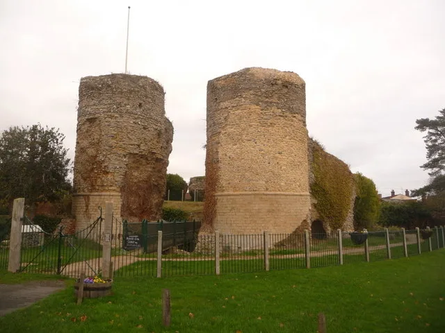
Bungay Castle
Castles · 0.1 km
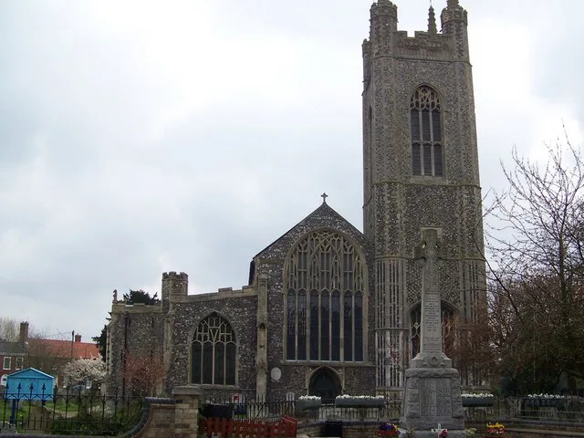
St Mary's Church, Bungay
Historic churches · 0.1 km

The Fisher Theatre
Theatres · 0.1 km
Fisher Theatre, Bungay
Theatres · 0.1 km
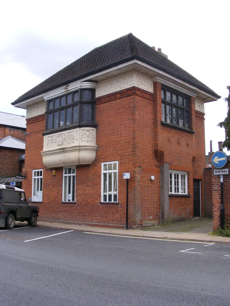
Bungay Museum
Museums · 0.1 km

J. B. Scott's Pastiche (1839)
Historic houses · 0.2 km

Church of Holy Trinity
Historic churches · 0.2 km

Bridge Over River Waveney
Historic bridges · 0.3 km

Trinity Hall
Historic houses · 0.3 km
Nearby
📷 4Memorials & monuments · East of England
Butter Cross
Butter Cross is a memorial in the United Kingdom.
📷 7📷 3Memorials & monuments · East of England
Bungay War Memorial
Bungay War Memorial — Grade II listed building-listed memorial in england-east, United Kingdom.
📷 3Castles · East of England
Bungay Castle
Bungay Castle — castle in Suffolk, England, UK.
📷 3Historic churches · East of England
St Mary's Church, Bungay
St Mary's Church, Bungay — church in Bungay, Suffolk, England, UK.
📷 3Where to eat & stay near Bungay
Places to stay
 📷 5
📷 5Caravan parks · East of England
Outney Meadow Caravan Park
Outney Meadow Caravan Park — a caravan park in england east.
 📷 5
📷 5Campsites · East of England
Wardley Hill Campsite
Wardley Hill Campsite — a campsite in england east.
 📷 5
📷 5 📷 5
📷 5Campsites · East of England
Three Rivers Pitch & Paddle
Three Rivers Pitch & Paddle — a campsite in england east.
 📷 5
📷 5Caravan parks · East of England
Little Lakeland Caravan Park
Little Lakeland Caravan Park — a caravan park in england east.
 📷 5
📷 5Hotels · East of England
The Kings Head Hotel
The Kings Head Hotel — a hotel in england east.
Places to eat & drink
📷 7 📷 5
📷 5Historic pubs · East of England
Crown And Anchor Public House
Crown And Anchor Public House in England East, United Kingdom.
 📷 5
📷 5 📷 5
📷 5Historic pubs · East of England
Cherry Tree Public House
Cherry Tree Public House in England East, United Kingdom.
 📷 5
📷 5Historic pubs · East of England
The Countryman Public House
The Countryman Public House in England East, United Kingdom.
 📷 5
📷 5More museums in this region
 📷 5
📷 5Museums · East of England
American Air Museum
American Air Museum — museum at Imperial War Museum Duxford, Cambridgeshire, England, UK.
 📷 5
📷 5Museums · East of England
Ashwell Village Museum
Ashwell Village Museum — historic building museum in Ashwell, Hertfordshire, England, United Kingdom.
 📷 5
📷 5Museums · East of England
Barleylands Farm Museum
Barleylands Farm Museum — Farm museum in Billericay, England.
 📷 5
📷 5Museums · East of England
Cromwell Museum
Cromwell Museum — museum in Huntingdon, England, United Kingdom.
Frequently asked questions
- Where is Bungay?
- Bungay is in Suffolk, East of England, United Kingdom (postcode NR35 1EE), in the parish of Bungay.
- What is Bungay?
- Bungay () is a market town, civil parish and electoral ward in the East Suffolk district of Suffolk, England. It lies in the Waveney Valley, 5+1⁄2 miles (9 kilometres) west of Beccles on the edge of T
- How do I get to Bungay?
- The nearest railway station is Beccles, about 9.0 km away. Drivers can use postcode NR35 1EE.
- How do I get to Bungay?
- Drivers can navigate to postcode NR35 1EE. It sits within the Waveney Valley parliamentary constituency.