Mountains & hills · Scottish Highlands
Bruntwood Tap
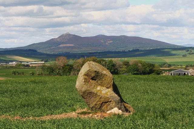
Bruntwood Tap — mountain in scotland highlands. Elevation: 411 m.

Mick Garratt — CC BY-SA 2.0 via Wikimedia Commons licence
Plan your visit
- Typical visit
- 3 h–8 h
- Best time of year
- Late spring – early autumn (May–Oct)
About
Bruntwood Tap is a mountain located in scotland highlands. Elevation: 411 m. A named British peak recorded in OpenStreetMap. Peaks are typically named on Ordnance Survey 1:50k mapping.
Photo gallery
Place summary
Bruntwood Tap is a mountain located in the Scottish Highlands. It is noted for its distinctive landscape and rugged terrain, appealing to outdoor enthusiasts. The area offers various recreational opportunities, including hiking and climbing, allowing visitors to experience the natural beauty of the Highlands. The mountain's elevation provides panoramic views of the surrounding region.
AI-generated from the structured facts on this page (operator, designation, listing, era). Not a substitute for visiting.
- Coordinates
- 57.2851, -2.5520
Sources
- osm: n2407697764 (ODbL)
Other places nearby
Loading nearby places…
Nearby
 📷 5
📷 5Mountains & hills · Scottish Highlands
Garbet Tap
Garbet Tap — mountain in scotland highlands. Elevation: 468 m.
 📷 3
📷 3Memorials & monuments · Scottish Highlands
Bennachie Royal Air Force Stone
Bennachie Royal Air Force Stone — a memorial in scotland-highlands, United Kingdom.
 📷 5
📷 5Mountains & hills · Scottish Highlands
Oxen Craig
Oxen Craig — Named summit at 529 m.
 📷 5
📷 5Natural landmarks · Scottish Highlands
Bennachie
Bennachie — range of hills in Aberdeenshire, Scotland, UK.
 📷 5
📷 5Mountains & hills · Scottish Highlands
Craigshannoch
Craigshannoch — mountain in scotland highlands. Elevation: 482 m.
 📷 5
📷 5Mountains & hills · Scottish Highlands
Mither Tap
Mither Tap — mountain in scotland highlands. Elevation: 518 m.
More mountains in this region
 📷 3
📷 3Mountains & hills · Scottish Highlands
A' Bhuidheanach Bheag
A' Bhuidheanach Bheag — Named summit at 936 m.
 📷 3
📷 3Mountains & hills · Scottish Highlands
A' Chailleach
A' Chailleach — Named summit at 997 m.
 📷 3
📷 3Mountains & hills · Scottish Highlands
A' Chailleach
A' Chailleach — Named summit at 930 m.
 📷 3
📷 3Mountains & hills · Scottish Highlands
A' Chaoirnich
A' Chaoirnich — Named summit at 875 m.
Frequently asked questions
- Where is Bruntwood Tap?
- Bruntwood Tap is in the Scottish Highlands, United Kingdom.
- What is Bruntwood Tap?
- Bruntwood Tap — mountain in scotland highlands. Elevation: 411 m.
- How do I get to Bruntwood Tap?
- Its coordinates are 57.2851°, -2.5520°.