
Other places · North East England
Brough
Also known as: Brough, Cumbria
In or near Helbeck.
Brough in England North East, United Kingdom.

Gordon Hatton — CC BY-SA 2.0 via Wikimedia Commons licence

Plan your visit
- Typical visit
- 1 h–2 h
- Nearest railway station
- Warcop · 4.3 km
- Free entry
Getting there & planning your visit
To visit Brough, the nearest railway station is Warcop, located 4.3 km away. The postcode for Brough is CA17 4AS. Entry details are not specified, so please check in advance for any fees or accessibility options.
About
Brough is a place of interest in England North East, United Kingdom — drawn from open-data sources for visitor reference. See the linked Wikipedia article for the full description.
Photo gallery
See it from the streetimagery from 2019
Imagery © Mapillary contributors, CC BY-SA 4.0
Official information
Brough Pinfold is a historical site located near Kirkby Stephen, featuring traditional pinfolds that are generally visible from the road. Visitors can explore the area, which is accessible to wheelchair users and those with visual impairments.
Protected designations
- Site of Special Scientific Interest: River Eden and Tributaries SSSI
- Area of Outstanding Natural Beauty: North Pennines
Designations sourced from Natural England open data under OGL v3.
From the Wikipedia article
Brough (), sometimes known as Brough under Stainmore, is a village and civil parish in the historic county of Westmorland and the ceremonial county of Cumbria, England, within the Westmorland and Furness unitary authority area, on the western fringe of the Pennines near Stainmore. The village is on the A66 trans-Pennine road, and the Swindale Beck, and is about 8 miles (13 km) south east of Appleby-in-Westmorland. Brough is situated 5 miles (8.0 km) north east of Kirkby Stephen and 28 miles (45 km) north east of Kendal on the A685. At the 2001 census it had a population of 680, increasing to 751 at the 2011 Census. This rose to 820 people at the 2021 Census.
Excerpt from Wikipedia under CC BY-SA 4.0. See the source article linked in Sources below.
Background
History
The village is on the site of the Roman fort of Verterae ("The Forts"), on the northern leg of the Roman-era Watling Street, linking Luguvalium (Carlisle) with Eboracum (York) and points south. The area of the rectangular fort, which once occupied the land to the south of the Swindale Beck, is now a Scheduled Ancient Monument. Brough Castle was built in the 11th century within the northern part of the former fort. Like many other castles in the area, Brough was restored in the 17th century by Lady Anne Clifford. The Castle is now in the care of English Heritage and its ruins can be visited. Brough has historically been divided into Market Brough, to the north, and Church Brough, to the…
Description
Traditionally, on Twelfth Night, a burning holly tree (subsequently, ash trees were used) would be carried through the village, followed by a brass band. When the flames had partially gone out, the villagers would try to bring the tree to a pub, where the party would continue until the early hours of the morning. The village was also the venue for a popular fair on the second Thursday of March.
Sourced from Wikipedia under CC BY-SA 4.0.
- Coordinates
- 54.5256, -2.3188
- District
- Westmorland and Furness
- Parish
- Brough
- Postcode
- CA17 4AS
- Parliamentary constituency
- Westmorland and Lonsdale
- Nearest railway station
- Warcop — 4.3 km
- Official site
- www.sheepfoldscumbria.co.uk
Sources
- wikidata: Q2926314 (CC0)
- wikipedia: Brough, Cumbria (CC BY-SA 4.0)
Other places nearby

Verterae
Castles · 0.1 km

Brough Pinfold
Public art & sculpture · 0.2 km

Bridge Over Swindle Beck To South Of Mill House
Historic bridges · 0.3 km

Bridge House, Opposite Ford Bridge
Historic bridges · 0.4 km
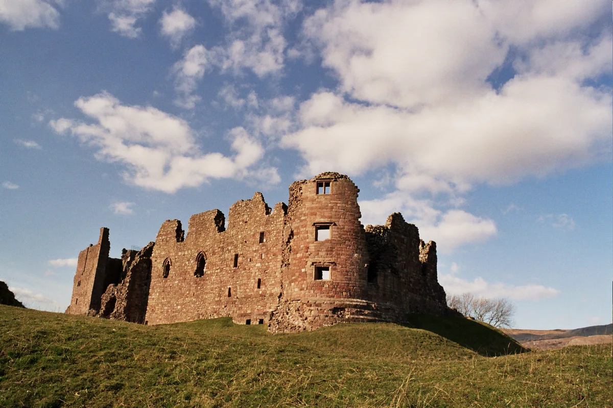
Brough Castle
Castles · 0.5 km

Helbeck
Towns & cities · 1.0 km

Augill Castle
Hotels · 1.3 km
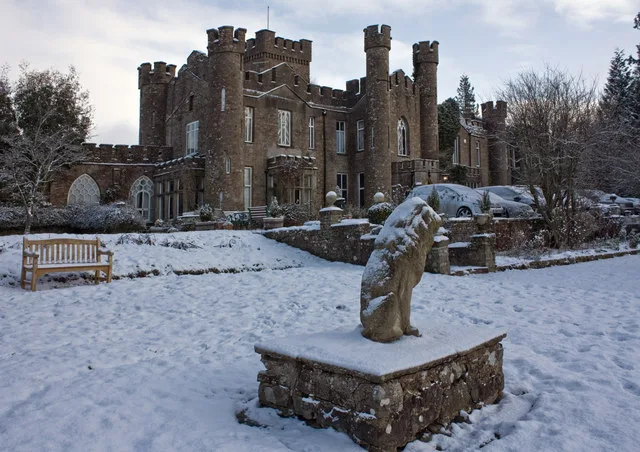
Augill Castle
Castles · 1.3 km

Barnarm Scar
Mountains & hills · 1.7 km

Brough Sowerby
Other places · 1.8 km

Fox Tower
Castles · 1.9 km

Helbeck Wood
Wildlife reserves · 2.1 km
Nearby
📷 4Castles · North East England
Verterae
Verterae in England North East, United Kingdom.
📷 3Public art & sculpture · North East England
Brough Pinfold
Brough Pinfold — a public art in england-north-east, United Kingdom.
📷 3Historic bridges · North East England
Bridge Over Swindle Beck To South Of Mill House
Bridge Over Swindle Beck To South Of Mill House — Grade II listed building-listed bridge in england-north-east, United Kingdom.
📷 3Historic bridges · North East England
Bridge House, Opposite Ford Bridge
Bridge House, Opposite Ford Bridge — Grade II listed building-listed bridge in england-north-east, United Kingdom.
📷 5Castles · North East England
Brough Castle
Brough Castle — castle in Cumbria, England, UK.
📷 3Towns & cities · North East England
Helbeck
Helbeck — a village located in Eden, United Kingdom.
Where to eat & stay near Brough
Places to stay
📷 5Hotels · North East England
Augill Castle
Augill Castle — a hotel in england north east.
 📷 7
📷 7Hotels · North West England
The Pennine Hotel
The Pennine Hotel — a hotel in england north west.
 📷 7
📷 7Hotels · North West England
Black Bull Hotel
Black Bull Hotel — a hotel in england north west.
 📷 7
📷 7B&Bs · North West England
Fletcher House
Fletcher House — a bed-and-breakfast in england north west.
 📷 5
📷 5Hostels · North West England
Kirkby Stephen Hostel
Kirkby Stephen Hostel — a hostel in england north west.
 📷 5
📷 5Places to eat & drink
📷 7Cafés · North West England
The White Hare Cafe
The White Hare Cafe — a café in england north west.
 📷 5
📷 5Historic pubs · North East England
1, Scattergate
1, Scattergate in England North East, United Kingdom.
 📷 5
📷 5 📷 5
📷 5Cafés · North West England
The Cross Keys Temperance Inn
The Cross Keys Temperance Inn — a café in england north west.
 📷 5
📷 5Historic pubs · Yorkshire & the Humber
Kings Head Inn
Kings Head Inn in England North West, United Kingdom.
More places in this region
 📷 5
📷 5Other places · North East England
Appleby Horse Fair
The Appleby Horse Fair, previously known as Appleby New Fair, is an annual gathering of Romani people (Gypsies) and Travellers in Appleby-in-Westmorland in Cumbria, England. The horse fair is held eac
 📷 5
📷 5Other places · North East England
Crosby Garrett
Crosby Garrett in England North East, United Kingdom.
 📷 5
📷 5Other places · North East England
Ravenstonedale
Ravenstonedale in England North East, United Kingdom.
 📷 5
📷 5Frequently asked questions
- Where is Brough?
- Brough is in North-East England, United Kingdom (postcode CA17 4AS), in the parish of Brough.
- What is Brough?
- Brough in England North East, United Kingdom.
- How do I get to Brough?
- The nearest railway station is Warcop, about 4.3 km away. Drivers can use postcode CA17 4AS.
- Is Brough a protected site?
- Yes — Brough is part of the River Eden and Tributaries SSSI Site of Special Scientific Interest and the North Pennines National Landscape (AONB).
- How do I get to Brough?
- The nearest railway station is Warcop, about 4.3 km away. Drivers can navigate to postcode CA17 4AS.