
Historic houses · East of England
Broke Hall
In or near Hemley.
Broke Hall — house in Nacton, Suffolk, England, UK.

Wikimedia Commons contributors — see linked file page for photographer and licence licence

Plan your visit
- Typical visit
- 1 h–2 h
- Nearest railway station
- Derby Road · 6.3 km
- Family-friendly
- Limited wheelchair access
Getting there & planning your visit
Broke Hall is located in Suffolk, with the nearest railway station being Derby Road, which is approximately 6.3 km away. The postcode for sat-nav is IP10 0ET. Accessibility is limited for wheelchair users.
About
Broke Hall is a historic house in the United Kingdom — typically a country seat, manor, or town house with notable architecture or history. Heritage designation: Grade II* listed building. Wikidata describes it as: "house in Nacton, Suffolk, England, UK". Coordinates: 52.0054°, 1.2392°.
Photo gallery
Protected designations
- Site of Special Scientific Interest: Orwell Estuary SSSI
- Area of Outstanding Natural Beauty: Suffolk Coast & Heaths
- Ramsar wetland: Stour and Orwell Estuaries
Designations sourced from Natural England open data under OGL v3.
From the Wikipedia article
Broke Hall is an English country house at Nacton, near Ipswich, Suffolk. It overlooks the River Orwell, opposite Pin Mill. The gardens were landscaped by Humphry Repton in 1794, and the house is Grade II* listed. The site was purchased by Sir Richard Broke, who built a manor house there, during the reign of Henry VIII. The present house was built by James Wyatt for Philip Bowes Broke in 1792, but is probably a remodelling of an earlier house built in 1775 by Richard Norris. Broke Hall was the birthplace of Admiral Philip Bowes Vere Broke. The property remained in the Broke family until 1887, when on the death of Admiral Sir George Broke-Middleton, it was inherited by his niece, Lady de Saumarez, formerly Jane Anne Broke, the wife of James Saumarez, 4th Baron de Saumarez, thus passing into the Saumarez family. A primary school in Ipswich is named after the hall.
Excerpt from Wikipedia under CC BY-SA 4.0. See the source article linked in Sources below.
- Coordinates
- 52.0054, 1.2392
- County
- Suffolk
- District
- East Suffolk
- Parish
- Nacton
- Postcode
- IP10 0ET
- Parliamentary constituency
- Suffolk Coastal
- Nearest railway station
- Derby Road — 6.3 km
- Official site
- suffolkhistoricgardensandparks.co.uk
Sources
- wikidata: Q4973274 (CC0)
- wikipedia: Broke Hall (CC BY-SA 4.0)
- commons: 300-year-old lime avenue to Broke Hall - geograph.org.uk - 22499.jpg (CC BY-SA 4.0)
Other places nearby

Levington Village Sign
Public art & sculpture · 0.9 km

Levington
Villages · 0.9 km

Water Tower, 50 Metres West Of Orwell Park School
Memorials & monuments · 0.9 km

Levington War Memorial
Memorials & monuments · 1.0 km

Church of St Peter
Historic churches · 1.0 km

Nacton War Memorial
Memorials & monuments · 1.0 km
Nacton Village Sign
Public art & sculpture · 1.1 km

Nacton
Villages · 1.4 km

Levington Lagoon Nature Reserve
Forests & woodlands · 1.5 km

Amberfield School
Natural landmarks · 1.6 km
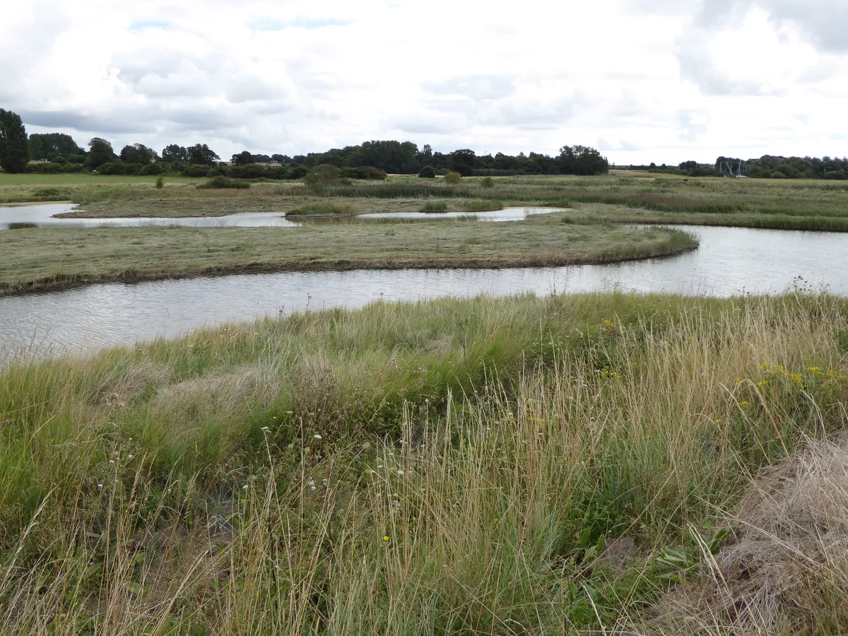
Levington Lagoon
Wildlife reserves · 1.7 km
Paupers' graveyard monument
Memorials & monuments · 1.7 km
Nearby
📷 3Public art & sculpture · East of England
Levington Village Sign
Levington Village Sign — a public art in East of England, United Kingdom.
📷 5📷 5Memorials & monuments · East of England
Water Tower, 50 Metres West Of Orwell Park School
Water Tower, 50 Metres West Of Orwell Park School — a water tower in england-east, United Kingdom.
📷 3Memorials & monuments · East of England
Levington War Memorial
Levington War Memorial — Grade II listed building-listed memorial in england-east, United Kingdom.
📷 3Historic churches · East of England
Church of St Peter
Church of St Peter — Grade I listed church in Levington, Suffolk, England, UK.
📷 3Memorials & monuments · East of England
Nacton War Memorial
Nacton War Memorial — Grade II listed building-listed memorial in england-east, United Kingdom.
Where to eat & stay near Broke Hall
Places to stay
 📷 5
📷 5Campsites · East of England
Toad Hall Caravan Site
Toad Hall Caravan Site — a campsite in england east.
 📷 5
📷 5Campsites · East of England
Hallowtree Scout Activity Centre
Hallowtree Scout Activity Centre — a campsite in england east.
 📷 5
📷 5Campsites · East of England
Cosy Camping Suffolk
Cosy Camping Suffolk — a campsite in england east.
📷 5📷 5Caravan parks · East of England
Westwood Caravan Park
Westwood Caravan Park — a caravan park in england east.
📷 5Caravan parks · East of England
The Oaks Caravan Park
The Oaks Caravan Park — a caravan park in england east.
Places to eat & drink
 📷 5
📷 5Historic pubs · East of England
The Butt and Oyster
The Butt and Oyster in England East, United Kingdom.
 📷 5
📷 5 📷 7
📷 7Historic pubs · East of England
The White Horse, Kirton
The White Horse, Kirton in England East, United Kingdom.
 📷 6
📷 6Historic pubs · East of England
The Three Mariners, Trimley St Mary
The Three Mariners, Trimley St Mary in England East, United Kingdom.
 📷 5
📷 5 📷 7
📷 7Historic pubs · East of England
The Margaret Catchpole Public House
The Margaret Catchpole Public House in England East, United Kingdom.
More historic houses in this region
 📷 5
📷 5Historic houses · East of England
41 and 41a, Broad Street
41 and 41a, Broad Street — Grade II* listed house in Ely, East Cambridgeshire, England, UK.
 📷 5
📷 5Historic houses · East of England
Abbey Gate House
Abbey Gate House — house in St Albans, Hertfordshire, England, UK.
 📷 5
📷 5Historic houses · East of England
Abbey House
Abbey House — house in Cambridge, Cambridgeshire, England, UK.
.jpg?width=1200) 📷 5
📷 5Historic houses · East of England
Amores Including Outbuildings
Amores Including Outbuildings — architectural structure in Hertford, East Hertfordshire, England, UK.
Frequently asked questions
- Where is Broke Hall?
- Broke Hall is in Suffolk, East of England, United Kingdom (postcode IP10 0ET), in the parish of Nacton.
- What is Broke Hall?
- Broke Hall — house in Nacton, Suffolk, England, UK.
- How do I get to Broke Hall?
- The nearest railway station is Derby Road, about 6.3 km away. The nearest town is Hemley. Drivers can use postcode IP10 0ET.
- Is Broke Hall a listed building?
- Broke Hall is officially recognised as Grade II* listed building listed.
- Is Broke Hall a protected site?
- Yes — Broke Hall is part of the Orwell Estuary SSSI Site of Special Scientific Interest and the Suffolk Coast & Heaths National Landscape (AONB).
- How do I get to Broke Hall?
- The nearest railway station is Derby Road, about 6.3 km away. Drivers can navigate to postcode IP10 0ET.