
Historic bridges · South East England
British Rail Midland Region London Rugby Line Bridge Number 114 (Parkhill Bridge)
In or near Aldbury.
British Rail Midland Region London Rugby Line Bridge Number 114 (Parkhill Bridge) — Grade II listed building-listed bridge in england-west-midlands, United Kingdom.

Rob Farrow — CC BY-SA 2.0 via Wikimedia Commons licence

Plan your visit
- Typical visit
- 15 min–30 min
- Nearest railway station
- Tring · 1.3 km
- Free entry
- Dog-friendly
Getting there & planning your visit
To visit the British Rail Midland Region London Rugby Line Bridge Number 114 (Parkhill Bridge), you can reach it by train to Tring station, which is 1.3 km away. The postcode for the bridge is HP23 5QW, and entry is free.
About
British Rail Midland Region London Rugby Line Bridge Number 114 (Parkhill Bridge) is a Grade II listed building-listed bridge in england-west-midlands, United Kingdom, registered on the National Heritage List for England (NHLE entry 1338845). Listed status protects buildings and structures of special architectural or historic interest. See the linked Wikipedia article for further details.
Photo gallery
Heritage listing
Details TRING BRITISH RAIL: SP 91 Sl4 MIDLAND REGION LONDON-RUGBY LINE 4/47 Bridge No. 114 - (Parkhill Bridge) GV II Road bridge over railway at Tring Cutting. Circa 1837 by Robert Stephenson for the London and Birmingham Railway Company. Brown brick with stone impost bands, skewbacks, cornice, and parapet copings. A long narrow three-arched bridge taking an access road across the great Tring Cutting, 2½ miles long and here about 50ft deep. A higher 7-ring segmental arch in middle over trackbed with slender rectangular pier at foot of earth slope on each side, and tall opening through each pier with round arched top and bottom. Slightly lower segmental side arches to abutments hidden in earth slope. Wide unmoulded stone cornice at roadway level with brick parapets, rectangular terminal piers and weathered stone copings. The cutting was made necessary by Stephenson's decision to have a maximum gradient on the line of 1/330, and there is a well known lithograph by J.C. Bourne showing an army of navvies excavating it. The line was opened 9 April 1838 (Lelux(1976)13-15). Listing NGR: SP9432813258 Legacy The contents of this record have been generated from a legacy data system. Legacy System number: 355684 Legacy System: LBS
From the Historic England List Entry under OGL v3.
Protected designations
- Area of Outstanding Natural Beauty: Chilterns
Designations sourced from Natural England open data under OGL v3.
Place summary
British Rail Midland Region London Rugby Line Bridge Number 114, also known as Parkhill Bridge, is located in Aldbury, Hertfordshire, within the West Midlands. It is designated as a Grade II listed building, reflecting its historical significance.
AI-generated from the structured facts on this page (operator, designation, listing, era). Not a substitute for visiting.
- Coordinates
- 51.8100, -0.6332
- County
- Hertfordshire
- District
- Dacorum
- Parish
- Aldbury
- Postcode
- HP23 5QW
- Parliamentary constituency
- Harpenden and Berkhamsted
- Nearest railway station
- Tring — 1.3 km
Sources
- wikidata: Q26623136 (CC0)
- wikipedia: Parkhill Bridge (CC BY-SA 4.0)
Other places nearby

British Rail Midland Region London Rugby Line Bridge Number 113
Historic bridges · 0.8 km

Aldbury Nowers
Mountains & hills · 1.0 km
Aldbury Nowers
Mountains & hills · 1.0 km
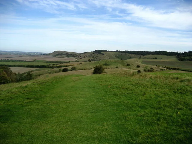
Pitstone Hill
Mountains & hills · 1.1 km

Court Theatre
Open-air theatres · 1.3 km
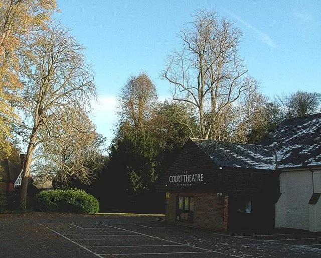
Court Theatre
Theatres · 1.3 km

Pendley Manor
Historic houses · 1.5 km

Pitstone Quarry
Quarries · 1.5 km

College Lake Nature Reserve
Forests & woodlands · 1.6 km
College Lake nature reserve
Wildlife reserves · 1.6 km
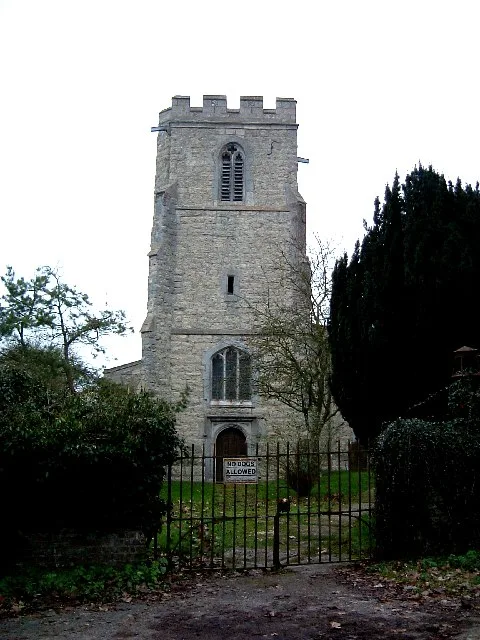
St Mary's Church, Pitstone
Historic churches · 1.7 km

Pitstone
Museums · 1.7 km
Nearby
📷 3Historic bridges · South East England
British Rail Midland Region London Rugby Line Bridge Number 113
British Rail Midland Region London Rugby Line Bridge Number 113 — Grade II listed building-listed bridge in england-west-midlands, United Kingdom.
📷 5Mountains & hills · South East England
Aldbury Nowers
Aldbury Nowers — a hill or mountain in england west midlands.
📷 5Mountains & hills · South East England
Aldbury Nowers
Aldbury Nowers — mountain in england west midlands. Elevation: 222 m.
📷 3📷 5Open-air theatres · South East England
Court Theatre
Court Theatre — a open-air theatre in england west midlands.
📷 3Theatres · South East England
Court Theatre
Court Theatre is a theatre in the United Kingdom.
Where to eat & stay near British Rail Midland Region London Rugby Line Bridge Number 114 (Parkhill Bridge)
Places to stay
 📷 4
📷 4 📷 5
📷 5Campsites · South East England
Norcott Campsite - Camping In The Orchard
Norcott Campsite - Camping In The Orchard — a campsite in england west midlands.
 📷 3
📷 3 📷 5
📷 5Campsites · South East England
Hill Farm Campsite
Hill Farm Campsite — a campsite in england west midlands.
 📷 5
📷 5Campsites · East of England
Highridge Farm Camping
Highridge Farm Camping — a campsite in england west midlands.
 📷 5
📷 5Campsites · South East England
Braid Wood Scout & Guide Activity Centre
Braid Wood Scout & Guide Activity Centre — a campsite in england west midlands.
Places to eat & drink
 📷 5
📷 5Historic pubs · East of England
The Valiant Trooper Public House
The Valiant Trooper Public House in England East, United Kingdom.
 📷 3
📷 3Historic pubs · South East England
The Old Swan
The Old Swan — Historic pub — listed building or notable heritage status.
 📷 5
📷 5Historic pubs · East of England
The Queens Head Public House With Attached East Barn,Linked South Block And Automobile Association Village Sign On Barn
The Queens Head Public House With Attached East Barn,Linked South Block And Automobile Association Village Sign On Barn in England East, United Kingdom.
 📷 5
📷 5Historic pubs · East of England
Saint George And The Dragon Public House
Saint George And The Dragon Public House in England East, United Kingdom.
 📷 5
📷 5 📷 5
📷 5Historic pubs · South East England
Full Moon Public House
Full Moon Public House in England East, United Kingdom.
More bridges in this region
 📷 5
📷 5Historic bridges · South East England
Briary Hill Bridge east
Briary Hill Bridge east is a historic bridge in the United Kingdom.
 📷 5
📷 5Historic bridges · South East England
Briary Hill Bridge west
Briary Hill Bridge west is a historic bridge in the United Kingdom.
 📷 5
📷 5Historic bridges · South East England
Bridge 157 VIR (Bath Hard Road)
Bridge 157 VIR (Bath Hard Road) is a historic bridge in the United Kingdom.
 📷 5
📷 5Historic bridges · South East England
Dorking Arch Bridge
Dorking Arch Bridge is a historic bridge in the United Kingdom.
Frequently asked questions
- Where is British Rail Midland Region London Rugby Line Bridge Number 114 (Parkhill Bridge)?
- British Rail Midland Region London Rugby Line Bridge Number 114 (Parkhill Bridge) is in Hertfordshire, the West Midlands, United Kingdom (postcode HP23 5QW), in the parish of Aldbury.
- What is British Rail Midland Region London Rugby Line Bridge Number 114 (Parkhill Bridge)?
- British Rail Midland Region London Rugby Line Bridge Number 114 (Parkhill Bridge) — Grade II listed building-listed bridge in england-west-midlands, United Kingdom.
- How do I get to British Rail Midland Region London Rugby Line Bridge Number 114 (Parkhill Bridge)?
- The nearest railway station is Tring, about 1.3 km away. Drivers can use postcode HP23 5QW.
- Is British Rail Midland Region London Rugby Line Bridge Number 114 (Parkhill Bridge) a listed building?
- British Rail Midland Region London Rugby Line Bridge Number 114 (Parkhill Bridge) is officially recognised as Grade II listed building listed.
- Is British Rail Midland Region London Rugby Line Bridge Number 114 (Parkhill Bridge) a protected site?
- Yes — British Rail Midland Region London Rugby Line Bridge Number 114 (Parkhill Bridge) is part of the Chilterns National Landscape (AONB).
- Is British Rail Midland Region London Rugby Line Bridge Number 114 (Parkhill Bridge) free to visit?
- Yes, British Rail Midland Region London Rugby Line Bridge Number 114 (Parkhill Bridge) is free to enter.
- How do I get to British Rail Midland Region London Rugby Line Bridge Number 114 (Parkhill Bridge)?
- The nearest railway station is Tring, about 1.3 km away. Drivers can navigate to postcode HP23 5QW.