
Castles · West Midlands
Brimfield, Herefordshire
In or near Middleton on the Hill.
Brimfield is a village and civil parish in north Herefordshire, England. The village lies on the A49 road at the border with Shropshire. To the south, near the hamlet of Ashton, excavations at the sit

Z Pryce — CC BY-SA 2.0 via Wikimedia Commons licence

Plan your visit
- Typical visit
- 1.5 h–3 h
- Nearest railway station
- Ludlow · 7.3 km
- Family-friendly
- Limited wheelchair access
Getting there & planning your visit
To visit Brimfield in Herefordshire, the nearest railway station is Ludlow, located 7.3 km away. The postcode for sat-nav is SY8 4NE. Accessibility is limited for wheelchair users.
About
Brimfield is a village and civil parish in north Herefordshire, England. The village lies on the A49 road at the border with Shropshire. To the south, near the hamlet of Ashton, excavations at the site of Ashton Castle have revealed traces of a large stone enclosure castle. Less than a mile to the north of this site are the earthwork remains of a medieval motte. The parish has a pub called The Roebuck Inn. Wyson is west of Brimfield and is part of its civil parish. To the north, in Shropshire, is Woofferton. The A49 ran through the village until a by-pass was built in 1982–83; the A49 now passes to the west, between Brimfield and Wyson. The village had a local store in its centre on Wyson Lane which served bread baked on site. The store was initially named A.A. Francis after Annie Amelia, later renamed R.R. Francis after her son Ronald Robert and then R. B. Francis after his son. The store closed and was sold to housing developers in 1996. Villagers later reinstated a local store annexed to The Roebuck which thrives today. The village also had a local Post Office which ran for over 100 years out of a building next door to The Roebuck which has been carefully restored as a residential premise called The Old Post Office. The Post Office facility now runs out of the Village Hall. These facilities and other various local landmarks such as The Foundry are depicted on a quilted display in the local church, St. Michael's. A penny sweet shop was run by a Mrs Humphreys opposite St. M
Photo gallery
Protected designations
- Site of Special Scientific Interest: River Teme SSSI
Designations sourced from Natural England open data under OGL v3.
From the Wikipedia article
Brimfield is a village and civil parish in north Herefordshire, England. The village lies on the A49 road at the border with Shropshire. To the south, near the hamlet of Ashton, excavations at the site of Ashton Castle have revealed traces of a large stone enclosure castle. Less than a mile to the north of this site are the earthwork remains of a medieval motte. The parish has a pub called The Roebuck Inn. Wyson is west of Brimfield and is part of its civil parish. To the north, in Shropshire, is Woofferton. The A49 ran through the village until a by-pass was built in 1982–83; the A49 now passes to the west, between Brimfield and Wyson. The village had a local store in its centre on Wyson Lane which served bread baked on site. The store was initially named A.A. Francis after Annie Amelia, later renamed R.R. Francis after her son Ronald Robert and then R. B. Francis after his son. The store closed and was sold to housing developers in 1996. Villagers later reinstated a local store annexed to The Roebuck which thrives today. The village also had a local Post Office which ran for over 100 years out of a building next door to The Roebuck which has been carefully restored as a residential premise called The Old Post Office. The Post Office facility now runs out of the Village Hall. These facilities and other various local landmarks such as The Foundry are depicted on a quilted display in the local church, St. Michael's. A penny sweet shop was run by a Mrs Humphreys opposite St. Michael's Gate. There is a vibrant local community offering many services in the Village Hall and support to inhabitants, including a long-running Grapevine newsletter.
Excerpt from Wikipedia under CC BY-SA 4.0. See the source article linked in Sources below.
- Coordinates
- 52.3070, -2.6960
- District
- Herefordshire, County of
- Parish
- Brimfield
- Postcode
- SY8 4NE
- Parliamentary constituency
- North Herefordshire
- Nearest railway station
- Ludlow — 7.3 km
Sources
- wikipedia: Brimfield, Herefordshire (CC BY-SA 4.0)
Other places nearby

Salwey Arms Public House Including Po Box
Historic pubs · 0.9 km

Woofferton
Villages · 0.9 km

Leominster Canal
Canals · 1.2 km
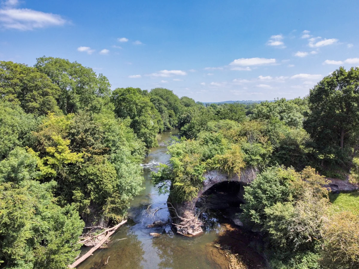
Teme Aqueduct At Ngr So 5368 6878 (That Part In Richards Castle Cp)
Aqueducts · 1.4 km

Nun Upton Oak
Natural landmarks · 1.8 km

Westbrook Country Holiday Park
Caravan parks · 2.1 km

Park Wood Hill
Mountains & hills · 2.2 km

Bridge Over Railway At Ngr So 5181 7035
Historic bridges · 2.6 km

Little Hereford Manor
Literary houses · 2.7 km

Ashford Carbonell War Memorial
Memorials & monuments · 2.9 km

Churchyard cross in St George's churchyard
Historic churches · 3.3 km

Ashford Bridge At Ngr So 5200 7113
Historic bridges · 3.3 km
Nearby
📷 6Historic pubs · West Midlands
Salwey Arms Public House Including Po Box
Salwey Arms Public House Including Po Box in England West Midlands, United Kingdom.
📷 5📷 3Canals · West Midlands
Leominster Canal
Leominster Canal — Canal in England, no longer in service.
📷 3Aqueducts · West Midlands
Teme Aqueduct At Ngr So 5368 6878 (That Part In Richards Castle Cp)
Teme Aqueduct At Ngr So 5368 6878 (That Part In Richards Castle Cp) — aqueduct in Richard's Castle, Shropshire, England, UK.
📷 3Natural landmarks · West Midlands
Nun Upton Oak
Nun Upton Oak — a other in wales-mid, United Kingdom.
📷 5Caravan parks · West Midlands
Westbrook Country Holiday Park
Westbrook Country Holiday Park — a caravan park in wales mid.
Where to eat & stay near Brimfield, Herefordshire
Places to stay
📷 5Caravan parks · West Midlands
Westbrook Country Holiday Park
Westbrook Country Holiday Park — a caravan park in wales mid.
 📷 5
📷 5Caravan parks · West Midlands
Fairfield Holiday Park
Fairfield Holiday Park — a caravan park in wales mid.
 📷 5
📷 5 📷 5
📷 5Caravan parks · West Midlands
Orleton Rise Holiday Home Park
Orleton Rise Holiday Home Park — a caravan park in wales mid.
 📷 5
📷 5Caravan parks · West Midlands
Home Farm Accommodation
Home Farm Accommodation — a caravan park in wales mid.
 📷 7
📷 7Places to eat & drink
📷 6Historic pubs · West Midlands
Salwey Arms Public House Including Po Box
Salwey Arms Public House Including Po Box in England West Midlands, United Kingdom.
 📷 5
📷 5Historic pubs · West Midlands
Duke of York, Leysters
Duke of York, Leysters in England West Midlands, United Kingdom.
 📷 5
📷 5Historic pubs · West Midlands
Wheatsheaf Inn and Chandlers Cottage
Wheatsheaf Inn and Chandlers Cottage in England West Midlands, United Kingdom.
 📷 5
📷 5 📷 7
📷 7Historic pubs · West Midlands
The Royal Oak Hotel
The Royal Oak Hotel in England West Midlands, United Kingdom.
 📷 7
📷 7Historic pubs · West Midlands
Old Bull Ring Tavern
Old Bull Ring Tavern in England West Midlands, United Kingdom.
More castles in this region
 📷 3
📷 3Castles · West Midlands
Chartley Castle
Chartley Castle is a castle in the United Kingdom.
 📷 3
📷 3Castles · West Midlands
Hoar Cross Hall
Hoar Cross Hall — a castle in england-east-midlands, United Kingdom.
 📷 3
📷 3Castles · West Midlands
Chartley Castle, Chartley Old Hall and associated water control systems including garden remains
Chartley Castle, Chartley Old Hall and associated water control systems including garden remains — scheduled monument-listed castle in england-east-midlands, United Kingdom.
 📷 5
📷 5Frequently asked questions
- Where is Brimfield, Herefordshire?
- Brimfield, Herefordshire is in Mid Wales, United Kingdom (postcode SY8 4NE), in the parish of Brimfield.
- What is Brimfield, Herefordshire?
- Brimfield is a village and civil parish in north Herefordshire, England. The village lies on the A49 road at the border with Shropshire. To the south, near the hamlet of Ashton, excavations at the sit
- How do I get to Brimfield, Herefordshire?
- The nearest railway station is Ludlow, about 7.3 km away. Drivers can use postcode SY8 4NE.
- Is Brimfield, Herefordshire a protected site?
- Yes — Brimfield, Herefordshire is part of the River Teme SSSI Site of Special Scientific Interest.
- Does Brimfield, Herefordshire charge admission?
- Brimfield, Herefordshire typically charges admission. Check the official site for current ticket prices and opening hours.
- How do I get to Brimfield, Herefordshire?
- The nearest railway station is Ludlow, about 7.3 km away. Drivers can navigate to postcode SY8 4NE.