
Historic bridges · South East England
Bridge Over River Great Ouse To North Of Thornborough
In or near Wicken.
Bridge Over River Great Ouse To North Of Thornborough — Grade II listed building-listed bridge in england-west-midlands, United Kingdom.

Philip Jeffrey — CC BY-SA 2.0 via Wikimedia Commons licence

Plan your visit
- Typical visit
- 15 min–30 min
- Free entry
- Dog-friendly
About
Bridge Over River Great Ouse To North Of Thornborough is a Grade II listed building-listed bridge in england-west-midlands, United Kingdom, registered on the National Heritage List for England (NHLE entry 1288365). Listed status protects buildings and structures of special architectural or historic interest. See the linked Wikipedia article for further details.
Photo gallery
Heritage listing
Details SP 73 NW LECKHAMPSTEAD 3/59 Bridge over River Great Ouse to N. of Thornborough II Bridge. C18 re-casing in brick of older rubble stone structure. English bond. Four pointed arches, very low parapet with later posts and railings. W. side has two cut-waters and off-set brickwork to two right hand arches. E. side has off-set brickwork and stepped corbels below parapet. Listing NGR: SP7384135493 Legacy The contents of this record have been generated from a legacy data system. Legacy System number: 399906 Legacy System: LBS
From the Historic England List Entry under OGL v3.
Place summary
The Bridge Over River Great Ouse to the north of Thornborough is a Grade II listed bridge located in the West Midlands. This structure serves as a notable crossing over the River Great Ouse, contributing to the area's historical architecture.
AI-generated from the structured facts on this page (operator, designation, listing, era). Not a substitute for visiting.
- Coordinates
- 52.0130, -0.9255
- District
- Buckinghamshire
- Parish
- Thornborough
- Postcode
- MK18 2ED
- Parliamentary constituency
- Buckingham and Bletchley
Sources
- wikidata: Q26576769 (CC0)
Other places nearby

Hyde Lane Lock
Natural landmarks · 1.0 km

Thornton
Villages · 1.4 km
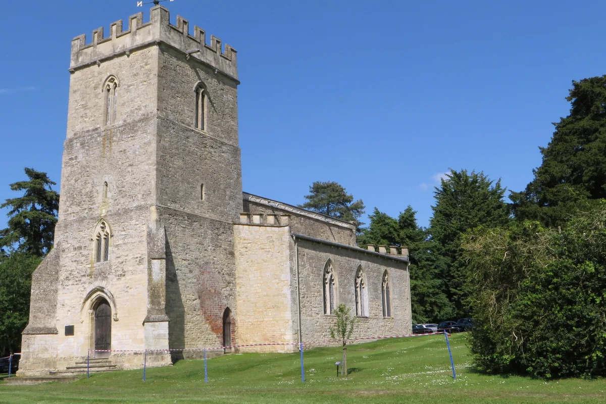
St Michael and All Angels' Church, Thornton
Historic churches · 1.6 km

Maids Moreton
Vineyards · 1.6 km

Thornborough
Villages · 1.9 km

Cranley Barn Camping
Campsites · 2.1 km

St Leonard's
Historic houses · 2.2 km
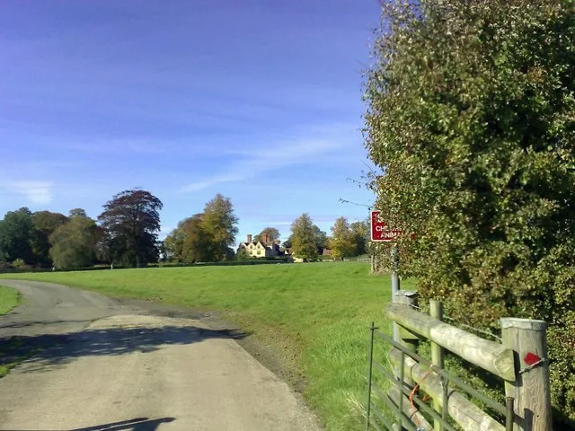
Foscott Manor
Stately homes · 2.2 km

Thornborough Mounds
Archaeological sites · 2.3 km

Thornborough Mounds
Archaeological sites · 2.3 km

Thornborough Bridge
Historic bridges · 2.5 km
Leckhampstead
Villages · 2.5 km
Nearby
📷 3Natural landmarks · South East England
Hyde Lane Lock
Hyde Lane Lock — a other in england-west-midlands, United Kingdom.
📷 5📷 3Historic churches · South East England
St Michael and All Angels' Church, Thornton
St Michael and All Angels' Church, Thornton — Grade I listed church in Thornton, Buckinghamshire, England, UK.
📷 5Vineyards · South East England
Maids Moreton
Maids Moreton — a UK vineyard in england west midlands, producing English or Welsh wine from cool-climate grape varieties.
📷 5📷 5Campsites · South East England
Cranley Barn Camping
Cranley Barn Camping — a campsite in england west midlands.
Where to eat & stay near Bridge Over River Great Ouse To North Of Thornborough
Places to stay
📷 5Campsites · South East England
Cranley Barn Camping
Cranley Barn Camping — a campsite in england west midlands.
 📷 7
📷 7Hotels · South East England
Villiers Hotel
Villiers Hotel — a hotel in england west midlands.
 📷 5
📷 5Campsites · South East England
Quarries Scout Camp
Quarries Scout Camp — a campsite in england west midlands.
 📷 5
📷 5Campsites · South East England
Silverstone Woodlands Campsite
Silverstone Woodlands Campsite — a campsite in england west midlands.
 📷 5
📷 5Campsites · South East England
Whittlebury Park - Wedgwood
Whittlebury Park - Wedgwood — a campsite in england west midlands.
📷 5Campsites · South East England
Dadford Road Campsite
Dadford Road Campsite — a campsite in england west midlands.
Places to eat & drink
 📷 7
📷 7Historic pubs · South East England
The Butcher's Arms
The Butcher's Arms in England South East, United Kingdom.
 📷 5
📷 5Historic pubs · South East England
The Black Bird
The Black Bird in England South East, United Kingdom.
 📷 5
📷 5Historic pubs · South East England
The Shoulder Of Mutton Public House
The Shoulder Of Mutton Public House in England South East, United Kingdom.
 📷 7
📷 7Historic pubs · South East England
Crown Public House
Crown Public House in England South East, United Kingdom.
 📷 5
📷 5Historic pubs · South East England
The Old George
The Old George in England South East, United Kingdom.
 📷 5
📷 5Cafés · South East England
The Winslow Cafe & Bistro
The Winslow Cafe & Bistro — a café in england west midlands.
More bridges in this region
 📷 5
📷 5Historic bridges · South East England
Briary Hill Bridge east
Briary Hill Bridge east is a historic bridge in the United Kingdom.
 📷 5
📷 5Historic bridges · South East England
Briary Hill Bridge west
Briary Hill Bridge west is a historic bridge in the United Kingdom.
 📷 5
📷 5Historic bridges · South East England
Bridge 157 VIR (Bath Hard Road)
Bridge 157 VIR (Bath Hard Road) is a historic bridge in the United Kingdom.
 📷 5
📷 5Historic bridges · South East England
Dorking Arch Bridge
Dorking Arch Bridge is a historic bridge in the United Kingdom.
Frequently asked questions
- Where is Bridge Over River Great Ouse To North Of Thornborough?
- Bridge Over River Great Ouse To North Of Thornborough is in the West Midlands, United Kingdom (postcode MK18 2ED), in the parish of Thornborough.
- What is Bridge Over River Great Ouse To North Of Thornborough?
- Bridge Over River Great Ouse To North Of Thornborough — Grade II listed building-listed bridge in england-west-midlands, United Kingdom.
- How do I get to Bridge Over River Great Ouse To North Of Thornborough?
- Drivers can use postcode MK18 2ED.
- Is Bridge Over River Great Ouse To North Of Thornborough a listed building?
- Bridge Over River Great Ouse To North Of Thornborough is officially recognised as Grade II listed building listed.
- Is Bridge Over River Great Ouse To North Of Thornborough free to visit?
- Yes, Bridge Over River Great Ouse To North Of Thornborough is free to enter.
- How do I get to Bridge Over River Great Ouse To North Of Thornborough?
- Drivers can navigate to postcode MK18 2ED. It sits within the Buckingham and Bletchley parliamentary constituency.