
Historic bridges · West Midlands
Bridge Number 56 at SK 0979 1553
In or near Lichfield.
Bridge Number 56 at SK 0979 1553 — Grade II listed building-listed bridge in england-east-midlands, United Kingdom.

Roger D Kidd — CC BY-SA 2.0 via Wikimedia Commons licence

Plan your visit
- Typical visit
- 15 min–30 min
- Nearest railway station
- Rugeley Town · 5.8 km
- Free entry
- Dog-friendly
Getting there & planning your visit
To visit Bridge Number 56, the nearest railway station is Rugeley Town, located 5.8 km away. The postcode for the bridge is WS15 4HJ, and entry is free. Accessibility details are not provided.
About
Bridge Number 56 at SK 0979 1553 is a Grade II listed building-listed bridge in england-east-midlands, United Kingdom, registered on the National Heritage List for England (NHLE entry 1249240). Listed status protects buildings and structures of special architectural or historic interest. See the linked Wikipedia article for further details.
Photo gallery
Heritage listing
Details KING'S BROMLEY TRENT AND MERSEY SK 01 NE CANAL 6/10002 Bridge No 56, Tuppenhurst Lane at SK 0979 1553 - II Canal road bridge. Late C18. Red brick with stone coping. Single span with towpath and humped back. Segmental headed arch. Swept wings terminating in piers at all 4 comers. Stone springing stones. Minor repairs include parts of the coping. The Trent and Mersey Canal was built between 1766 and 1777 by James Brindley and Hugh Henshall. Charles Hadfield, The Canals of West Midlands (1966) Jean Lindsay, The Trent and Mersey Canal (1979) Listing NGR: SK0982915565 Legacy The contents of this record have been generated from a legacy data system. Legacy System number: 431005 Legacy System: LBS
From the Historic England List Entry under OGL v3.
Place summary
Bridge Number 56 at SK 0979 1553 is a Grade II listed bridge located in the East Midlands. Its designation reflects its historical and architectural significance within the region.
AI-generated from the structured facts on this page (operator, designation, listing, era). Not a substitute for visiting.
- Coordinates
- 52.7376, -1.8559
- County
- Staffordshire
- District
- Lichfield
- Parish
- Armitage with Handsacre
- Postcode
- WS15 4HJ
- Parliamentary constituency
- Lichfield
- Nearest railway station
- Rugeley Town — 5.8 km
Sources
- wikidata: Q26541392 (CC0)
Other places nearby

Trent and Mersey Canal Bridge Number 59 at SK 0786 1642
Historic bridges · 1.4 km

Old Hall
Historic houses · 2.1 km

Trent and Mersey Canal Bridge Number 60 at SK 079 164
Historic bridges · 2.1 km
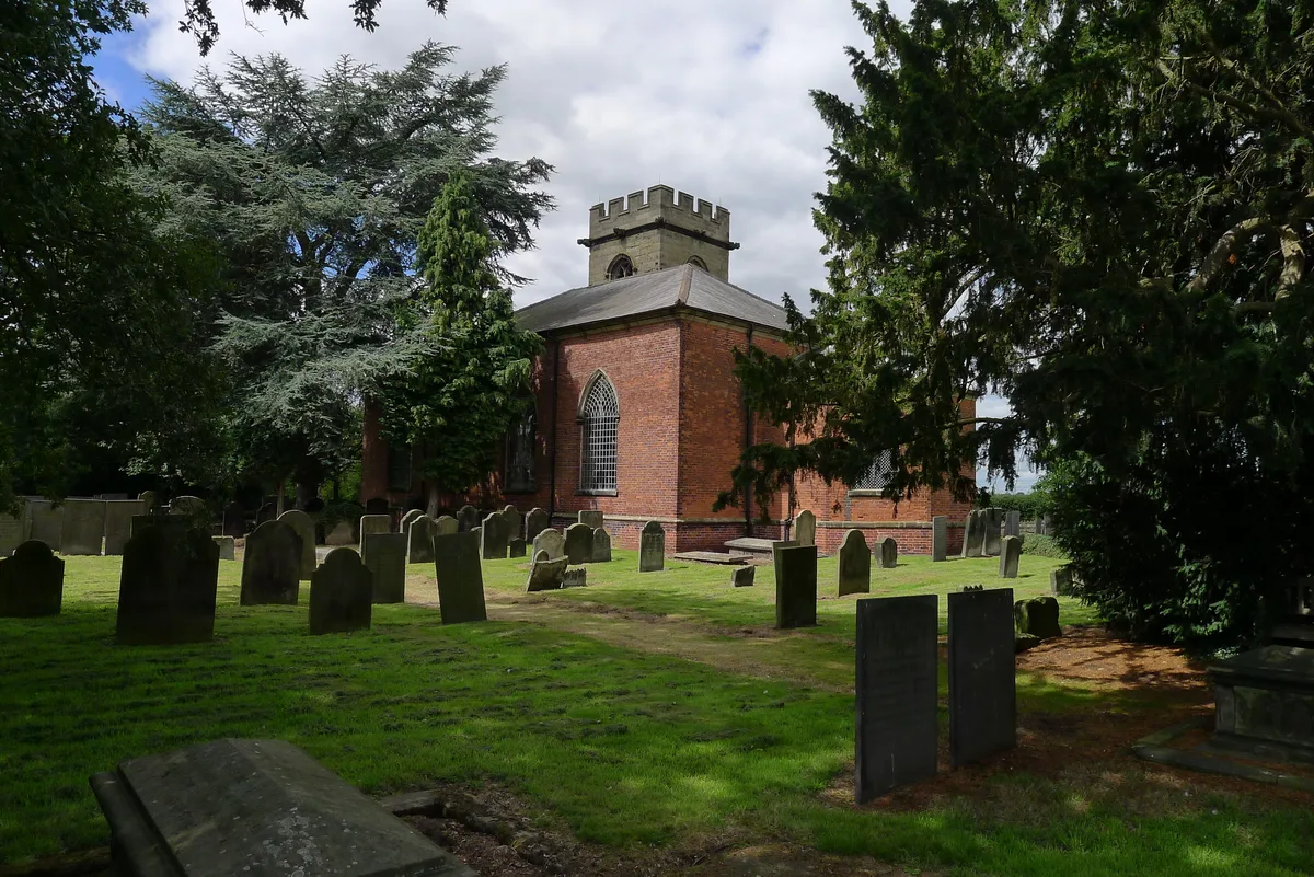
Church of St Nicholas, Mavesyn Ridware
Historic churches · 2.1 km

Armitage United Reform Church Chapel
Chapels · 2.1 km

Pipe Ridware
Villages · 2.2 km
Ridware Theatre
Open-air theatres · 2.2 km

River Blithe
Museums · 2.6 km

Kings Bromley
Villages · 2.7 km

Kings Bromley War Memorial
Memorials & monuments · 2.7 km

Church of All Saints
Historic churches · 2.8 km

Longdon
Villages · 3.0 km
Nearby
📷 3Historic bridges · West Midlands
Trent and Mersey Canal Bridge Number 59 at SK 0786 1642
Trent and Mersey Canal Bridge Number 59 at SK 0786 1642 — Grade II listed building-listed bridge in england-east-midlands, United Kingdom.
📷 3Historic houses · West Midlands
Old Hall
Old Hall — house in Mavesyn Ridware, Staffordshire, England, UK.
📷 3Historic bridges · West Midlands
Trent and Mersey Canal Bridge Number 60 at SK 079 164
Trent and Mersey Canal Bridge Number 60 at SK 079 164 — Grade II listed building-listed bridge in england-east-midlands, United Kingdom.
📷 5Historic churches · West Midlands
Church of St Nicholas, Mavesyn Ridware
Church of St Nicholas, Mavesyn Ridware — church in Mavesyn Ridware, Staffordshire, England, UK.
📷 3Chapels · West Midlands
Armitage United Reform Church Chapel
Armitage United Reform Church Chapel — chapel in Armitage with Handsacre, Lichfield, Staffordshire, England, UK.
📷 5Where to eat & stay near Bridge Number 56 at SK 0979 1553
Places to stay
 📷 5
📷 5Caravan parks · West Midlands
Kingfisher Holiday Park
Kingfisher Holiday Park — a caravan park in england east midlands.
 📷 5
📷 5Caravan parks · West Midlands
Cannock Chase Camping and Caravanning Club
Cannock Chase Camping and Caravanning Club — a caravan park in england east midlands.
 📷 5
📷 5Hotels · West Midlands
George Hotel
George Hotel — a hotel in england west midlands.
 📷 5
📷 5Caravan parks · West Midlands
Silvertrees Caravan Park
Silvertrees Caravan Park — a caravan park in england east midlands.
 📷 5
📷 5Caravan parks · West Midlands
Tackeroo Caravan Site
Tackeroo Caravan Site — a caravan park in england west midlands.
 📷 5
📷 5Campsites · East Midlands
Needwood Forest Scout Camp
Needwood Forest Scout Camp — a campsite in england east midlands.
Places to eat & drink
 📷 5
📷 5Historic pubs · West Midlands
The Swan And Attached Buildings
The Swan And Attached Buildings in England West Midlands, United Kingdom.
 📷 5
📷 5 📷 5
📷 5Historic pubs · West Midlands
Earl Of Lichfield Arms Public House
Earl Of Lichfield Arms Public House in England West Midlands, United Kingdom.
 📷 5
📷 5Historic pubs · West Midlands
The Scales Public House
The Scales Public House in England West Midlands, United Kingdom.
 📷 5
📷 5Restaurants · West Midlands
Thai Rainbow
Thai Rainbow — a restaurant in england west midlands.
 📷 5
📷 5Restaurants · West Midlands
Lichfield House
Lichfield House — a restaurant in england west midlands.
More bridges in this region
 📷 3
📷 3Historic bridges · West Midlands
Wolseley Bridge
Wolseley Bridge is a historic bridge in the United Kingdom.
 📷 3
📷 3Historic bridges · West Midlands
Bridge, Gatepiers, Walls And Ha Ha South Of Blithfield Hall
Bridge, Gatepiers, Walls And Ha Ha South Of Blithfield Hall — Grade II listed building-listed bridge in england-east-midlands, United Kingdom.
 📷 3
📷 3Historic bridges · West Midlands
Bridge Over River Swarbourn At West End Of Town Hill
Bridge Over River Swarbourn At West End Of Town Hill — Grade II listed building-listed bridge in england-east-midlands, United Kingdom.
 📷 3
📷 3Historic bridges · West Midlands
Viaduct over Trent and Mersey Canal at SK 0485 1780
Viaduct over Trent and Mersey Canal at SK 0485 1780 — Grade II listed building-listed bridge in england-east-midlands, United Kingdom.
Frequently asked questions
- Where is Bridge Number 56 at SK 0979 1553?
- Bridge Number 56 at SK 0979 1553 is in Staffordshire, the East Midlands, United Kingdom (postcode WS15 4HJ), in the parish of Armitage with Handsacre.
- What is Bridge Number 56 at SK 0979 1553?
- Bridge Number 56 at SK 0979 1553 — Grade II listed building-listed bridge in england-east-midlands, United Kingdom.
- How do I get to Bridge Number 56 at SK 0979 1553?
- The nearest railway station is Rugeley Town, about 5.8 km away. Drivers can use postcode WS15 4HJ.
- Is Bridge Number 56 at SK 0979 1553 a listed building?
- Bridge Number 56 at SK 0979 1553 is officially recognised as Grade II listed building listed.
- Is Bridge Number 56 at SK 0979 1553 free to visit?
- Yes, Bridge Number 56 at SK 0979 1553 is free to enter.
- How do I get to Bridge Number 56 at SK 0979 1553?
- The nearest railway station is Rugeley Town, about 5.8 km away. Drivers can navigate to postcode WS15 4HJ.