
Historic bridges · Scottish Lowlands
Bridge, Drummonds Hall
In or near Gordon.
Bridge, Drummonds Hall — category B listed building-listed bridge in scotland-central, United Kingdom.

M J Richardson — CC BY-SA 2.0 via Wikimedia Commons licence

Plan your visit
- Typical visit
- 15 min–30 min
- Nearest railway station
- Stow · 9.4 km
- Free entry
- Dog-friendly
Getting there & planning your visit
To visit Drummonds Hall Bridge, the nearest railway station is Stow, located 9.4 km away. The postcode for navigation is TD2 6QT, and entry is free.
About
Bridge, Drummonds Hall is a category B listed building-listed bridge in scotland-central, United Kingdom, registered on the Historic Environment Scotland register (entry LB13847). Listed status protects buildings and structures of special architectural or historic interest. See the linked Wikipedia article for further details.
Photo gallery
Heritage listing
Category B Date Added 23/01/1996 Local Authority Scottish Borders Planning Authority Scottish Borders Parish Lauder NGR NT 54193 48424 Coordinates 354193, 648424 — Mid to late 18th century. Disused road bridge over Earnscleugh Water. Rubble with wide single-span arch and smaller overflow arch to W. Coped rubble parapet. Elongated voussoirs. — A good example of an early double-arched, rubble road bridge, located on a disused stretch of road within the original boundary of the Thirlestane Castle estate. It is notable for its broad, well-proportioned principal arch and hump-backed carriageway which evidences its 18th century building date and defines the bridge within its landscape setting. The bridge over Earnscleugh Water (known locally as 'East Water') originally served the 18th century coach road from Edinburgh to Kelso. The carriageway is currently grassed over and the coping to the N side of the parapet is predominantly missing (2008). A carter's inn, where the carters changed their horses, was located at Drummonds Hall in the 18th century and a sawmill was built on the old walls around 1845 although little evidence of this interest remains. List description updated at resurvey (2009).
From Historic Environment Scotland under OGL v3.
Place summary
Bridge, Drummonds Hall is a category B listed bridge located in central Scotland. It is notable for its architectural significance and historical value within the region.
AI-generated from the structured facts on this page (operator, designation, listing, era). Not a substitute for visiting.
- Coordinates
- 55.7270, -2.7309
- District
- Scottish Borders
- Postcode
- TD2 6QT
- Parliamentary constituency
- Berwickshire, Roxburgh and Selkirk
- Nearest railway station
- Stow — 9.4 km
Sources
- wikidata: Q17841289 (CC0)
Other places nearby
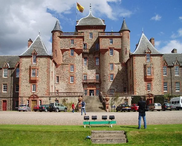
Thirlestane Castle
Castles · 1.0 km

Lauder Bridge
Historic bridges · 1.1 km

Thirlestane Castle Caravan Park
Caravan parks · 1.3 km

Park Hill
Mountains & hills · 1.3 km

Lauder
Villages · 1.4 km

Black Bull Hotel
Hotels · 1.4 km

Lauder Tower
Gardens · 1.4 km

St Mary's Parish Church, East High Street, Lauder
Historic churches · 1.4 km

Flat Cat Gallery
Galleries · 1.4 km

Lauderdale Hotel
Hotels · 1.5 km

Bonnet Plantation
Vineyards · 1.5 km

War Memorial, Edinburgh Road, Lauder
Memorials & monuments · 1.6 km
Nearby
📷 3Castles · Scottish Lowlands
Thirlestane Castle
Thirlestane Castle — castle and museum in Scottish Borders, Scotland, United Kingdom.
📷 5Historic bridges · Scottish Lowlands
Lauder Bridge
Lauder Bridge — category B listed building-listed bridge in scotland-central, United Kingdom.
📷 5Caravan parks · Scottish Lowlands
Thirlestane Castle Caravan Park
Thirlestane Castle Caravan Park — a caravan park in scotland central.
📷 5Mountains & hills · Scottish Lowlands
Park Hill
Park Hill — mountain in scotland central. Elevation: 322 m.
📷 5📷 7Where to eat & stay near Bridge, Drummonds Hall
Places to stay
📷 5Caravan parks · Scottish Lowlands
Thirlestane Castle Caravan Park
Thirlestane Castle Caravan Park — a caravan park in scotland central.
📷 7📷 5 📷 5
📷 5Caravan parks · Central Scotland
Lauder - Camping and Caravanning Club Site
Lauder - Camping and Caravanning Club Site — a caravan park in scotland central.
 📷 5
📷 5Caravan parks · Scottish Lowlands
Kilnknowe Park Caravan Site
Kilnknowe Park Caravan Site — a caravan park in scotland central.
 📷 7
📷 7Places to eat & drink
 📷 7
📷 7Historic pubs · Scottish Lowlands
Clovenfords Hotel, Clovenfords
Clovenfords Hotel, Clovenfords in Scotland Central, United Kingdom.
 📷 6
📷 6Historic pubs · Scottish Lowlands
Town Arms Inn, 1 Market Place, Selkirk
Town Arms Inn, 1 Market Place, Selkirk in Scotland Central, United Kingdom.
 📷 7
📷 7Historic pubs · Central Scotland
The Royal Bar, 15 Market Square, Duns
The Royal Bar, 15 Market Square, Duns in Scotland Central, United Kingdom.
More bridges in this region
 📷 5
📷 5 📷 3
📷 3Historic bridges · Scottish Lowlands
Spittal-on-Rule
Spittal-on-Rule in England North East, United Kingdom.
 📷 4
📷 4Historic bridges · Scottish Lowlands
Coldstream Bridge
Coldstream Bridge in England North East, United Kingdom.
 📷 3
📷 3Frequently asked questions
- Where is Bridge, Drummonds Hall?
- Bridge, Drummonds Hall is in central Scotland, United Kingdom (postcode TD2 6QT).
- What is Bridge, Drummonds Hall?
- Bridge, Drummonds Hall — category B listed building-listed bridge in scotland-central, United Kingdom.
- How do I get to Bridge, Drummonds Hall?
- The nearest railway station is Stow, about 9.4 km away. Drivers can use postcode TD2 6QT.
- Is Bridge, Drummonds Hall a listed building?
- Bridge, Drummonds Hall is officially recognised as category B listed building listed.
- Is Bridge, Drummonds Hall free to visit?
- Yes, Bridge, Drummonds Hall is free to enter.
- How do I get to Bridge, Drummonds Hall?
- Drivers can navigate to postcode TD2 6QT. It sits within the Berwickshire, Roxburgh and Selkirk parliamentary constituency.