
Historic bridges · North East England
Bridge, C100 Metres East Of Witton Castle, And Wall Attached
In or near Witton-le-Wear.
Bridge, C100 Metres East Of Witton Castle, And Wall Attached — Grade II listed building-listed bridge in scotland-lowlands, United Kingdom.

peter robinson — CC BY-SA 2.0 via Wikimedia Commons licence

Plan your visit
- Typical visit
- 15 min–30 min
- Nearest railway station
- Witton-le-Wear · 0.9 km
- Free entry
- Dog-friendly
Getting there & planning your visit
To visit the bridge located 100 metres east of Witton Castle, head to the nearest railway station, Witton-le-Wear, which is 0.9 km away. The postcode for the location is DL14 0DE. Entry to the site is free.
About
Bridge, C100 Metres East Of Witton Castle, And Wall Attached is a Grade II listed building-listed bridge in scotland-lowlands, United Kingdom, registered on the National Heritage List for England (NHLE entry 1338597). Listed status protects buildings and structures of special architectural or historic interest. See the linked Wikipedia article for further details.
Photo gallery
Heritage listing
Details EVENWOOD AND BARONY SLOSHES LANE NZ 13 SE (North side) 2/33 (inset) Bridge, c.100 metres east of Witton Castle, and wall attached GV II Bridge at north end of Witton Castle pond. Early/mid C19. Irregular courses of squared sandstone with ashlar dressings; ashlar piers. High segmental arch with voussoirs, embattled parapets, and north-east, north-west and south-west square piers with 3-tiered coping chamfers. Wall of same materials continues south parapet in curve to south-west c.80 metres long,ending in rusticated round pier. Listing NGR: NZ1546630435 Legacy The contents of this record have been generated from a legacy data system. Legacy System number: 111398 Legacy System: LBS
From the Historic England List Entry under OGL v3.
Place summary
The Bridge, C100 Metres East Of Witton Castle, is a Grade II listed bridge located in the Scottish Lowlands, within the parish of Evenwood and Barony. This structure is notable for its historical significance and architectural integrity.
AI-generated from the structured facts on this page (operator, designation, listing, era). Not a substitute for visiting.
- Coordinates
- 54.6688, -1.7617
- District
- County Durham
- Parish
- Evenwood and Barony
- Postcode
- DL14 0DE
- Parliamentary constituency
- Bishop Auckland
- Nearest railway station
- Witton-le-Wear — 0.9 km
Sources
- wikidata: Q26622906 (CC0)
Other places nearby
Witton Castle
Castles · 0.1 km

Witton-le-Wear railway station
Heritage railways · 0.9 km

Witton le Wear
Villages · 1.1 km

Witton-le-Wear
Towns & cities · 1.2 km

Observation Tower
Viewpoints · 1.2 km

Witton Tower
Memorials & monuments · 1.4 km

Witton Park Colliery
Mines & mining heritage · 1.5 km

Phoenix Row
Farms (open to visitors) · 1.6 km

Slotburn Brick Works
Archaeological sites · 1.8 km

Toft Hill
Vineyards · 1.8 km

Wear Valley Junction railway station
Heritage railway stations · 1.8 km

Witton Park
Parks · 1.8 km
Nearby
📷 3Castles · North East England
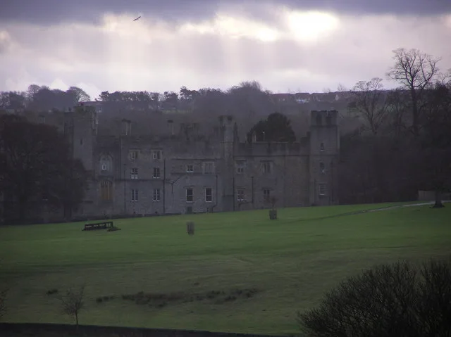
Witton Castle
Witton Castle — castle in County Durham, England, United Kingdom.
📷 4Heritage railways · North East England
Witton-le-Wear railway station
Witton-le-Wear railway station in England North East, United Kingdom.
📷 5📷 5Towns & cities · North East England
Witton-le-Wear
Witton-le-Wear in England North East, United Kingdom.
📷 4Viewpoints · North East England
Observation Tower
Observation Tower is a viewpoint in the United Kingdom.
📷 3Memorials & monuments · North East England
Witton Tower
Witton Tower — Grade II* listed building-listed memorial in scotland-lowlands, United Kingdom.
Where to eat & stay near Bridge, C100 Metres East Of Witton Castle, And Wall Attached
Places to stay
 📷 5
📷 5Caravan parks · North East England
Meadow Farm Caravan Park and Campsite
Meadow Farm Caravan Park and Campsite — a caravan park in scotland lowlands.
 📷 5
📷 5Campsites · North East England
Green Acres Hamsterley
Green Acres Hamsterley — a campsite in scotland lowlands.
 📷 7
📷 7Hotels · North East England
The Manor House Hotel & Country Club
The Manor House Hotel & Country Club — a hotel in scotland lowlands.
 📷 3
📷 3Campsites · North East England
High Shipley Farm Bungalow
High Shipley Farm Bungalow — a campsite in scotland lowlands.
 📷 5
📷 5Caravan parks · North East England
Craggwood Holiday Home Park Riverside Touring Park
Craggwood Holiday Home Park Riverside Touring Park — a caravan park in scotland lowlands.
 📷 5
📷 5Caravan parks · North East England
Bradley Burn Farm Touring site
Bradley Burn Farm Touring site — a caravan park in scotland lowlands.
Places to eat & drink
 📷 7
📷 7Historic pubs · North East England
The Eden Arms Public House
The Eden Arms Public House in Scotland Lowlands, United Kingdom.
 📷 5
📷 5Historic pubs · North East England
Wheatsheaf Public House
Wheatsheaf Public House in Scotland Lowlands, United Kingdom.
 📷 5
📷 5Historic pubs · North East England
Bay Horse Public House
Bay Horse Public House in Scotland Lowlands, United Kingdom.
 📷 5
📷 5Historic pubs · North East England
Coopers Public House
Coopers Public House in Scotland Lowlands, United Kingdom.
 📷 5
📷 5Historic pubs · North East England
Green Tree Public House
Green Tree Public House in Scotland Lowlands, United Kingdom.
 📷 5
📷 5Historic pubs · North East England
5, Market Place
5, Market Place in Scotland Lowlands, United Kingdom.
More bridges in this region
 📷 3
📷 3Historic bridges · North East England
Bridge About 30 Metres South Of The Manor House
Bridge About 30 Metres South Of The Manor House — Grade II listed building-listed bridge in england-yorkshire, United Kingdom.
 📷 3
📷 3Historic bridges · North East England
Old Bridge Over Nor Beck, On East Side Of Road
Old Bridge Over Nor Beck, On East Side Of Road — Grade II listed building-listed bridge in england-yorkshire, United Kingdom.
 📷 3
📷 3Historic bridges · North East England
Barnard Castle Bridge
Barnard Castle Bridge is a historic bridge in the United Kingdom.
 📷 3
📷 3Historic bridges · North East England
Blandswath Bridge
Blandswath Bridge is a historic bridge in the United Kingdom.
Frequently asked questions
- Where is Bridge, C100 Metres East Of Witton Castle, And Wall Attached?
- Bridge, C100 Metres East Of Witton Castle, And Wall Attached is in the Scottish Lowlands, United Kingdom (postcode DL14 0DE), in the parish of Evenwood and Barony.
- What is Bridge, C100 Metres East Of Witton Castle, And Wall Attached?
- Bridge, C100 Metres East Of Witton Castle, And Wall Attached — Grade II listed building-listed bridge in scotland-lowlands, United Kingdom.
- How do I get to Bridge, C100 Metres East Of Witton Castle, And Wall Attached?
- The nearest railway station is Witton-le-Wear, about 0.9 km away. Drivers can use postcode DL14 0DE.
- Is Bridge, C100 Metres East Of Witton Castle, And Wall Attached a listed building?
- Bridge, C100 Metres East Of Witton Castle, And Wall Attached is officially recognised as Grade II listed building listed.
- Is Bridge, C100 Metres East Of Witton Castle, And Wall Attached free to visit?
- Yes, Bridge, C100 Metres East Of Witton Castle, And Wall Attached is free to enter.
- How do I get to Bridge, C100 Metres East Of Witton Castle, And Wall Attached?
- The nearest railway station is Witton-le-Wear, about 0.9 km away. Drivers can navigate to postcode DL14 0DE.