
Historic bridges · South East England
Bridge And Pump Approximately 20 Metres West Of Joiners Arms
In or near Milton.
Bridge And Pump Approximately 20 Metres West Of Joiners Arms — Grade II listed building-listed bridge in england-west-midlands, United Kingdom.

Nick Barber — CC BY-SA 2.0 via Wikimedia Commons licence

Plan your visit
- Typical visit
- 15 min–30 min
- Nearest railway station
- Banbury · 5.6 km
- Free entry
- Dog-friendly
Getting there & planning your visit
To visit the Bridge and Pump approximately 20 metres west of Joiners Arms, the nearest railway station is Banbury, which is 5.6 km away. Entry is free.
About
Bridge And Pump Approximately 20 Metres West Of Joiners Arms is a Grade II listed building-listed bridge in england-west-midlands, United Kingdom, registered on the National Heritage List for England (NHLE entry 1046203). Listed status protects buildings and structures of special architectural or historic interest. See the linked Wikipedia article for further details.
Photo gallery
See it from the streetimagery from 2021
Imagery © Mapillary contributors, CC BY-SA 4.0
Heritage listing
Details BLOXHAM HIGH STREET SP4235 (East side) 9/138 Bridge and pump approx. 20m. W of Joiner's Arms. GV II Bridge. 1815. Regular coursed ironstone. Single keystoned arch. Buttresses either side. C19 water pump and shaft attached to right. Cast iron painted black. Iron railings. The High Street was straightened before 1815 by the Banbury & Chipping Norton Turnpike Trust. (VCH : Oxfordshire, Vol IX, p55) Listing NGR: SP4302335862 Legacy The contents of this record have been generated from a legacy data system. Legacy System number: 244241 Legacy System: LBS
From the Historic England List Entry under OGL v3.
Official information
Bloxham Village Museum is a small museum located in the center of Bloxham village, showcasing the local history and significance of the area. It features annual exhibitions designed for all ages and offers a free quiz for children, making it an engaging visit for families.
Protected designations
- Area of Outstanding Natural Beauty: Cotswolds
Designations sourced from Natural England open data under OGL v3.
Place summary
The Bridge and Pump, located approximately 20 metres west of the Joiners Arms in Bloxham, Oxfordshire, is a Grade II listed bridge. This structure is part of the West Midlands' historical landscape, recognised for its architectural significance.
AI-generated from the structured facts on this page (operator, designation, listing, era). Not a substitute for visiting.
- Coordinates
- 52.0195, -1.3745
- County
- Oxfordshire
- District
- Cherwell
- Parish
- Bloxham
- Postcode
- OX15 4LX
- Parliamentary constituency
- Banbury
- Phone
- 07721 187813
- Nearest railway station
- Banbury — 5.6 km
- Opening
- Saturday, Sunday and Bank Holiday Monday 2.30pm–5pm; open from Easter to the last Saturday in October
- Official site
- bloxhammuseum.com
Sources
- wikidata: Q26298333 (CC0)
Other places nearby

Bloxham War Memorial
Memorials & monuments · 0.1 km

Elephant And Castle Public House
Historic pubs · 0.1 km

Bloxham
Museums · 0.2 km

Church of St Mary, Bloxham
Historic churches · 0.2 km
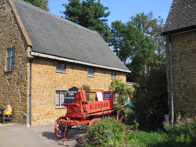
Bloxham Village Museum
Museums · 0.2 km

Bloxham School
Historic houses · 0.3 km

Dovecote at Milcombe Hall
Historic houses · 2.0 km
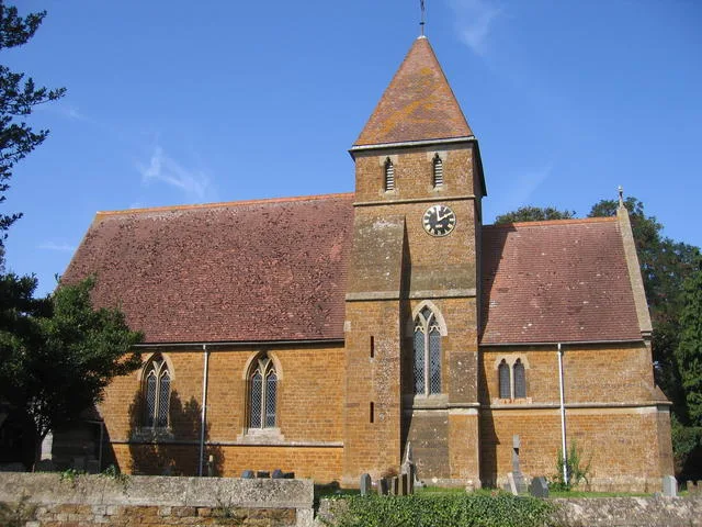
Milton
Towns & cities · 2.3 km

Tudor Hall School
Historic houses · 2.4 km
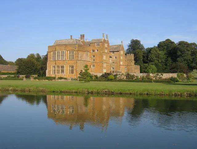
Broughton Castle
Castles · 2.6 km

Broughton, Oxfordshire
Museums · 2.7 km

Church of St Mary the Virgin, Broughton
Historic churches · 2.7 km
Nearby
📷 3Memorials & monuments · South East England
Bloxham War Memorial
Bloxham War Memorial — Grade II listed building-listed memorial in england-west-midlands, United Kingdom.
📷 5Historic pubs · South East England
Elephant And Castle Public House
Elephant And Castle Public House in England West Midlands, United Kingdom.
📷 5Museums · South East England
Bloxham
Bloxham is a village and civil parish in northern Oxfordshire several miles from the Cotswolds, about 3 miles (5 km) southwest of Banbury. It is on the edge of a valley and overlooked by Hobb Hill. Th
📷 5Historic churches · South East England
Church of St Mary, Bloxham
Church of St Mary, Bloxham — Grade I listed building-listed church in england-west-midlands, United Kingdom.
📷 5Museums · South East England
Bloxham Village Museum
Bloxham Village Museum — Local museum in Bloxham, England, United Kingdom.
📷 3Historic houses · South East England
Bloxham School
Bloxham School — a Grade II*-listed historic house in england-west-midlands, United Kingdom.
Where to eat & stay near Bridge And Pump Approximately 20 Metres West Of Joiners Arms
Places to stay
 📷 5
📷 5Campsites · South East England
Cheyney Manor House Campsite
Cheyney Manor House Campsite — a campsite in england west midlands.
 📷 5
📷 5Caravan parks · South East England
Newton Grove CL
Newton Grove CL — a caravan park in england west midlands.
 📷 5
📷 5B&Bs · South East England
Easington House
Easington House — a bed-and-breakfast in england west midlands.
 📷 7
📷 7B&Bs · South East England
Banbury Cross Bed and Breakfast
Banbury Cross Bed and Breakfast — a bed-and-breakfast in england west midlands.
 📷 5
📷 5Caravan parks · South East England
Bo Peep Caravan Park
Bo Peep Caravan Park — a caravan park in england west midlands.
 📷 5
📷 5Campsites · South East England
Bo Peep Caravan Park
Bo Peep Caravan Park — a campsite in england west midlands.
Places to eat & drink
📷 5Historic pubs · South East England
Elephant And Castle Public House
Elephant And Castle Public House in England West Midlands, United Kingdom.
 📷 5
📷 5Historic pubs · South East England
Baker's Arms Public House
Baker's Arms Public House in England West Midlands, United Kingdom.
 📷 5
📷 5Historic pubs · South East England
The Blinking Owl
The Blinking Owl in England West Midlands, United Kingdom.
 📷 6
📷 6Historic pubs · South East England
The Jolly Weaver Public House
The Jolly Weaver Public House in England West Midlands, United Kingdom.
 📷 5
📷 5Historic pubs · South East England
The Woolpack Public House And Left Part Of Compare Insurance
The Woolpack Public House And Left Part Of Compare Insurance in England West Midlands, United Kingdom.
 📷 5
📷 5Historic pubs · South East England
Wheatsheaf Inn
Wheatsheaf Inn in England West Midlands, United Kingdom.
More bridges in this region
 📷 5
📷 5Historic bridges · South East England
Briary Hill Bridge east
Briary Hill Bridge east is a historic bridge in the United Kingdom.
 📷 5
📷 5Historic bridges · South East England
Briary Hill Bridge west
Briary Hill Bridge west is a historic bridge in the United Kingdom.
 📷 5
📷 5Historic bridges · South East England
Bridge 157 VIR (Bath Hard Road)
Bridge 157 VIR (Bath Hard Road) is a historic bridge in the United Kingdom.
 📷 5
📷 5Historic bridges · South East England
Dorking Arch Bridge
Dorking Arch Bridge is a historic bridge in the United Kingdom.
Frequently asked questions
- Where is Bridge And Pump Approximately 20 Metres West Of Joiners Arms?
- Bridge And Pump Approximately 20 Metres West Of Joiners Arms is in Oxfordshire, the West Midlands, United Kingdom (postcode OX15 4LX), in the parish of Bloxham.
- What is Bridge And Pump Approximately 20 Metres West Of Joiners Arms?
- Bridge And Pump Approximately 20 Metres West Of Joiners Arms — Grade II listed building-listed bridge in england-west-midlands, United Kingdom.
- How do I get to Bridge And Pump Approximately 20 Metres West Of Joiners Arms?
- The nearest railway station is Banbury, about 5.6 km away. Drivers can use postcode OX15 4LX.
- Is Bridge And Pump Approximately 20 Metres West Of Joiners Arms a listed building?
- Bridge And Pump Approximately 20 Metres West Of Joiners Arms is officially recognised as Grade II listed building listed.
- Is Bridge And Pump Approximately 20 Metres West Of Joiners Arms a protected site?
- Yes — Bridge And Pump Approximately 20 Metres West Of Joiners Arms is part of the Cotswolds National Landscape (AONB).
- Is Bridge And Pump Approximately 20 Metres West Of Joiners Arms free to visit?
- Yes, Bridge And Pump Approximately 20 Metres West Of Joiners Arms is free to enter.
- How do I get to Bridge And Pump Approximately 20 Metres West Of Joiners Arms?
- The nearest railway station is Banbury, about 5.6 km away. Drivers can navigate to postcode OX15 4LX.