
Historic bridges · East of England
Bridge 30 Metres South East Of Fasbourne Hall
In or near Onehouse.
Bridge 30 Metres South East Of Fasbourne Hall — Grade II listed building-listed bridge in england-east, United Kingdom.

Dave King — CC BY-SA 2.0 via Wikimedia Commons licence

Plan your visit
- Typical visit
- 15 min–30 min
- Nearest railway station
- Stowmarket · 5.9 km
- Free entry
- Dog-friendly
Getting there & planning your visit
To visit Bridge 30 Metres South East Of Fasbourne Hall, the nearest railway station is Stowmarket, located 5.9 km away. The postcode for sat-nav is IP14 3EB, and entry to the bridge is free.
About
Bridge 30 Metres South East Of Fasbourne Hall is a Grade II listed building-listed bridge in england-east, United Kingdom, registered on the National Heritage List for England (NHLE entry 1032995). Listed status protects buildings and structures of special architectural or historic interest. See the linked Wikipedia article for further details.
Photo gallery
Heritage listing
Details This list entry was subject to a Minor Amendment on 2 May 2023 to correct a typo in the name, address and description and to reformat the text to current standards TL 95 NE 1/53 BUXHALL VALLEY LANE Bridge 30m south-east of Fasbourn Hall GV II Bridge, C17. Red brick; spanning the remaining east arm of a medieval moat once surrounding Fasbourne Hall, and once carrying the main approach to the house. Twin round arches with a cutwater between; at the base of the parapet is a semicircular string course. The parapets, about 3m apart and lm high are capped by terracotta copings matching those upon the garden wall attached to Fasbourne Hall. At the east end of the bridge, the parapets are splayed outwards. Listing NGR: TL9968756614 Legacy The contents of this record have been generated from a legacy data system. Legacy System number: 279828 Legacy System: LBS
From the Historic England List Entry under OGL v3.
Place summary
Bridge 30 Metres South East Of Fasbourne Hall is a Grade II listed bridge located in the East of England. Its designation reflects architectural or historical significance, marking it as an important structure within the region.
AI-generated from the structured facts on this page (operator, designation, listing, era). Not a substitute for visiting.
- Coordinates
- 52.1716, 0.9187
- County
- Suffolk
- District
- Mid Suffolk
- Parish
- Buxhall
- Postcode
- IP14 3EB
- Parliamentary constituency
- Bury St Edmunds and Stowmarket
- Nearest railway station
- Stowmarket — 5.9 km
Sources
- wikidata: Q26284452 (CC0)
Other places nearby

Buxhall Mill
Windmills · 1.1 km

Buxhall Village Sign
Public art & sculpture · 1.3 km

Great Finborough
Villages · 1.9 km
Chestnut Horse
Historic pubs · 2.1 km
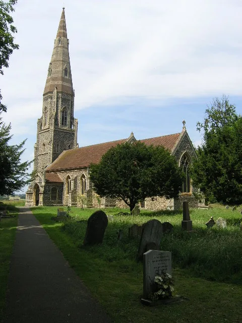
St Andrew’s Church, Great Finborough
Historic churches · 2.1 km

Great Finborough War Memorial Cross
Memorials & monuments · 2.1 km

Great Finborough Devils Hill
Castles · 2.3 km

Onehouse
Towns & cities · 3.0 km

Rattlesden
Villages · 3.0 km

Rattlesden Village Sign
Public art & sculpture · 3.2 km

Lakeside Fishing and Caravan Park
Campsites · 3.5 km

Combs Castle
Literary houses · 3.6 km
Nearby
📷 3📷 3Public art & sculpture · East of England
Buxhall Village Sign
Buxhall Village Sign — a public art in england-east, United Kingdom.
📷 5📷 7Historic pubs · East of England
Chestnut Horse
Chestnut Horse in England East, United Kingdom.
📷 3Historic churches · East of England
St Andrew’s Church, Great Finborough
St Andrew’s Church, Great Finborough — church in Great Finborough, Suffolk, England, UK.
📷 3Memorials & monuments · East of England
Great Finborough War Memorial Cross
Great Finborough War Memorial Cross — Grade II listed building-listed memorial in england-east, United Kingdom.
Where to eat & stay near Bridge 30 Metres South East Of Fasbourne Hall
Places to stay
📷 5Campsites · East of England
Lakeside Fishing and Caravan Park
Lakeside Fishing and Caravan Park — a campsite in england east.
 📷 5
📷 5 📷 7
📷 7 📷 5
📷 5Caravan parks · East of England
Red House Farm Caravan Site
Red House Farm Caravan Site — a caravan park in england east.
 📷 7
📷 7Hotels · East of England
Limes Hotel
Limes Hotel — a hotel in england east.
 📷 5
📷 5Caravan parks · East of England
Bright Meadow Caravan Park
Bright Meadow Caravan Park — a caravan park in england east.
Places to eat & drink
📷 7Historic pubs · East of England
Chestnut Horse
Chestnut Horse in England East, United Kingdom.
 📷 4
📷 4Historic pubs · East of England
The Shepherd and Dog
The Shepherd and Dog — Historic pub — listed building or notable heritage status.
 📷 5
📷 5Historic pubs · East of England
The Queen's Head, Stowmarket
The Queen's Head, Stowmarket in England East, United Kingdom.
 📷 6
📷 6 📷 5
📷 5Historic pubs · East of England
The Meadlands Public House
The Meadlands Public House in England East, United Kingdom.
 📷 7
📷 7Historic pubs · East of England
The Gardeners Arms Public House
The Gardeners Arms Public House in England East, United Kingdom.
More bridges in this region
.JPG?width=1200) 📷 5
📷 5Historic bridges · East of England
Albert Bridge
Albert Bridge is a historic bridge in the United Kingdom.
.jpg?width=1200) 📷 5
📷 5Historic bridges · East of England
Bedford Town Bridge
Bedford Town Bridge is a historic bridge in the United Kingdom.
 📷 5
📷 5Historic bridges · East of England
Bethnal Green and King's Lynn Line
Bethnal Green and King's Lynn Line is a historic bridge in the United Kingdom.
 📷 5
📷 5Historic bridges · East of England
Bethnal Green and King's Lynn Line
Bethnal Green and King's Lynn Line is a historic bridge in the United Kingdom.
Frequently asked questions
- Where is Bridge 30 Metres South East Of Fasbourne Hall?
- Bridge 30 Metres South East Of Fasbourne Hall is in Suffolk, East of England, United Kingdom (postcode IP14 3EB), in the parish of Buxhall.
- What is Bridge 30 Metres South East Of Fasbourne Hall?
- Bridge 30 Metres South East Of Fasbourne Hall — Grade II listed building-listed bridge in england-east, United Kingdom.
- How do I get to Bridge 30 Metres South East Of Fasbourne Hall?
- The nearest railway station is Stowmarket, about 5.9 km away. Drivers can use postcode IP14 3EB.
- Is Bridge 30 Metres South East Of Fasbourne Hall a listed building?
- Bridge 30 Metres South East Of Fasbourne Hall is officially recognised as Grade II listed building listed.
- Is Bridge 30 Metres South East Of Fasbourne Hall free to visit?
- Yes, Bridge 30 Metres South East Of Fasbourne Hall is free to enter.
- How do I get to Bridge 30 Metres South East Of Fasbourne Hall?
- The nearest railway station is Stowmarket, about 5.9 km away. Drivers can navigate to postcode IP14 3EB.