
Archaeological sites · Mid Wales
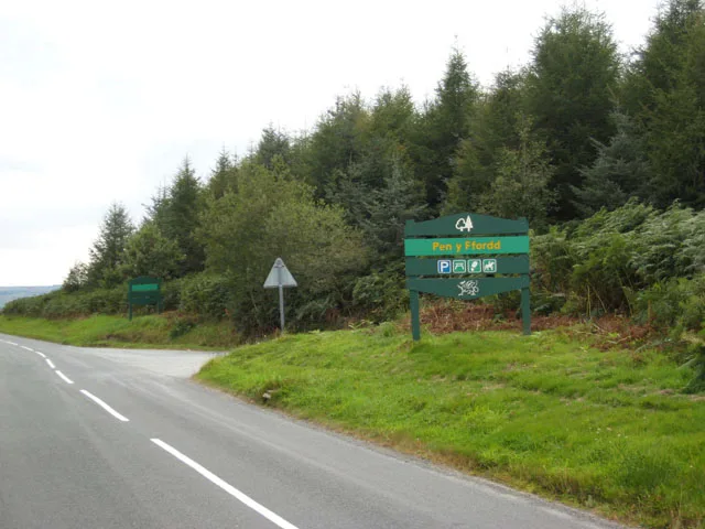
Brechfa Forest
Also known as: Coedwig Brechfa
In or near Llanfynydd.
Brechfa Forest — forest in Carmarthenshire, Wales, UK.

Wikimedia Commons licence
Plan your visit
- Typical visit
- 45 min–1.5 h
- Free entry
- Dog-friendly
About
Brechfa Forest is an archaeological site in the United Kingdom. Wikidata describes it as: "forest in Carmarthenshire, Wales, UK". Coordinates: 51.9900°, -4.1400°.
Photo gallery
From the Wikipedia article
The Brechfa Forest is a forest in Carmarthenshire, south Wales. Brechfa Forest is the 'modern' name for part of the ancient Glyn Cothi Forest. From before records began in the 6th century the communities in the 15 villages which encircle Glyn Cothi Forest were managing it to provide employment, building materials, products, and grazing. At various times the forest has been the refuge of Welsh princes fighting the Norman invasion, a royal hunting forest, and for two centuries was the 'Texas' of Wales, producing large quantities of oil for lamps. and was a major supplier of timber for the trenches and explosives during World War One. The Forestry Commission was established to increase timber production during World War One taking control of woodland which was no longer productive. Like the New Forest and the Forest of Dean, Glyn Cothi Forest was still being actively managed by the local community at this point and was a major supplier of timber for the trenches, as well as oil and explosives. During the depression in the 1930s the UK government purchased land which had been part of the original Glyn Cothi forest but had been converted to agriculture. Much of the planting work to create conifer plantations and construction of forest roads was carried out by young unemployed men from a Ministry of Labour work camp. Many came from the distressed coal mining communities, and were recruited for training in one of a number of Instructional Centres created by the Ministry, most of which were on Forestry Commission property; by 1938, the Ministry had 38 Instructional Centres across Britain. The hutted camp in Brechfa was later used to house Basque children who were refugees from the Spanish Civil War. Management and maintenance of the forest continued to be a major source of employment for local residents until the 1980s when Forestry Commission policies changed to increased mechanisation and subcontracting of work. Carmarthenshire County Council then started regeneration…
Excerpt from Wikipedia under CC BY-SA 4.0. See the source article linked in Sources below.
- Coordinates
- 51.9900, -4.1400
- District
- Carmarthenshire
- Parish
- Llanfihangel Rhos-y-Corn
- Postcode
- SA32 7SB
- Parliamentary constituency
- Caerfyrddin
Sources
- wikidata: Q4959996 (CC0)
- wikipedia: Brechfa Forest (CC BY-SA 4.0)
Other places nearby

Gwernogle
Forests & woodlands · 0.5 km

Llanfihangel Rhos-y-Corn
Other places · 1.8 km

Llanfihangel-Rhos-y-corn
Villages · 1.8 km

Brechfa Forest Wind Farm
Forests & woodlands · 1.8 km

Pont Cwmmawr-du
Historic bridges · 1.8 km

Allt Cynarth
Mountains & hills · 2.1 km

Allt Llainoleu
Mountains & hills · 2.2 km
Raven Black Trail
Mountain bike trails · 2.4 km

Raven Black Trail
Mountain bike trails · 2.8 km

Allt Tai-cid
Mountains & hills · 2.8 km

Glyn Cothi Forest
Battlefields & battle sites · 3.0 km

Mynydd Llanfihangel-rhos-y-corn
Mountains & hills · 3.1 km
Nearby
📷 3📷 2Other places · Mid Wales
Llanfihangel Rhos-y-Corn
Llanfihangel Rhos-y-Corn in Wales Mid, United Kingdom.
📷 5📷 3Forests & woodlands · Mid Wales
Brechfa Forest Wind Farm
Brechfa Forest Wind Farm in Wales Mid, United Kingdom.
📷 4Historic bridges · Mid Wales
Pont Cwmmawr-du
Pont Cwmmawr-du — Grade II listed building-listed bridge in wales-south, United Kingdom.
📷 5Where to eat & stay near Brechfa Forest
Places to stay
 📷 5
📷 5 📷 5
📷 5 📷 7
📷 7 📷 5
📷 5 📷 5
📷 5Campsites · South Wales
Towy Valley Caravan Park
Towy Valley Caravan Park — a campsite in wales south.
 📷 5
📷 5Caravan parks · Mid Wales
Springwater Lakes Touring Site
Springwater Lakes Touring Site — a caravan park in wales mid.
Places to eat & drink
 📷 3
📷 3 📷 3
📷 3 📷 5
📷 5 📷 3
📷 3 📷 5
📷 5 📷 4
📷 4More archaeological sites in this region
 📷 5
📷 5 📷 3
📷 3Archaeological sites · Mid Wales
Quaker settlement Dolgellau
Quaker settlement Dolgellau — a archaeological in wales-north, United Kingdom.
 📷 3
📷 3Archaeological sites · Mid Wales
Centenary Viewpoint
Centenary Viewpoint — a archaeological in wales-north, United Kingdom.
 📷 3
📷 3Archaeological sites · Mid Wales
Gwanas-Fawr Roman Marching Camp
Gwanas-Fawr Roman Marching Camp — a archaeological in wales-north, United Kingdom.
Frequently asked questions
- Where is Brechfa Forest?
- Brechfa Forest is in South Wales, United Kingdom (postcode SA32 7SB), in the parish of Llanfihangel Rhos-y-Corn.
- What is Brechfa Forest?
- Brechfa Forest — forest in Carmarthenshire, Wales, UK.
- How do I get to Brechfa Forest?
- Drivers can use postcode SA32 7SB.
- Is Brechfa Forest free to visit?
- Yes, Brechfa Forest is free to enter.
- How do I get to Brechfa Forest?
- Drivers can navigate to postcode SA32 7SB. It sits within the Caerfyrddin parliamentary constituency.