
Historic churches · South West England
Breaney Methodist chapel
In or near Boderwennack.
Breaney Methodist chapel is a Methodist chapel in the civil parish of Breage, near Helston, Cornwall, UK. The chapel is on Trewithick road in Breage, past the school. It was built in 1829 for and by

Adrian Dust — CC BY-SA 2.0 via Wikimedia Commons licence
_-_geograph.org.uk_-_7798180.jpg)
Plan your visit
- Typical visit
- 30 min–1 h
- Nearest railway station
- Trevarno · 4.0 km
- Free entry
Getting there & planning your visit
Breaney Methodist Chapel is located in Cornwall, postcode TR13 9PZ. The nearest railway station is Trevarno, which is 4 km away. Entry is free.
About
Breaney Methodist chapel is a Methodist chapel in the civil parish of Breage, near Helston, Cornwall, UK. The chapel is on Trewithick road in Breage, past the school. It was built in 1829 for and by the Miners of Breage. There were many other chapels in Breage parish (all of them turned into houses except one which is now a social club). The chapel is listed as of having architectural merit and must be painted white as it is a marker for fishermen in the bay. It was officially called Troon Methodist chapel until 1992 when the name changed to Breaney. Breaney was the name chosen by the uniting congregations of Breage and Sithney obviously taking half of each name! In 1992 the chapel was renovated with a new first floor worship area, new seating, new carpets, new paint, a new organ and more whilst key features such as the gallery pews and plaster columns were retained. In 2016 the future of the chapel was questioned in a rationalisation process by The Lizard & Mounts bay Methodist circuit. After much prayer and discussion the fellowship are seeking new ways to serve the community and share the love of God. The Methodist chapel originally had a very old, mainly wood pipe organ which was fitted in the organ loft but in 1992 the organ was taken out and replaced by an electronic organ. There is an Ordnance Survey benchmark on the bottom wall of the chapel on a corner. On 25 August 1987 Breaney Methodist chapel became a Grade II listed building listed as "Breage Methodist Church
Photo gallery
Protected designations
- Area of Outstanding Natural Beauty: Cornwall
Designations sourced from Natural England open data under OGL v3.
From the Wikipedia article
Breaney Methodist chapel is a Methodist chapel in the civil parish of Breage, near Helston, Cornwall, UK. The chapel is on Trewithick road in Breage, past the school. It was built in 1829 for and by the Miners of Breage. There were many other chapels in Breage parish (all of them turned into houses except one which is now a social club). The chapel is listed as of having architectural merit and must be painted white as it is a marker for fishermen in the bay. It was officially called Troon Methodist chapel until 1992 when the name changed to Breaney. Breaney was the name chosen by the uniting congregations of Breage and Sithney obviously taking half of each name! In 1992 the chapel was renovated with a new first floor worship area, new seating, new carpets, new paint, a new organ and more whilst key features such as the gallery pews and plaster columns were retained. In 2016 the future of the chapel was questioned in a rationalisation process by The Lizard & Mounts bay Methodist circuit. After much prayer and discussion the fellowship are seeking new ways to serve the community and share the love of God. The Methodist chapel originally had a very old, mainly wood pipe organ which was fitted in the organ loft but in 1992 the organ was taken out and replaced by an electronic organ. There is an Ordnance Survey benchmark on the bottom wall of the chapel on a corner. On 25 August 1987 Breaney Methodist chapel became a Grade II listed building listed as "Breage Methodist Church Including Courtyard Walls And Gate Piers".
Excerpt from Wikipedia under CC BY-SA 4.0. See the source article linked in Sources below.
- Coordinates
- 50.1051, -5.3356
- District
- Cornwall
- Parish
- Breage
- Postcode
- TR13 9PZ
- Parliamentary constituency
- St Ives
- Nearest railway station
- Trevarno — 4 km
Sources
- wikipedia: Breaney Methodist chapel (CC BY-SA 4.0)
Other places nearby

Breage, Cornwall
Historic churches · 0.4 km
St Breage's Church
Historic churches · 0.4 km

Trevena Cross
Historic houses · 0.4 km

Breage, Germoe and Godolphin War Memorial
Memorials & monuments · 0.4 km
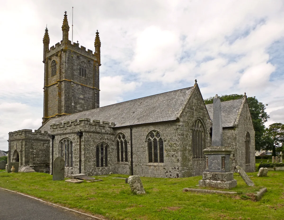
Church of St Breaca, Breage
Historic churches · 0.4 km

Ashton, Cornwall
Historic churches · 1.4 km

Watson's Shaft Engine House (Wheal Metal & Flow)
Historic houses · 1.6 km

Dropped Anchor Camping Site
Campsites · 1.6 km

Carleen
Historic churches · 1.7 km

Sithney
Historic churches · 1.9 km

Trem
Campsites · 2.0 km

Trewavas
Climbing & bouldering crags · 2.0 km
Nearby
📷 5Historic churches · South West England
Breage, Cornwall
Breage ( BREEG, locally BRAYG; Cornish: Eglosbrek (village) or Pluw Vrek (parish)) is a village and civil parish in Cornwall, England, United Kingdom. The village is three miles (five kilometres) we
📷 5Historic churches · South West England
St Breage's Church
St Breage's Church — a other in england-south-west, United Kingdom.
📷 3Historic houses · South West England
Trevena Cross
Trevena Cross — a Grade II*-listed historic house in england-south-west, United Kingdom.
📷 3Memorials & monuments · South West England
Breage, Germoe and Godolphin War Memorial
Breage, Germoe and Godolphin War Memorial — Grade II listed building-listed memorial in england-south-west, United Kingdom.
📷 5Historic churches · South West England
Church of St Breaca, Breage
Church of St Breaca, Breage — Grade I listed church in Breage, United Kingdom.
📷 5Historic churches · South West England
Ashton, Cornwall
Ashton (Cornish: Trevonnen) is a village in the civil parish of Breage, west Cornwall, England, UK at OS grid ref SW604286. It is on the A394 Penzance – Helston road one mile north-east of Praa Sands.
Where to eat & stay near Breaney Methodist chapel
Places to stay
📷 3Campsites · South West England
Dropped Anchor Camping Site
Dropped Anchor Camping Site — a campsite in england south west.
📷 5 📷 5
📷 5Campsites · South West England
Mill Lane Camp Site
Mill Lane Camp Site — a campsite in england south west.
 📷 5
📷 5Campsites · South West England
Wheal Vreagh Farm Campsite
Wheal Vreagh Farm Campsite — a campsite in england south west.
 📷 5
📷 5Campsites · South West England
Penrose Camp Site
Penrose Camp Site — a campsite in england south west.
 📷 5
📷 5Caravan parks · South West England
Praa Sands Holiday Park
Praa Sands Holiday Park — a caravan park in england south west.
Places to eat & drink
 📷 5
📷 5 📷 5
📷 5Historic pubs · South West England
Fitzsimmons Arms Public House
Fitzsimmons Arms Public House in England South West, United Kingdom.
 📷 7
📷 7Historic pubs · South West England
The Pendarves Arms
The Pendarves Arms in England South West, United Kingdom.
 📷 5
📷 5Historic pubs · South West England
The Bucket of Blood
The Bucket of Blood in England South West, United Kingdom.
 📷 7
📷 7Restaurants · South West England
The Old Lifeboat House Bistro
The Old Lifeboat House Bistro — a restaurant in england south west. Cuisine: seafood.
 📷 5
📷 5Historic pubs · South West England
First And Last Inn
First And Last Inn in England South West, United Kingdom.
More places in this region
 📷 5
📷 5Historic churches · South West England
Abbey Church of St Gregory the Great, Downside Abbey
Abbey Church of St Gregory the Great, Downside Abbey — church in Stratton-on-the-Fosse, Somerset, England, UK.
 📷 5
📷 5Historic churches · South West England
All Saints Church
All Saints Church — Grade I listed church in Woolley, Somerset, England, UK.
 📷 5
📷 5Historic churches · South West England
All Saints Church, Hampreston
All Saints Church, Hampreston — church in Hampreston, Dorset, England, UK.
 📷 5
📷 5Historic churches · South West England
All Saints Church, Nether Cerne
All Saints Church, Nether Cerne — church in Nether Cerne, Dorset, England, UK.
Frequently asked questions
- Where is Breaney Methodist chapel?
- Breaney Methodist chapel is in South-West England, United Kingdom (postcode TR13 9PZ), in the parish of Breage.
- What is Breaney Methodist chapel?
- Breaney Methodist chapel is a Methodist chapel in the civil parish of Breage, near Helston, Cornwall, UK. The chapel is on Trewithick road in Breage, past the school. It was built in 1829 for and by
- How do I get to Breaney Methodist chapel?
- The nearest railway station is Trevarno, about 4.0 km away. Drivers can use postcode TR13 9PZ.
- Is Breaney Methodist chapel a protected site?
- Yes — Breaney Methodist chapel is part of the Cornwall National Landscape (AONB).
- Is Breaney Methodist chapel free to visit?
- Yes, Breaney Methodist chapel is free to enter.
- How do I get to Breaney Methodist chapel?
- The nearest railway station is Trevarno, about 4.0 km away. Drivers can navigate to postcode TR13 9PZ.