Towns & cities · East of England
Brampton
Brampton — village in Broadland, Norfolk, England.

Wikimedia Commons contributors — see linked file page for photographer and licence licence
Plan your visit
- Typical visit
- 3 h–6 h
- Nearest railway station
- Brampton · 1.1 km
- Free entry
- Family-friendly
- Dog-friendly
Getting there & planning your visit
To visit Brampton in the East Midlands, the nearest railway station is Brampton, located 1.1 km away. Entry to the town is free. The postcode for sat-nav is NR10.
About
Brampton is a town, city, village or settlement in the United Kingdom. It covers approximately 5 km². Recent population estimates put it at around 162 people. Address: NR10. Wikidata describes it as: "village in Broadland, Norfolk, England". Coordinates: 52.7600°, 1.2800°.
Photo gallery
Protected designations
- Area of Outstanding Natural Beauty: Norfolk Coast
Designations sourced from Natural England open data under OGL v3.
From the Wikipedia article
Brampton is a village and civil parish in the English county of Norfolk. It is 2.4 miles (3.9 km) south-east of Aylsham and 10 miles (16 km) north of Norwich.
Excerpt from Wikipedia under CC BY-SA 4.0. See the source article linked in Sources below.
Background
History
Brampton was the subject of an archeological excavation in the 1960s which revealed the existence of a Roman bath house and almost 140 pottery kilns. The village name is Anglo-Saxon in origin and in the Domesday Book it is recorded as a settlement of 30 households in the hundred of South Erpingham. It was part of the estates of William de Warenne and Ralph de Beaufour. Oxnead Hall was built by the Paston family during the 16th century on medieval foundations. Clement Paston was responsible for the original phase of building, and during the 17th century the house became "one of the most magnificent houses in England". It is thought that King Charles II was entertained in the hall by Robert…
Sourced from Wikipedia under CC BY-SA 4.0.
- Coordinates
- 52.7600, 1.2800
- County
- Norfolk
- District
- Broadland
- Parish
- Marsham
- Postcode
- NR10
- Parliamentary constituency
- Broadland and Fakenham
- Population
- 162
- Nearest railway station
- Brampton — 1.1 km
Sources
- wikidata: Q897600 (CC0)
- wikipedia: Brampton, Norfolk (CC BY-SA 4.0)
- commons: St Peter, Brampton, Norfolk - geograph.org.uk - 316156.jpg (CC BY-SA 4.0)
Other places nearby

Marsham Mill Road Village Sign
Public art & sculpture · 0.9 km

Brampton Village Sign
Public art & sculpture · 1.3 km

Hevingham War Memorial
Memorials & monuments · 1.5 km

Brampton War Memorial
Memorials & monuments · 1.6 km

Pump Corner Village Sign
Public art & sculpture · 1.7 km

Oxnead Hall Folly
Follies · 1.8 km

Oxnead
Vineyards · 1.8 km

Marsham War Memorial
Memorials & monuments · 1.8 km

Oxnead Hall
Historic houses · 1.9 km

Buxton War Memorial
Memorials & monuments · 2.0 km

Buxton Village Sign
Public art & sculpture · 2.0 km

Bolwick Hall
Historic houses · 2.0 km
Brampton is a town in Norfolk, located in the East Midlands, with a population of 162. Our guide lists N attractions within reach.
At a glance
- Population
- 162
- Administrative county
- Norfolk
- Constituency
- Broadland and Fakenham
- Top categories near here
Things to see in Brampton
25 attractions within 12 km — showing the 24 most editorially-significant. Full guide: things to do in Brampton →
📷 3Historic houses · East of England
Bolwick Hall
Bolwick Hall — house in Aylsham, Norfolk, England, UK.
 📷 3
📷 3Historic churches · East of England
Church of St Mary the Virgin
Church of St Mary the Virgin — church in Burgh next Aylsham, Norfolk, England, UK.
📷 3📷 3 📷 4
📷 4Gardens · East of England
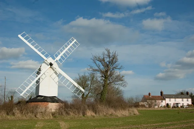
Buxton Watermill
Buxton Watermill — a garden in england-east-midlands, United Kingdom.
 📷 3
📷 3Watermills · East of England
Burgh Mill
Burgh Mill — Grade II* listed building-listed watermill in england-east-midlands, United Kingdom.
📷 3Memorials & monuments · East of England
Buxton War Memorial
Buxton War Memorial — Grade II listed building-listed memorial in england-east-midlands, United Kingdom.
📷 3Memorials & monuments · East of England
Brampton War Memorial
Brampton War Memorial — Grade II listed building-listed memorial in england-east-midlands, United Kingdom.
 📷 3
📷 3Memorials & monuments · East of England
Burgh-Next-Aylsham War Memorial
Burgh-Next-Aylsham War Memorial — Grade II listed building-listed memorial in england-east-midlands, United Kingdom.
📷 3Memorials & monuments · East of England
Marsham War Memorial
Marsham War Memorial — Grade II listed building-listed memorial in england-east-midlands, United Kingdom.
 📷 3
📷 3Memorials & monuments · East of England
Lammas with Little Hautbois War Memorial
Lammas with Little Hautbois War Memorial — Grade II listed building-listed memorial in england-east-midlands, United Kingdom.
📷 3Public art & sculpture · East of England
Brampton Village Sign
Brampton Village Sign — a public art in england-east-midlands, United Kingdom.
📷 3Public art & sculpture · East of England
Buxton Village Sign
Buxton Village Sign — a public art in england-east-midlands, United Kingdom.
📷 3Public art & sculpture · East of England
Burgh next Aylsham Village Sign
Burgh next Aylsham Village Sign — a public art in england-east-midlands, United Kingdom.
 📷 3
📷 3Public art & sculpture · East of England
Marsham Village Sign
Marsham Village Sign — a public art in england-east-midlands, United Kingdom.
 📷 3
📷 3Public art & sculpture · East of England
Tuttington Village Sign
Tuttington Village Sign — a public art in england-east-midlands, United Kingdom.
📷 3Public art & sculpture · East of England
Pump Corner Village Sign
Pump Corner Village Sign — a public art in england-east-midlands, United Kingdom.
📷 3Public art & sculpture · East of England
Marsham Mill Road Village Sign
Marsham Mill Road Village Sign — a public art in england-east-midlands, United Kingdom.
 📷 3
📷 3Public art & sculpture · East of England
Lammas Village Sign
Lammas Village Sign — a public art in england-east-midlands, United Kingdom.
 📷 5
📷 5 📷 5
📷 5Campsites · East of England
Goat Inn
Goat Inn — a campsite in england east midlands.
📷 5Vineyards · East of England
Oxnead
Oxnead — a UK vineyard in england east midlands, producing English or Welsh wine from cool-climate grape varieties.
 📷 2
📷 2Literary houses · East of England
Burgh next Aylsham
Burgh next Aylsham — a literary house museum in england east midlands.
 📷 5
📷 5Nearby
📷 3Public art & sculpture · East of England
Marsham Mill Road Village Sign
Marsham Mill Road Village Sign — a public art in england-east-midlands, United Kingdom.
📷 3Public art & sculpture · East of England
Brampton Village Sign
Brampton Village Sign — a public art in england-east-midlands, United Kingdom.
📷 3Memorials & monuments · East of England
Hevingham War Memorial
Hevingham War Memorial — Grade II listed building-listed memorial in england-east-midlands, United Kingdom.
📷 3Memorials & monuments · East of England
Brampton War Memorial
Brampton War Memorial — Grade II listed building-listed memorial in england-east-midlands, United Kingdom.
📷 3Public art & sculpture · East of England
Pump Corner Village Sign
Pump Corner Village Sign — a public art in england-east-midlands, United Kingdom.
📷 3Where to eat & stay near Brampton
Places to stay
 📷 5
📷 5 📷 5
📷 5Campsites · East of England
Cobbleacre Park Lakes
Cobbleacre Park Lakes — a campsite in england east midlands.
 📷 5📷 5📷 5
Campsites · East of England
Goat Inn
Goat Inn — a campsite in england east midlands.
 📷 5
📷 5Places to eat & drink
📷 5 📷 7
📷 7Historic pubs · East of England
Recruiting Sergeant Inn
Recruiting Sergeant Inn in England East, United Kingdom.
 📷 5
📷 5Historic pubs · East of England
Buckinghamshire Arms Public House
Buckinghamshire Arms Public House in England East, United Kingdom.
 📷 5
📷 5 📷 5
📷 5Historic pubs · East of England
Saracen's Head
Saracen's Head in England East, United Kingdom.
 📷 5
📷 5More towns in this region
 Flagship📷 10
 Flagship📷 10
Towns & cities · East of England
Cambridge
Cambridge — city in Cambridgeshire, England.
 Flagship📷 10
Towns & cities · East of England
Chelmsford
Chelmsford — city in Essex, United Kingdom.
 Flagship📷 10
Towns & cities · East of England
Colney Heath
Colney Heath — village and civil parish in St Albans, Hertfordshire, England, UK.
Frequently asked questions
- Where is Brampton?
- Brampton is in Norfolk, the East Midlands, United Kingdom (postcode NR10), in the parish of Marsham.
- What is Brampton?
- Brampton — village in Broadland, Norfolk, England.
- How do I get to Brampton?
- The nearest railway station is Brampton, about 1.1 km away. Drivers can use postcode NR10.
- Is Brampton a protected site?
- Yes — Brampton is part of the Norfolk Coast National Landscape (AONB).
- Is Brampton free to visit?
- Yes, Brampton is free to enter.
- How do I get to Brampton?
- The nearest railway station is Brampton, about 1.1 km away. Drivers can navigate to postcode NR10.