
Natural landmarks · Scottish Highlands
Braeriach
Also known as: Am Bràigh Riabhach
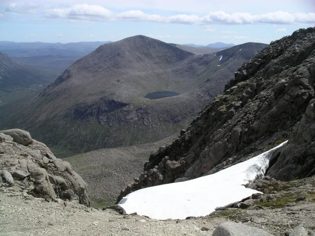
Braeriach — 1296m high mountain on the Aberdeenshire and Highland border, Scotland, UK.

Wikimedia Commons contributors — see linked file page for photographer and licence licence

Plan your visit
- Typical visit
- 1 h–2 h
- Nearest railway station
- Sheiling / Middle · 6.8 km
- Free entry
- Dog-friendly
Getting there & planning your visit
To visit Braeriach in the Scottish Highlands, the nearest railway station is Sheiling / Middle, which is 6.8 km away. Entry to the landmark is free.
About
Braeriach is a named natural landmark in the United Kingdom. Wikidata describes it as: "1296m high mountain on the Aberdeenshire and Highland border, Scotland, UK". Coordinates: 57.0783°, -3.7284°.
Photo gallery
Official information
Braeriach is a prominent mountain located in the Cairngorms, known for its stunning landscapes and challenging hiking routes. Visitors can enjoy various trails leading to the summit, offering breathtaking views of the surrounding area.
From the Wikipedia article
Braeriach or Brae Riach (Scottish Gaelic: Am Bràigh Riabhach, 'the brindled upland') is the third-highest mountain in Scotland and all of the British Isles, after Ben Nevis and Ben Macdui, rising 1,296 metres (4,252 ft) above sea level. It is in the Scottish Highlands and is the highest point in the western massif of the Cairngorms, separated from the central section by the Lairig Ghru pass. The summit is a crescent-shaped plateau, overlooking several corries. Probably the most commonly used route up Braeriach starts from Sugar Bowl car park, on the road leading to the Cairn Gorm ski area. From here a path leads over the hillside to a steep-sided rocky ravine known as the Chalamain Gap, before descending around 100 metres (330 ft) to the Lairig Ghru. After crossing this pass the route heads for the summit via Braeriach's north ridge, crossing a subsidiary peak, Sròn na Lairige. The summit is about nine kilometres (5+1⁄2 miles) from the car park by this route.
Excerpt from Wikipedia under CC BY-SA 4.0. See the source article linked in Sources below.
- Coordinates
- 57.0783, -3.7284
- Address
- Cairngorms, Scotland
- Nearest railway station
- Sheiling / Middle — 6.8 km
Sources
- wikidata: Q897186 (CC0)
- wikipedia: Braeriach (CC BY-SA 4.0)
- commons: Braeriach.jpg (CC BY-SA 4.0)
Other places nearby
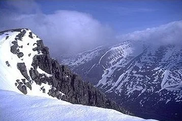
Braeriach
Mountains & hills · 0.0 km

Falls of Dee
Waterfalls · 1.2 km

Sron na Lairige
Mountains & hills · 1.3 km

Sron na Lairige
Mountains & hills · 1.3 km

Loch Coire an Lochain
Lakes · 1.3 km

Lochan Uaine
Lakes · 2.0 km

Carn na Criche
Mountains & hills · 2.2 km
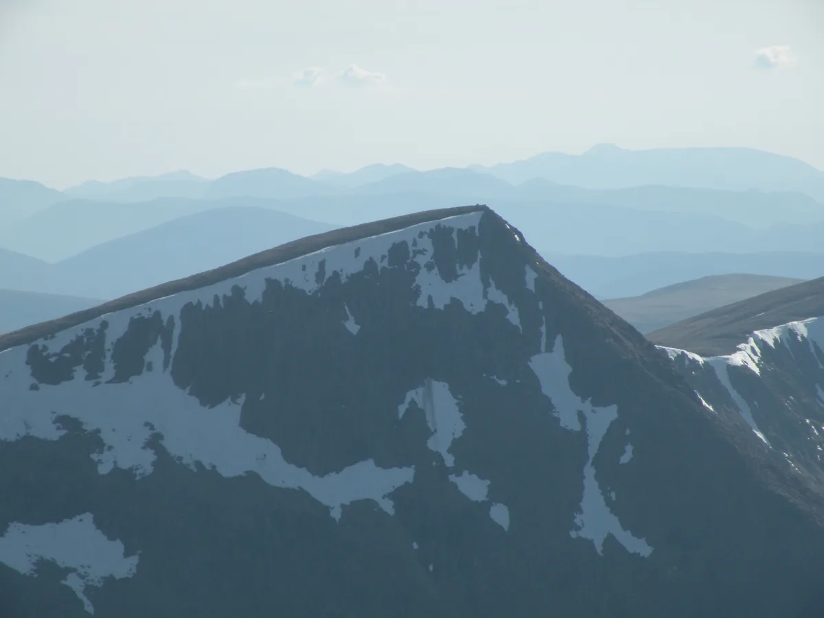
Sgòr an Lochain Uaine
Natural landmarks · 2.2 km
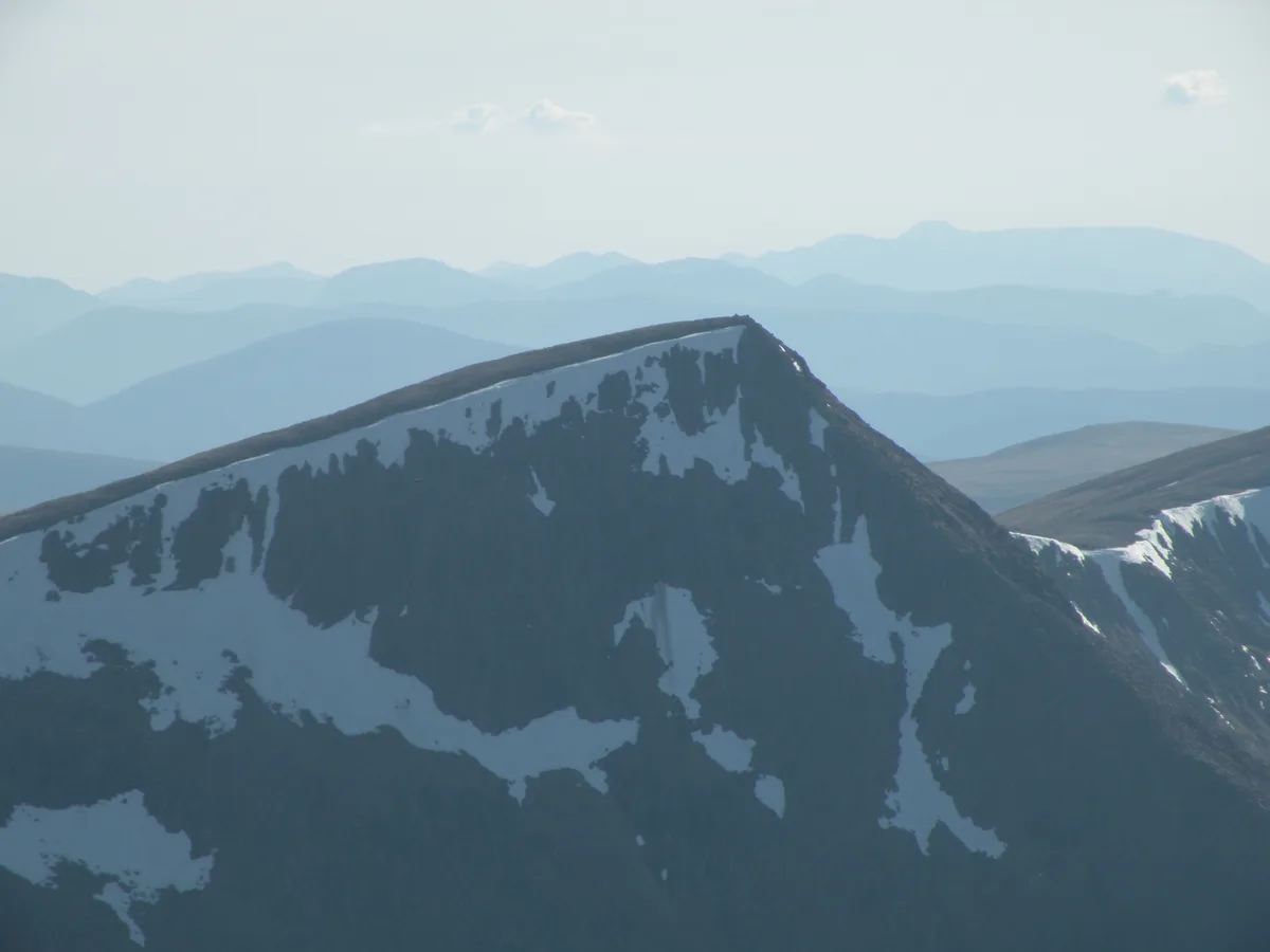
Sgor an Lochain Uaine
Mountains & hills · 2.2 km
Carn na Criche
Mountains & hills · 2.2 km
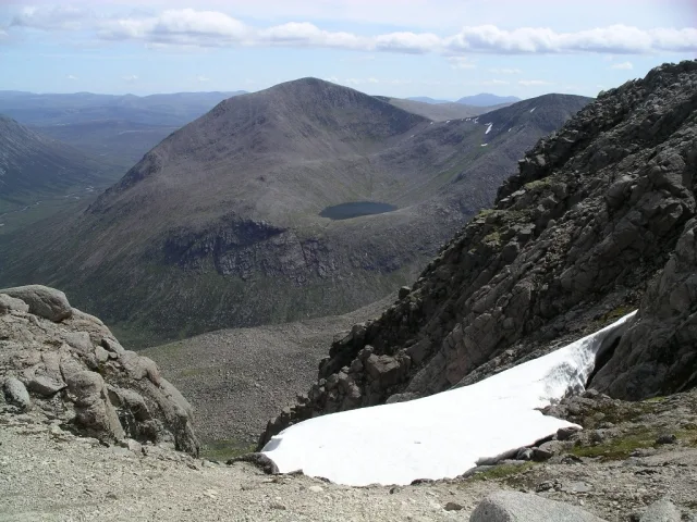
Cairn Toul
Natural landmarks · 2.9 km
Cairn Toul
Mountains & hills · 2.9 km
Nearby
📷 3📷 5📷 3Mountains & hills · Scottish Highlands
Sron na Lairige
Sron na Lairige — a mountain in scotland-highlands, United Kingdom.
📷 5Mountains & hills · Scottish Highlands
Sron na Lairige
Sron na Lairige — mountain in scotland highlands. Elevation: 1184 m.
📷 5Lakes · Scottish Highlands
Loch Coire an Lochain
Loch Coire an Lochain — a lake in scotland highlands.
📷 5Where to eat & stay near Braeriach
Places to stay
 📷 5
📷 5Campsites · Scottish Highlands
Glenmore Camp Site
Glenmore Camp Site — a campsite in scotland highlands.
📷 5Hostels · Scottish Highlands
Cairngorm Lodge Youth Hostel
Cairngorm Lodge Youth Hostel — a hostel in scotland highlands.
 📷 5
📷 5Hostels · Scottish Highlands
Glen Feshie Hostel
Glen Feshie Hostel — a hostel in scotland highlands.
 📷 5
📷 5Campsites · Scottish Highlands
Rothiemurchus Camp and Caravan
Rothiemurchus Camp and Caravan — a campsite in scotland highlands.
 📷 5
📷 5Hotels · Scottish Highlands
Coylumbridge Aviemore Hotel
Coylumbridge Aviemore Hotel — a hotel in scotland highlands.
 📷 5
📷 5More natural landmarks in this region
 Flagship📷 3
Natural landmarks · Scottish Highlands
Dunalastair Water
Dunalastair Water — lake in Perth and Kinross, Scotland, UK, on the River Tummel.
 Flagship📷 3
Natural landmarks · Scottish Highlands
Loch Arkaig
Loch Arkaig — lake in Highland, Scotland, UK, outflows east to River Arkaig.
 Flagship📷 3
Natural landmarks · Scottish Highlands
Loch Assynt
Loch Assynt — lake in Highland, Scotland, UK, outflows to the River Inver and Loch na Garbh Uidhe.
 Flagship📷 5
Natural landmarks · Scottish Highlands
Loch Eilt
Loch Eilt — lake in Highland, Scotland, UK, outflows west to River Ailort.
Frequently asked questions
- Where is Braeriach?
- Braeriach is in the Scottish Highlands, United Kingdom.
- What is Braeriach?
- Braeriach — 1296m high mountain on the Aberdeenshire and Highland border, Scotland, UK.
- How do I get to Braeriach?
- The nearest railway station is Sheiling / Middle, about 6.8 km away. Its coordinates are 57.0783°, -3.7284°.
- Is Braeriach free to visit?
- Yes, Braeriach is free to enter.
- How do I get to Braeriach?
- The nearest railway station is Sheiling / Middle, about 6.8 km away.