
Towns & cities · East of England
Bradfield Combust
Bradfield Combust — village and civil parish in Suffolk, United Kingdom.

Wikimedia Commons licence
Plan your visit
- Typical visit
- 3 h–6 h
- Nearest railway station
- Thurston · 8.0 km
- Free entry
- Family-friendly
- Dog-friendly
About
Bradfield Combust is a town, city, village or settlement in the United Kingdom. Address: IP30. Wikidata describes it as: "village and civil parish in Suffolk, United Kingdom". Coordinates: 52.1830°, 0.7670°.
Photo gallery
See it from the streetimagery from 2026
Imagery © Mapillary contributors, CC BY-SA 4.0
From the Wikipedia article
Bradfield Combust (or Burnt Bradfield) is a village and former manor and civil parish, now in the parish of Bradfield Combust with Stanningfield, in the West Suffolk district of Suffolk, England. It is located on the A134 between Windsor Green and Great Whelnetham. In 1961 the parish had a population of 108. In 1988 the parish was merged with Stanningfield.
Excerpt from Wikipedia under CC BY-SA 4.0. See the source article linked in Sources below.
Background
History
Before the Conquest, the manor was probably owned by Ulfketel, ealdorman of East Anglia, who gave this part of his manor to the monks of St. Edmund, while reserving the lordship. The Domesday Book records the population of Bradefelda manor, including Bradfield St Clare and Bradfield St George. Bradefelda/fella existed before the Conquest. The book states that then (i.e. before the Conquest), as in 1066, there were fifteen villans and eighteen bordars; 'then' one slave, and in 1086 six slaves; and three free men. Over these men St. Edmund (the Abbey of Edmund the Martyr) had sake and soke with regard to every customary due. They were not allowed to sell their lands without the Abbot's…
Sourced from Wikipedia under CC BY-SA 4.0.
- Coordinates
- 52.1830, 0.7670
- County
- Suffolk
- District
- West Suffolk
- Parish
- Bradfield Combust with Stanningfield
- Postcode
- IP30
- Parliamentary constituency
- Bury St Edmunds and Stowmarket
- Nearest railway station
- Thurston — 8 km
Sources
- wikidata: Q607881 (CC0)
- wikipedia: Bradfield Combust (CC BY-SA 4.0)
Other places nearby

Bradfield Combust Village Sign
Public art & sculpture · 0.0 km

Stanningfield
Towns & cities · 1.3 km

Stanningfield Village Sign
Public art & sculpture · 1.3 km

Bradfield St Mary Village Sign
Public art & sculpture · 2.1 km

Church of St Thomas à Becket, Great Whelnetham
Historic churches · 2.4 km

Little Welnetham
Villages · 2.6 km

Church of St Mary Magdalene, Little Whelnetham
Historic churches · 2.6 km

Roundwood House
B&Bs · 2.7 km
.jpg?width=1200)
Church House
Historic houses · 2.8 km

Bradfield St George Village Sign
Public art & sculpture · 2.8 km

Great Whelnetham
Towns & cities · 2.8 km

St Georges's Church
Historic churches · 2.9 km
Bradfield Combust is a charming village located in Suffolk, within the East of England region. Visitors can explore the natural beauty of Bradfield Woods and Bull's Wood, both designated as wildlife reserves. The area also offers cultural interest through the Church of St Peter and the distinctive Bradfield Combust Village Sign.
At a glance
- Administrative county
- Suffolk
- Constituency
- Bury St Edmunds and Stowmarket
- Top categories near here
Things to see in Bradfield Combust
9 attractions within 12 km. Full guide: things to do in Bradfield Combust →
 📷 4
📷 4Wildlife reserves · East of England
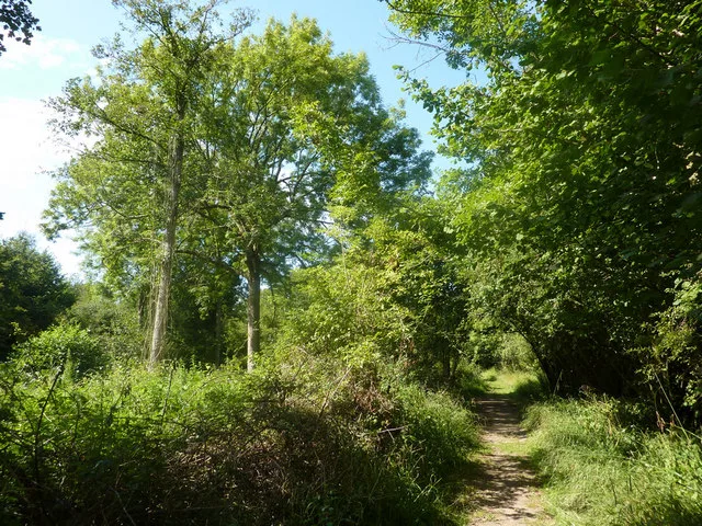
Bradfield Woods
Bradfield Woods — Suffolk Wildlife Trust nature reserve.
 📷 4
📷 4Forests & woodlands · East of England
Bradfield Woods National Nature Reserve
Bradfield Woods National Nature Reserve is a forest or woodland in the United Kingdom.
 📷 5
📷 5Wildlife reserves · East of England
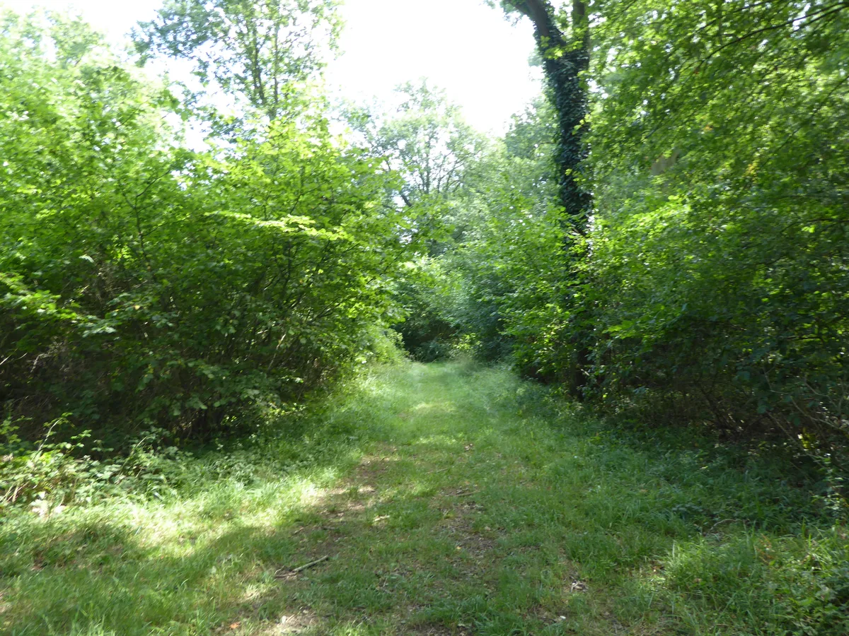
Bull's Wood
Bull's Wood — Suffolk Wildlife Trust nature reserve.
 📷 3
📷 3Historic churches · East of England
Church of St Peter
Church of St Peter — church in Felsham, Suffolk, England, UK.
📷 3Public art & sculpture · East of England
Bradfield Combust Village Sign
Bradfield Combust Village Sign — a public art in england-east, United Kingdom.
 📷 3
📷 3Public art & sculpture · East of England
Cockfield Village Sign
Cockfield Village Sign — a public art in england-east, United Kingdom.
📷 3Public art & sculpture · East of England
Bradfield St George Village Sign
Bradfield St George Village Sign — a public art in england-east, United Kingdom.
📷 3Public art & sculpture · East of England
Bradfield St Mary Village Sign
Bradfield St Mary Village Sign — a public art in england-east, United Kingdom.
 📷 5
📷 5Nearby
📷 3Public art & sculpture · East of England
Bradfield Combust Village Sign
Bradfield Combust Village Sign — a public art in england-east, United Kingdom.
📷 3📷 3Public art & sculpture · East of England
Stanningfield Village Sign
Stanningfield Village Sign — a public art in england-east, United Kingdom.
📷 3Public art & sculpture · East of England
Bradfield St Mary Village Sign
Bradfield St Mary Village Sign — a public art in england-east, United Kingdom.
📷 3Historic churches · East of England
Church of St Thomas à Becket, Great Whelnetham
Church of St Thomas à Becket, Great Whelnetham — a Grade I-listed church in england-east, United Kingdom.
📷 5Where to eat & stay near Bradfield Combust
Places to stay
📷 5 📷 5
📷 5Campsites · East of England
Brighthouse Farm Caravan & Campsite
Brighthouse Farm Caravan & Campsite — a campsite in england east.
 📷 5
📷 5Hotels · East of England
Dragonfly Hotel
Dragonfly Hotel — a hotel in england east.
 📷 7
📷 7Hotels · East of England
Chantry Hotel
Chantry Hotel — a hotel in england east.
 📷 5
📷 5Caravan parks · East of England
Bright Meadow Caravan Park
Bright Meadow Caravan Park — a caravan park in england east.
 📷 5
📷 5Hotels · East of England
Angel Hotel
Angel Hotel — a hotel in england east.
Places to eat & drink
 📷 5
📷 5Historic pubs · East of England
The Elephant And Castle Public House
The Elephant And Castle Public House in England East, United Kingdom.
 📷 7
📷 7Restaurants · East of England
Cheers
Cheers — a restaurant in england east.
 📷 7
📷 7Historic pubs · East of England
The Nutshell
The Nutshell in England East, United Kingdom.
 📷 7
📷 7Historic pubs · East of England
The Market Tavern Public House
The Market Tavern Public House in England East, United Kingdom.
 📷 5
📷 5Historic pubs · East of England
The Rising Sun Public House
The Rising Sun Public House in England East, United Kingdom.
 📷 6
📷 6Historic pubs · East of England
The Bushel Public House
The Bushel Public House in England East, United Kingdom.
More towns in this region
 Flagship📷 10
 Flagship📷 10
Towns & cities · East of England
Cambridge
Cambridge — city in Cambridgeshire, England.
 Flagship📷 10
Towns & cities · East of England
Chelmsford
Chelmsford — city in Essex, United Kingdom.
 Flagship📷 10
Towns & cities · East of England
Colney Heath
Colney Heath — village and civil parish in St Albans, Hertfordshire, England, UK.
Frequently asked questions
- Where is Bradfield Combust?
- Bradfield Combust is in Suffolk, East of England, United Kingdom (postcode IP30), in the parish of Bradfield Combust with Stanningfield.
- What is Bradfield Combust?
- Bradfield Combust — village and civil parish in Suffolk, United Kingdom.
- How do I get to Bradfield Combust?
- The nearest railway station is Thurston, about 8.0 km away. Drivers can use postcode IP30.
- Is Bradfield Combust free to visit?
- Yes, Bradfield Combust is free to enter.
- How do I get to Bradfield Combust?
- Drivers can navigate to postcode IP30. It sits within the Bury St Edmunds and Stowmarket parliamentary constituency.