
Historic houses · South East England
Bourne Park House
In or near Bishopsbourne.
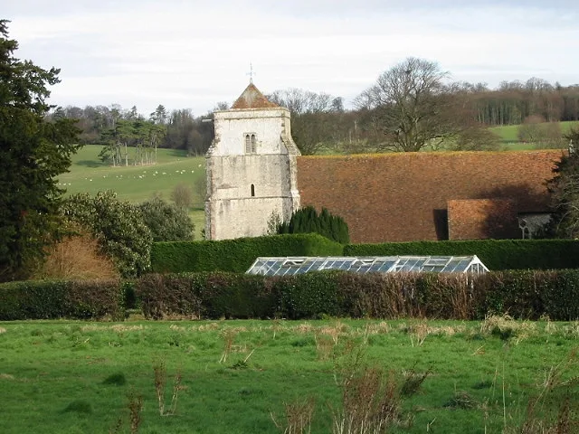
Bourne Park House — Grade I listed house in Bishopsbourne, Canterbury, Kent, England, UK.

Wikimedia Commons contributors — see linked file page for photographer and licence licence

Plan your visit
- Typical visit
- 1 h–2 h
- Nearest railway station
- Bekesbourne · 3.0 km
- Family-friendly
- Limited wheelchair access
Getting there & planning your visit
Bourne Park House is located in Canterbury, Kent, with the postcode CT4 5BJ. The nearest railway station is Bekesbourne, which is 3 km away. Accessibility is limited for wheelchair users.
About
Bourne Park House is a historic house in the United Kingdom — typically a country seat, manor, or town house with notable architecture or history. Heritage designation: Grade I listed building. Wikidata describes it as: "Grade I listed house in Bishopsbourne, Canterbury, Kent, England, UK". Coordinates: 51.2357°, 1.1232°.
Photo gallery
Protected designations
- Area of Outstanding Natural Beauty: Kent Downs
Designations sourced from Natural England open data under OGL v3.
From the Wikipedia article
Bourne Park House is a Queen Anne style country house on Bourne Park Road, between Bishopsbourne and Bridge near Canterbury in Kent. Built in 1701, it has been listed Grade I listed on the National Heritage List for England since 1954. An 18th-century red-brick ice house and a bridge that spans the Nailbourne that feeds the lake in the grounds of Bourne Park are both Grade II listed. Originally known as Bourne Place, the present house was commissioned by Elizabeth Aucher, the widow of Sir Anthony Aucher. Built in place of an existing building belonging to the Bourne family, it is large red brick rectangular mansion of two storeys with attic and basement and a hipped tile roof. There is a 13 bay frontage, of which the central 5 bays project surmounted by a pediment containing a Venetian window. The interior, altered in 1848, contains a good 18th-century staircase, panelling and ceilings. The house is surrounded by parkland of which all but the adjacent 3.6 hectares (9 acres) are now separately owned. Notable features of the gardens are the 18th-century lime avenue, the yew walk and fine examples of Wellingtonia and cork oak. Some trees were lost in the storm of October 1987. There is also a private cricket ground, known historically as Bishopsbourne Paddock. Bourne Park is a site for ongoing archaeological research by the University of Cambridge. Several reports have been published to describe findings which include both archaeological features and artefacts. The evidence suggests usage of the area dating from the Bronze Age. The earliest artefact found is an Iron Age silver coin and there have been numerous findings associated with Roman Britain.
Excerpt from Wikipedia under CC BY-SA 4.0. See the source article linked in Sources below.
Background
History
Lady Aucher built and maintained the house during the minority of her only son, Sir Hewitt Aucher, Bt, passing it over to him in 1708. He left it to his elder sister, from whom it passed by marriage to the Beckingham family. After spending the night in nearby Canterbury, Leopold Mozart, his wife Anna Maria, and their children Maria Anna and Wolfgang Amadeus, spent the last week of July 1765 at the house as part of the English leg of their European grand tour before their departure for the Hague. The Mozarts were visiting Sir Horatio Mann, Bt. who had leased the house. Mann was an avid cricketer and a number of top-class cricket matches were held between 1766 and 1790 at the Bishopsbourne…
Sourced from Wikipedia under CC BY-SA 4.0.
- Coordinates
- 51.2357, 1.1232
- County
- Kent
- District
- Canterbury
- Parish
- Bishopsbourne
- Postcode
- CT4 5BJ
- Parliamentary constituency
- Canterbury
- Established
- 1704
- Nearest railway station
- Bekesbourne — 3 km
- Official site
- heritage.kent.gov.uk
Sources
- wikidata: Q17529608 (CC0)
- wikipedia: Bourne Park House (CC BY-SA 4.0)
- commons: Bourne Park House and sheep fields - geograph.org.uk - 335631.jpg (CC BY-SA 4.0)
Other places nearby

Bridge In The Grounds Of Bourne Park House
Historic bridges · 0.3 km

Church of St Mary, Bishopsbourne
Historic churches · 0.8 km
Bishopsbourne
Towns & cities · 0.9 km

Plough & Harrow Turkish Restaurant
Restaurants · 1.1 km

Bridge Farmers Market
Farmers’ markets · 1.1 km

Higham Park
Historic houses · 1.4 km

Charlton Park
Historic houses · 1.6 km

Bridge Over Nail Bourne
Historic bridges · 2.1 km

Sunnyside Farm
Campsites · 2.4 km

Kingston
Villages · 2.5 km

Church of St Peter, Bekesbourne
Historic churches · 2.7 km

Bridge Over Ford Near Parish Church
Historic bridges · 2.7 km
Nearby
📷 5Historic bridges · South East England
Bridge In The Grounds Of Bourne Park House
Bridge In The Grounds Of Bourne Park House — Grade II listed building-listed bridge in england-south-east, United Kingdom.
📷 5Historic churches · South East England
Church of St Mary, Bishopsbourne
Church of St Mary, Bishopsbourne — Grade I listed building-listed church in england-south-east, United Kingdom.
Flagship📷 10Towns & cities · South East England
Bishopsbourne
Bishopsbourne — village in Kent, England, UK.
📷 5Restaurants · South East England
Plough & Harrow Turkish Restaurant
Plough & Harrow Turkish Restaurant — a restaurant in england south east. Cuisine: turkish.
📷 5Farmers’ markets · South East England
Bridge Farmers Market
Bridge Farmers Market — a UK farmers' market in england south east.
📷 5Historic houses · South East England
Higham Park
Higham Park — house in Bekesbourne-with-Patrixbourne, Kent, England, UK.
Where to eat & stay near Bourne Park House
Places to stay
📷 5 📷 5
📷 5Caravan parks · South East England
Cobb's Meadow
Cobb's Meadow — a caravan park in england south east.
 📷 5
📷 5Campsites · South East England
Duskin Farm
Duskin Farm — a campsite in england south east.
 📷 5
📷 5Hostels · South East England
Canterbury Youth Hostel
Canterbury Youth Hostel — a hostel in england south east.
 📷 5
📷 5Campsites · South East England
Canterbury Camping and Caravanning Club Site
Canterbury Camping and Caravanning Club Site — a campsite in england south east.
 📷 7
📷 7Hotels · South East England
Abbots Barton Hotel
Abbots Barton Hotel — a hotel in england south east. 3-star. Brand: Best Western.
Places to eat & drink
📷 5Restaurants · South East England
Plough & Harrow Turkish Restaurant
Plough & Harrow Turkish Restaurant — a restaurant in england south east. Cuisine: turkish.
 📷 5
📷 5Historic pubs · South East England
Black Robin Public House
Black Robin Public House in England South East, United Kingdom.
 📷 5
📷 5Restaurants · South East England
Kudos
Kudos — a restaurant in england south east.
 📷 5
📷 5Restaurants · South East England
The Corner House
The Corner House — a restaurant in england south east.
 📷 5
📷 5Restaurants · South East England
Bangkok House
Bangkok House — a restaurant in england south east.
 📷 5
📷 5Cafés · South East England
The Moat Tea Rooms
The Moat Tea Rooms — a café in england south east.
More historic houses in this region
 📷 5
📷 5Historic houses · South East England
12 and 14 High Street, Rochester
12 and 14 High Street, Rochester — building in Rochester, Kent, England, UK.
 📷 5
📷 5Historic houses · South East England
Berkeley House
Berkeley House — house in Rochester, Kent, England, UK.
.jpg?width=1200) 📷 5
📷 5Historic houses · South East England
Betchworth House
Betchworth House — house in Betchworth, Mole Valley, England, UK.
 📷 5
📷 5Historic houses · South East England
Bookham Grove
Bookham Grove — building in Mole Valley, Surrey, England, UK.
Frequently asked questions
- Where is Bourne Park House?
- Bourne Park House is in Kent, South-East England, United Kingdom (postcode CT4 5BJ), in the parish of Bishopsbourne.
- What is Bourne Park House?
- Bourne Park House — Grade I listed house in Bishopsbourne, Canterbury, Kent, England, UK.
- How do I get to Bourne Park House?
- The nearest railway station is Bekesbourne, about 3.0 km away. The nearest town is Bishopsbourne. Drivers can use postcode CT4 5BJ.
- When was Bourne Park House built?
- Built or established in 1704.
- Who owns Bourne Park House?
- Bourne Park House is owned by | designation1 = Grade I listed building.
- Is Bourne Park House a listed building?
- Bourne Park House is officially recognised as Grade I listed building listed.
- Is Bourne Park House a protected site?
- Yes — Bourne Park House is part of the Kent Downs National Landscape (AONB).
- How do I get to Bourne Park House?
- The nearest railway station is Bekesbourne, about 3.0 km away. Drivers can navigate to postcode CT4 5BJ.