
Castles · North East England
Bothal
In or near Stakeford.
Bothal in England North East, United Kingdom.

N Chadwick — CC BY-SA 2.0 via Wikimedia Commons licence

Plan your visit
- Typical visit
- 1.5 h–3 h
- Nearest railway station
- Pegswood · 1.3 km
- Family-friendly
- Limited wheelchair access
Getting there & planning your visit
To visit Bothal Castle in Northumberland, the nearest railway station is Pegswood, located 1.3 km away. The postcode for sat-nav is NE61 6SL. Please note that accessibility is limited for wheelchair users.
About
Bothal is a place of interest in England North East, United Kingdom — drawn from open-data sources for visitor reference. See the linked Wikipedia article for the full description.
Photo gallery
Protected designations
- Site of Special Scientific Interest: Northumberland Shore SSSI
Designations sourced from Natural England open data under OGL v3.
From the Wikipedia article
Bothal is a hamlet in the civil parish of Ashington, Northumberland, England. It is situated between Morpeth and Ashington. There is a castle, a church, a vicarage opposite the church gates, stepping stones over the River Wansbeck, and a few houses. Bothal was the headquarters of the extensive Welbeck Estates in Northumberland. Half a mile upstream of the castle are the remains of a watermill that still had a working waterwheel up to about the First World War. It had a turbine for electricity production for the mill house from 1947 to 1980. Until 1866 Bothal was a civil parish, In 1831 the parish had a population of 1319. Bothal was also a drift mine ('Bothal Barns Drift') though this is something of a misnomer. Bothal Drift was merely another entrance to the Ashington colliery. Now, Bothal Barns Drift is the site of a private house with the old entrance to the drift mine being long disused. The Bothal Drift is situated on the top of the bank on the Ashington side. Further west (a few hundred yards) from the church and castle, it is possible to walk along the River Wansbeck for some 30–45 minutes west towards Morpeth. The name Morpeth apparently means 'murder path' and was once the main thoroughfare along the river. Further along the footpath is the remains of an old chapel. The footpath starts near the site of the old mill. You can park your car near the gate (at the bridge) and then walk westwards past the weir. The path does not allow bikes or horses and is not wheelchair accessible,
Excerpt from Wikipedia under CC BY-SA 4.0. See the source article linked in Sources below.
- Coordinates
- 55.1730, -1.6250
- District
- Northumberland
- Parish
- Ashington
- Postcode
- NE61 6SL
- Parliamentary constituency
- Blyth and Ashington
- Nearest railway station
- Pegswood — 1.3 km
Sources
Other places nearby
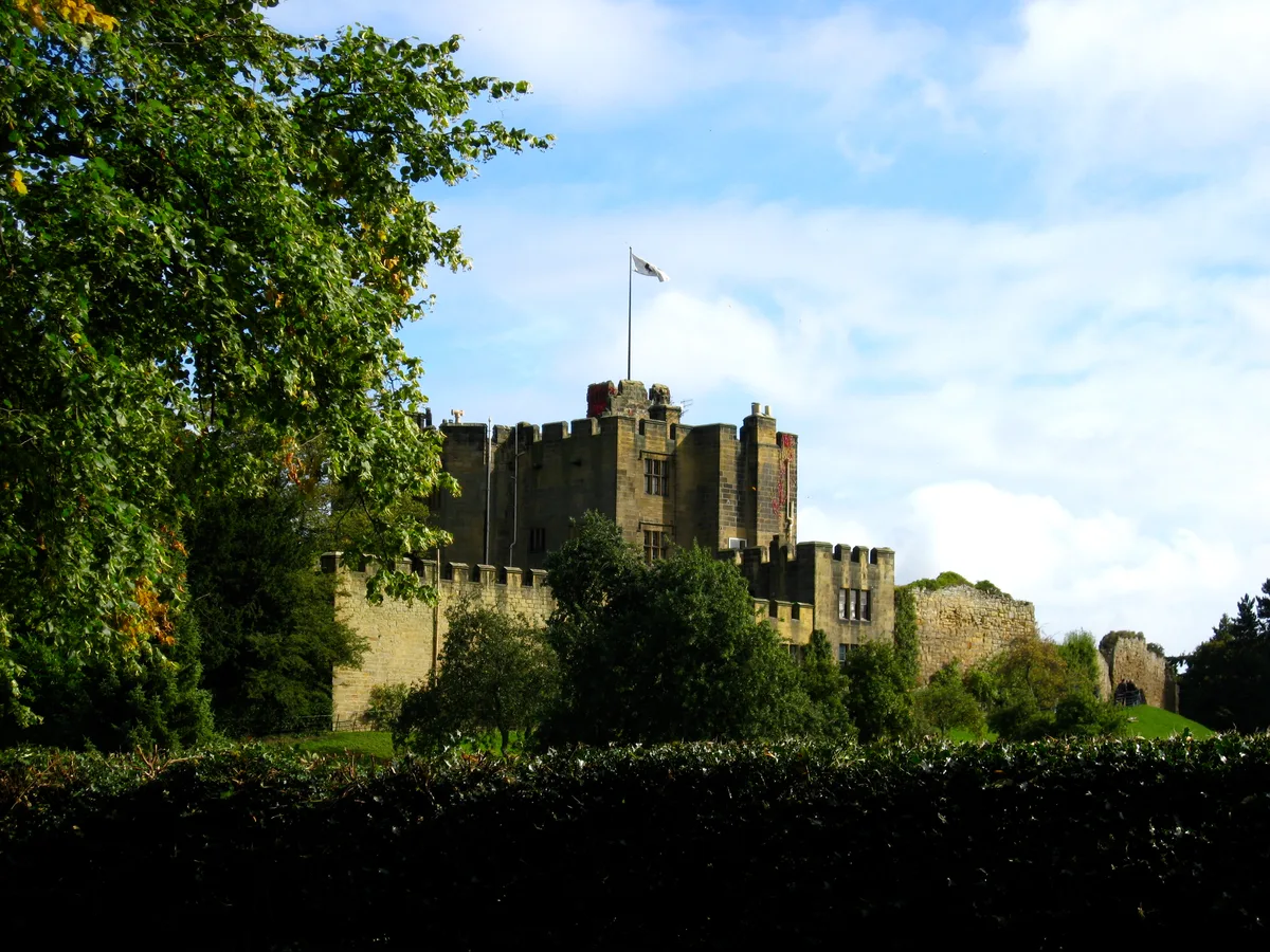
Bothal Castle
Castles · 0.0 km
Bothal War Memorial
Memorials & monuments · 0.0 km
Bothal Castle Remains Of Curtain Wall To South Of Residential Block
Castles · 0.1 km

Fire (Robin of Pegswood)
Public art & sculpture · 1.0 km

Wansbeck
Cathedrals · 1.0 km

Pegswood railway station
Memorials & monuments · 1.3 km
Pegswood
Mines & mining heritage · 1.4 km

Ashington Colliery Junction railway station
Mines & mining heritage · 1.5 km
Colliers Hill
Viewpoints · 1.6 km
Welfare Cinema
Theatres · 1.6 km

Sheepwash
Other places · 1.8 km

Stakeford War Memorial
Memorials & monuments · 2.0 km
Nearby
📷 3Castles · North East England
Bothal Castle
Bothal Castle — Grade I listed castle in Ashington, Northumberland, England, UK.
📷 3Memorials & monuments · North East England
Bothal War Memorial
Bothal War Memorial — Grade II listed building-listed memorial in scotland-lowlands, United Kingdom.
📷 3Castles · North East England
Bothal Castle Remains Of Curtain Wall To South Of Residential Block
Bothal Castle Remains Of Curtain Wall To South Of Residential Block — a Grade I-listed castle in scotland-lowlands, United Kingdom.
📷 3Public art & sculpture · North East England
Fire (Robin of Pegswood)
Fire (Robin of Pegswood) — a public art in scotland-lowlands, United Kingdom.
Flagship📷 4📷 4Memorials & monuments · North East England
Pegswood railway station
Pegswood railway station in England North East, United Kingdom.
Where to eat & stay near Bothal
Places to stay
 📷 5
📷 5Campsites · North East England
Tranwell Farm Camp Site
Tranwell Farm Camp Site — a campsite in scotland lowlands.
 📷 5
📷 5 📷 5
📷 5Caravan parks · North East England
Ellington Caravan Park
Ellington Caravan Park — a caravan park in scotland lowlands.
 📷 7
📷 7Hotels · North East England
The Commissioners Quay Inn
The Commissioners Quay Inn — a hotel in scotland lowlands.
 📷 5
📷 5Campsites · North East England
Selby Woods Scout Campsite
Selby Woods Scout Campsite — a campsite in scotland lowlands.
 📷 5
📷 5Caravan parks · North East England
Felmoor Park
Felmoor Park — a caravan park in scotland lowlands.
Places to eat & drink
 📷 5
📷 5 📷 3
📷 3Historic pubs · North East England
The Kings Arms
The Kings Arms — Historic pub — listed building or notable heritage status.
 📷 5
📷 5Historic pubs · North East England
Northumberland Arms
Northumberland Arms in Scotland Lowlands, United Kingdom.
 📷 5
📷 5Historic pubs · North East England
Border Minstrel
Border Minstrel in Scotland Lowlands, United Kingdom.
 📷 5
📷 5Historic pubs · North East England
The Seven Stars Public House
The Seven Stars Public House in Scotland Lowlands, United Kingdom.
 📷 5
📷 5Historic pubs · North East England
The Anglers Arms
The Anglers Arms in Scotland Lowlands, United Kingdom.
More castles in this region
 📷 3
📷 3Castles · North East England
Scargill Castle
Scargill Castle — house in Scargill, County Durham, England, UK.
 📷 3
📷 3Castles · North East England
Roper Castle or Round Table (Roman Signal Station)
Roper Castle or Round Table (Roman Signal Station) — a castle in england-north-west, United Kingdom.
 📷 5
📷 5 📷 5
📷 5Castles · North East England
Appleby Castle
Appleby Castle — Grade I listed English country house in Appleby-in-Westmorland, United Kingdom.
Frequently asked questions
- Where is Bothal?
- Bothal is in North-East England, United Kingdom (postcode NE61 6SL), in the parish of Ashington.
- What is Bothal?
- Bothal in England North East, United Kingdom.
- How do I get to Bothal?
- The nearest railway station is Pegswood, about 1.3 km away. Drivers can use postcode NE61 6SL.
- Is Bothal a protected site?
- Yes — Bothal is part of the Northumberland Shore SSSI Site of Special Scientific Interest.
- Does Bothal charge admission?
- Bothal typically charges admission. Check the official site for current ticket prices and opening hours.
- How do I get to Bothal?
- The nearest railway station is Pegswood, about 1.3 km away. Drivers can navigate to postcode NE61 6SL.