Museums · East Midlands
Borough of Rushcliffe
In or near Keyworth.
Rushcliffe is a local government district with borough status in south Nottinghamshire, England. Its council is based in West Bridgford. The borough also includes the towns of Bingham and Cotgrave as

Mat Fascione — CC BY-SA 2.0 via Wikimedia Commons licence
Plan your visit
- Typical visit
- 1.5 h–3 h
- Best time of year
- Year-round
- Nearest railway station
- Radcliffe · 5.5 km
- Family-friendly
- Limited wheelchair access
Getting there & planning your visit
To visit the Borough of Rushcliffe, the nearest railway station is Radcliffe, located 5.5 km away. The postcode for sat-nav is NG12 5PB. Please note that wheelchair accessibility is limited.
About
Rushcliffe is a local government district with borough status in south Nottinghamshire, England. Its council is based in West Bridgford. The borough also includes the towns of Bingham and Cotgrave as well as numerous villages and surrounding rural areas. Some of the built-up areas in the north-west of the borough, including West Bridgford, form part of the Nottingham Urban Area. The neighbouring districts are Broxtowe, Nottingham, Gedling, Newark and Sherwood, Melton, Charnwood, North West Leicestershire and Erewash.
Photo gallery
From the Wikipedia article
Rushcliffe is a local government district with borough status in south Nottinghamshire, England. Its council is based in West Bridgford. The borough also includes the towns of Bingham and Cotgrave as well as numerous villages and surrounding rural areas. Some of the built-up areas in the north-west of the borough, including West Bridgford, form part of the Nottingham Urban Area. The neighbouring districts are Broxtowe, Nottingham, Gedling, Newark and Sherwood, Melton, Charnwood, North West Leicestershire and Erewash.
Excerpt from Wikipedia under CC BY-SA 4.0. See the source article linked in Sources below.
Background
History
The district was formed on 1 April 1974 under the Local Government Act 1972. The new district covered the whole area of two former districts and part of a third, which were all abolished at the same time: The new district was named after the ancient Rushcliffe Wapentake, which had covered part of the area. Rushcliffe means "cliff where brushwood grows", from Old English hris "brushwood" and clif "cliff". The new Rushcliffe district was granted borough status from its creation, allowing the chair of the council to take the title of mayor.
Sourced from Wikipedia under CC BY-SA 4.0.
- Coordinates
- 52.9000, -1.0500
- County
- Nottinghamshire
- District
- Rushcliffe
- Parish
- Clipston
- Postcode
- NG12 5PB
- Parliamentary constituency
- Rushcliffe
- Nearest railway station
- Radcliffe — 5.5 km
Sources
- wikipedia: Borough of Rushcliffe (CC BY-SA 4.0)
Other places nearby

Primrose House B&B
B&Bs · 1.2 km

Cotgrave
Villages · 1.3 km
All Saints' Church, Cotgrave
Historic churches · 1.4 km

Cotgrave
Museums · 1.6 km

Normanton on the Wolds
Villages · 2.0 km

Normanton House
Historic houses · 2.1 km

Windmill Hill
Viewpoints · 2.2 km

Plumtree Pinfold
Memorials & monuments · 2.5 km

Tollerton War Memorial
Memorials & monuments · 2.6 km
507th Parachute Regiment
Memorials & monuments · 2.6 km
Church of St. Mary the Virgin, Plumtree
Historic churches · 2.7 km

Plumtree War Memorial, Nottinghamshire
Memorials & monuments · 2.7 km
Nearby
📷 5B&Bs · East Midlands
Primrose House B&B
Primrose House B&B — a bed-and-breakfast in england east midlands.
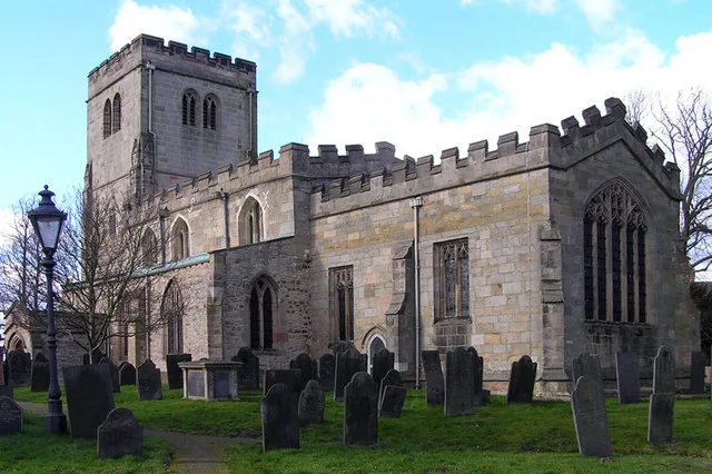
📷 5📷 3Historic churches · East Midlands
All Saints' Church, Cotgrave
All Saints' Church, Cotgrave — Grade I listed church in Cotgrave, Rushcliffe, Nottinghamshire, England, UK.
📷 5Museums · East Midlands
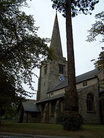
Cotgrave
Cotgrave () is a town and civil parish in the borough of Rushcliffe in Nottinghamshire, England. It is 5 miles (8 km) south-east of Nottingham. It perches on the South Nottinghamshire Wolds about 131
📷 5Villages · East Midlands
Normanton on the Wolds
Normanton on the Wolds — a village in england east midlands.
📷 3Historic houses · East Midlands
Normanton House
Normanton House — house in Normanton on the Wolds, Rushcliffe, Nottinghamshire, England, UK.
Where to eat & stay near Borough of Rushcliffe
Places to stay
📷 5B&Bs · East Midlands
Primrose House B&B
Primrose House B&B — a bed-and-breakfast in england east midlands.
 📷 5
📷 5Campsites · East Midlands
Hollygate Scout Camp
Hollygate Scout Camp — a campsite in england east midlands.
 📷 5
📷 5Campsites · East Midlands
Canping & Caravan Club Nottingham Site
Canping & Caravan Club Nottingham Site — a campsite in england east midlands.
 📷 5
📷 5Campsites · East Midlands
Oddhouse Farm Glamping
Oddhouse Farm Glamping — a campsite in england east midlands.
 📷 5
📷 5Campsites · East Midlands
Bell Tent Village Parks
Bell Tent Village Parks — a campsite in england east midlands.
 📷 5
📷 5Campsites · East Midlands
Holme Pierrepont Country Park
Holme Pierrepont Country Park — a campsite in england east midlands.
Places to eat & drink
 📷 5
📷 5Historic pubs · East Midlands
Manvers Arms Public House
Manvers Arms Public House in England East Midlands, United Kingdom.
 📷 7
📷 7Historic pubs · East Midlands
Test Match Hotel
Test Match Hotel in England East Midlands, United Kingdom.
 📷 7
📷 7Historic pubs · East Midlands
Trent Bridge Inn
Trent Bridge Inn in England East Midlands, United Kingdom.
 📷 5
📷 5 📷 5
📷 5Restaurants · East Midlands
Restaurant Sat Bains
Restaurant Sat Bains — a restaurant in england east midlands.
 📷 7
📷 7Historic pubs · East Midlands
Bath Inn Public House
Bath Inn Public House in England East Midlands, United Kingdom.
More museums in this region
 📷 5
📷 5Museums · East Midlands
Stamford Town Hall
Stamford Town Hall — building in Stamford, Lincolnshire, England, UK.
 📷 5
📷 5Museums · East Midlands
Thorney Museum
Thorney Museum — a museum in england-london, United Kingdom.
 📷 5
📷 5Museums · East Midlands
Octavia Hill Birthplace Museum
Octavia Hill Birthplace Museum — a museum in england-london, United Kingdom.
 📷 5
📷 5Museums · East Midlands
Museum of Technology
Museum of Technology — a museum in england-london, United Kingdom.
Frequently asked questions
- Where is Borough of Rushcliffe?
- Borough of Rushcliffe is in Nottinghamshire, the East Midlands, United Kingdom (postcode NG12 5PB), in the parish of Clipston.
- What is Borough of Rushcliffe?
- Rushcliffe is a local government district with borough status in south Nottinghamshire, England. Its council is based in West Bridgford. The borough also includes the towns of Bingham and Cotgrave as
- How do I get to Borough of Rushcliffe?
- The nearest railway station is Radcliffe, about 5.5 km away. Drivers can use postcode NG12 5PB.
- How do I get to Borough of Rushcliffe?
- The nearest railway station is Radcliffe, about 5.5 km away. Drivers can navigate to postcode NG12 5PB.