
Archaeological sites · North West England
Boreland Mote
Boreland Mote — a archaeological in scotland-lowlands, United Kingdom.

Andy Farrington — CC BY-SA 2.0 via Wikimedia Commons licence

Plan your visit
- Typical visit
- 45 min–1.5 h
- Free entry
- Dog-friendly
About
Boreland Mote is a archaeological located in scotland-lowlands, United Kingdom. Sourced from OpenStreetMap (ODbL licence); see local listings for visitor information, opening hours and admission details.
Photo gallery
See it from the streetimagery from 2024
Imagery © Mapillary contributors, CC BY-SA 4.0
Place summary
Boreland Mote is an archaeological site located in the Scottish Lowlands. It features a large motte, a type of earthwork castle, indicative of medieval fortifications in Scotland. The site provides insight into the region's historical landscape and settlement patterns.
AI-generated from the structured facts on this page (operator, designation, listing, era). Not a substitute for visiting.
- Coordinates
- 54.8931, -4.5664
- District
- Dumfries and Galloway
- Postcode
- DG8 0DB
- Parliamentary constituency
- Dumfries and Galloway
Sources
- osm: node/6227980693 (ODbL)
Other places nearby

Boreland Mote
Archaeological sites · 0.0 km

Spittal Bridge
Historic bridges · 0.7 km

Doon Hill, Boreland
Vineyards · 0.8 km

Kirkchrist
Villages · 1.3 km

Clugston Loch
Lakes · 1.5 km

Johnstone's Bridge
Historic bridges · 2.6 km

Lincuan Bridge
Historic bridges · 3.1 km

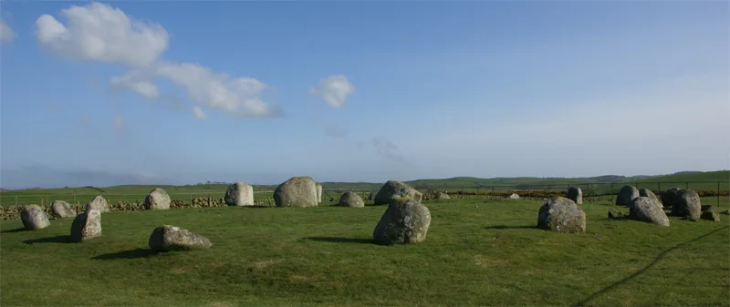
Torhouse Stone Circle
Stone circles · 3.3 km
Torhouse
Hill forts · 3.3 km

Old Parish Church and burial ground, Kirkcowan
Historic churches · 3.4 km

Kirkcowan Old Parish Churchyard
Cemeteries · 3.4 km

Kirkcowan
Villages · 3.5 km
Nearby
📷 5Archaeological sites · North West England
Boreland Mote
Boreland Mote — archaeological in scotland lowlands.
📷 5Historic bridges · North West England
Spittal Bridge
Spittal Bridge — category B listed building-listed bridge in scotland-lowlands, United Kingdom.
📷 5Vineyards · North West England
Doon Hill, Boreland
Doon Hill, Boreland — a UK vineyard in scotland lowlands, producing English or Welsh wine from cool-climate grape varieties.
📷 5📷 5📷 5Historic bridges · North West England
Johnstone's Bridge
Johnstone's Bridge — category B listed building-listed bridge in scotland-lowlands, United Kingdom.
Where to eat & stay near Boreland Mote
Places to stay
 📷 5
📷 5Campsites · North West England
Balloch O' Dee
Balloch O' Dee — a campsite in scotland lowlands.
 📷 7
📷 7Hotels · North West England
Cree Bridge House Hotel
Cree Bridge House Hotel — a hotel in scotland lowlands.
 📷 5
📷 5Campsites · North West England
Creebridge Caravan Park
Creebridge Caravan Park — a campsite in scotland lowlands.
 📷 5
📷 5Hostels · North West England
Minigaff Youth Hostel
Minigaff Youth Hostel — a hostel in scotland lowlands.
 📷 5
📷 5Caravan parks · North West England
Three Lochs Holiday Park
Three Lochs Holiday Park — a caravan park in scotland lowlands.
 📷 5
📷 5Campsites · North West England
DRUMROAMIN FARM CAMPING & CARAVAN SITE
DRUMROAMIN FARM CAMPING & CARAVAN SITE — a campsite in scotland lowlands.
Places to eat & drink
📷 7Historic pubs · North West England
The Craighlaw Arms, 23 Main Street, Kirkcowan
The Craighlaw Arms, 23 Main Street, Kirkcowan in Scotland Lowlands, United Kingdom.
 📷 7
📷 7Historic pubs · North West England
17 North Main Street, Wigtown
17 North Main Street, Wigtown in Scotland Lowlands, United Kingdom.
 📷 7
📷 7Historic pubs · North West England
The Harbour Inn, 18, 19 South Crescent, Garlieston
The Harbour Inn, 18, 19 South Crescent, Garlieston in Scotland Lowlands, United Kingdom.
More archaeological sites in this region
 📷 3
📷 3Archaeological sites · North West England
Early medieval sculptural fragments in St Mary's churchyard
Early medieval sculptural fragments in St Mary's churchyard — archaeological site in Sandbach, Cheshire East, England, UK.
 📷 3
📷 3Archaeological sites · North West England
Gaddum's Wood
Gaddum's Wood is a archaeological site in the United Kingdom.
 📷 3
📷 3Archaeological sites · North West England
Marton moated monastic grange, three fishponds, connecting channels and base of stone cross
Marton moated monastic grange, three fishponds, connecting channels and base of stone cross — archaeological site in Whitegate and Marton, Cheshire West and Chester, England, UK.
 📷 3
📷 3Archaeological sites · North West England
St Oswalds Well
St Oswalds Well — a archaeological in england-west-midlands, United Kingdom.
Frequently asked questions
- Where is Boreland Mote?
- Boreland Mote is in the Scottish Lowlands, United Kingdom (postcode DG8 0DB).
- What is Boreland Mote?
- Boreland Mote — a archaeological in scotland-lowlands, United Kingdom.
- How do I get to Boreland Mote?
- Drivers can use postcode DG8 0DB.
- Is Boreland Mote free to visit?
- Yes, Boreland Mote is free to enter.
- How do I get to Boreland Mote?
- Drivers can navigate to postcode DG8 0DB. It sits within the Dumfries and Galloway parliamentary constituency.