
Mountains & hills · Scottish Lowlands
Bombie Hill
In or near Eskdalemuir.
Bombie Hill — mountain in scotland lowlands. Elevation: 347 m.

Richard Webb — CC BY-SA 2.0 via Wikimedia Commons licence

Plan your visit
- Typical visit
- 3 h–8 h
- Best time of year
- Late spring – early autumn (May–Oct)
- Dog-friendly
About
Bombie Hill is a mountain located in scotland lowlands. Elevation: 347 m. A named British peak recorded in OpenStreetMap. Peaks are typically named on Ordnance Survey 1:50k mapping.
Photo gallery
Place summary
Bombie Hill is a mountain located in the Scottish Lowlands. It is part of the region's varied landscape, characterised by rolling hills and open moorland. Visitors to Bombie Hill can expect a range of outdoor activities, including hiking and wildlife observation. The area offers scenic views typical of the Lowlands, making it a suitable destination for those interested in nature and rural exploration.
AI-generated from the structured facts on this page (operator, designation, listing, era). Not a substitute for visiting.
- Coordinates
- 55.1804, -3.0695
- District
- Dumfries and Galloway
- Postcode
- DG13 0NW
- Parliamentary constituency
- Dumfriesshire, Clydesdale and Tweeddale
Sources
- osm: n535860812 (ODbL)
Other places nearby

Black Knowe
Mountains & hills · 0.8 km
Whitecleuch Fell
Mountains & hills · 1.1 km
Whitecleuch Fell
Mountains & hills · 1.1 km

settlement 300m E of Calkin
Vineyards · 1.7 km

Todhill Brae
Mountains & hills · 1.7 km

Burnfoot House
Historic houses · 1.8 km

Craig Hill, Hillfort
Hill forts · 1.9 km

Little Hill
Mountains & hills · 1.9 km

Craig Hill
Mountains & hills · 1.9 km

Bentpath, Settlement
Archaeological sites · 1.9 km
Craig Hill
Mountains & hills · 2.0 km

Burnfoot Bridge
Historic bridges · 2.0 km
Nearby
📷 5Mountains & hills · Scottish Lowlands
Black Knowe
Black Knowe — mountain in scotland lowlands. Elevation: 355 m.
📷 5Mountains & hills · Scottish Lowlands
Whitecleuch Fell
Whitecleuch Fell — mountain in scotland lowlands. Elevation: 393 m.
📷 5Mountains & hills · Scottish Lowlands
Whitecleuch Fell
Whitecleuch Fell — a hill or mountain in scotland lowlands.
📷 3Vineyards · Scottish Lowlands
settlement 300m E of Calkin
settlement 300m E of Calkin — a UK vineyard in scotland lowlands, producing English or Welsh wine from cool-climate grape varieties.
📷 5Mountains & hills · Scottish Lowlands
Todhill Brae
Todhill Brae — mountain in scotland lowlands. Elevation: 397 m.
📷 3Historic houses · Scottish Lowlands
Burnfoot House
Burnfoot House — house in Dumfries and Galloway, Scotland, UK.
Where to eat & stay near Bombie Hill
Places to stay
 📷 5
Campsites · North West England
Ewes Water Caravan and Camping Site
Ewes Water Caravan and Camping Site — a campsite in scotland lowlands.
 📷 5
 📷 5
Caravan parks · North West England
Riverview Holiday Park
Riverview Holiday Park — a caravan park in scotland lowlands.
 📷 7
Hotels · North West England
Grapes Hotel
Grapes Hotel — a hotel in scotland lowlands.
 📷 5
Caravan parks · North West England
Lidalia Caravan Park
Lidalia Caravan Park — a caravan park in scotland lowlands.
 📷 5
Caravan parks · North West England
Bruce's Cave
Bruce's Cave — a caravan park in scotland lowlands.
Places to eat & drink
 📷 7
Historic pubs · North West England
The Globe Tavern
The Globe Tavern in Scotland Lowlands, United Kingdom.
 📷 5
Historic pubs · Scottish Lowlands
Bruce Arms Public House, 3 Castle Street, Lochmaben
Bruce Arms Public House, 3 Castle Street, Lochmaben in Scotland Lowlands, United Kingdom.
 📷 7
Historic pubs · North West England
Queensberry Arms Hotel
Queensberry Arms Hotel in Scotland Lowlands, United Kingdom.
More mountains in this region
 📷 3
 📷 5
Mountains & hills · Scottish Lowlands
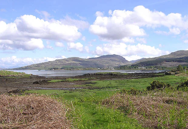
Aros Bay
Aros Bay — bay on Islay, Argyll and Bute, Scotland, UK.
 📷 3
Mountains & hills · Scottish Lowlands
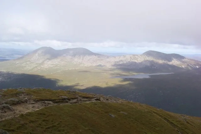
Beinn Bharrain
Beinn Bharrain — Named summit at 717 m.
 📷 5
Frequently asked questions
- Where is Bombie Hill?
- Bombie Hill is in the Scottish Lowlands, United Kingdom (postcode DG13 0NW).
- What is Bombie Hill?
- Bombie Hill — mountain in scotland lowlands. Elevation: 347 m.
- How do I get to Bombie Hill?
- The nearest town is Eskdalemuir. Drivers can use postcode DG13 0NW.
- How do I get to Bombie Hill?
- Drivers can navigate to postcode DG13 0NW. It sits within the Dumfriesshire, Clydesdale and Tweeddale parliamentary constituency.