
Battlefields & battle sites · Northern Ireland
Bohill Forest
In or near Loughinisland.
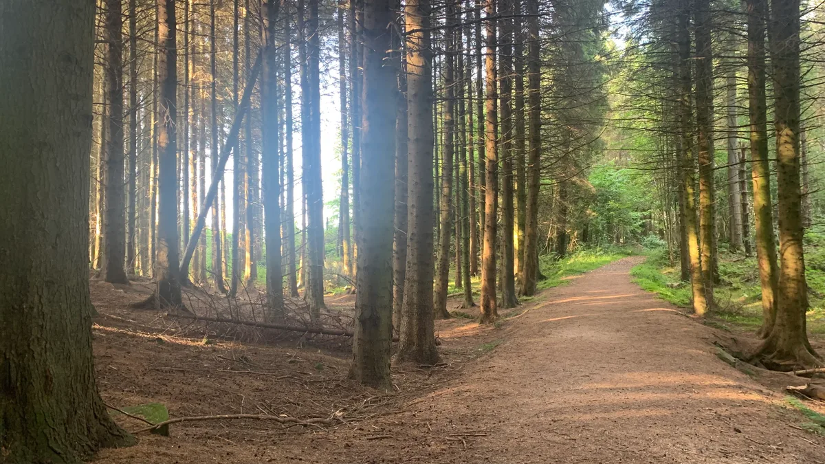
Bohill Forest in Northern Ireland, United Kingdom.

Alan Campbell — CC BY-SA 2.0 via Wikimedia Commons licence

Plan your visit
- Typical visit
- 1 h–2 h
- Nearest railway station
- Inch Abbey · 7.1 km
- Free entry
- Dog-friendly
Getting there & planning your visit
To visit Bohill Forest, the nearest railway station is Inch Abbey, located 7.1 km away. The postcode for navigation is BT30 8PR. Entry to the site is free.
About
Bohill Forest is a registered historic battlefield in Northern Ireland, United Kingdom. Britain's battlefields range from the medieval clashes of the Wars of the Roses to the Civil War sieges and the 1745 Jacobite Rising at Culloden — most are open landscapes with interpretive trails and battle-monument markers.
Photo gallery
From the Wikipedia article
Bohill Forest is a small coniferous forest located near Drumaness, County Down, Northern Ireland. It is managed by the Forest Service Northern Ireland and includes a designated nature reserve established to protect the habitat of the holly blue butterfly (Celastrina argiolus). The Bohill Forest Nature Reserve covers approximately 2.8 hectares within the larger forest area of 38.96 hectares. It is situated at grid reference J396459, about 4 miles southeast of Ballynahinch.
Excerpt from Wikipedia under CC BY-SA 4.0. See the source article linked in Sources below.
Background
History
Bohill Forest was historically clear-felled, and the land was subsequently allowed to regenerate naturally. This regeneration led to the development of a small area of deciduous woodland, now comprising holly, oak, birch, rowan, and hazel. The forest includes a tiny pocket of native scrub, largely of holly with oak standards, situated on a steeply sloping, south-east facing Silurian shale hill. Until the mid-1960s, this area was mixed scrub. Today, bracken and bilberry dominate the small clearings, which provide ideal conditions for the holly blue butterfly (Celastrina argiolus), typically seen in May. This is considered a key site for the species, which remains rare in Northern Ireland.…
Visiting
Bohill Forest has no formal recreational facilities. Visitors typically park on the roadside verge and access the site via a Forest Service track from the public road to the east. The best time to observe butterflies and other wildlife is typically between April and June.
Sourced from Wikipedia under CC BY-SA 4.0.
- Coordinates
- 54.3471, -5.8444
- District
- Newry, Mourne and Down
- Postcode
- BT30 8PR
- Parliamentary constituency
- South Down
- Nearest railway station
- Inch Abbey — 7.1 km
Sources
- wikidata: Q22000358 (CC0)
- wikipedia: Bohill Forest (CC BY-SA 4.0)
Other places nearby
Bohill Forest
Wildlife reserves · 0.0 km
_-_geograph.org.uk_-_798824.jpg?width=1200)
Tievenadarragh
Natural landmarks · 0.9 km

Rays Fort
Archaeological sites · 1.5 km

Loughinisland
Towns & cities · 1.7 km

Loughinisland Churches
Historic churches · 2.3 km

Loughinisland Churches
Archaeological sites · 2.4 km

Annadorn Dolmen
Burial mounds & barrows · 2.7 km

Kinelarty
Natural landmarks · 2.7 km

Drumaness
Towns & cities · 2.9 km

Gardenhill Fort
Hill forts · 2.9 km

Seaforde House
Castles · 3.1 km

Seaforde House
Castles · 3.1 km
Nearby
📷 3Wildlife reserves · Northern Ireland
Bohill Forest
Bohill Forest — nature reserve in Count Down, Northern Ireland.
📷 4Natural landmarks · Northern Ireland
Tievenadarragh
Tievenadarragh in Northern Ireland, United Kingdom.
📷 3Archaeological sites · Northern Ireland
Rays Fort
Rays Fort — a archaeological in northern-ireland, United Kingdom.
📷 5Towns & cities · Northern Ireland
Loughinisland
Loughinisland — village in County Down, Northern Ireland, UK.
📷 3Historic churches · Northern Ireland
Loughinisland Churches
Loughinisland Churches — set of 3 ruined church building in Downpatrick, County Down, Northern Ireland.
📷 5Archaeological sites · Northern Ireland
Loughinisland Churches
Loughinisland Churches — archaeological in northern ireland.
Where to eat & stay near Bohill Forest
Places to stay
 📷 5
📷 5Campsites · Northern Ireland
Slieve Croob Camping
Slieve Croob Camping — a campsite in northern ireland.
 📷 5
📷 5Campsites · Northern Ireland
Castlewellan Touring-in-the-Trees
Castlewellan Touring-in-the-Trees — a campsite in northern ireland.
 📷 4
📷 4Caravan parks · Northern Ireland
Quoile Yacht Club Caravan Park
Quoile Yacht Club Caravan Park — a caravan park in northern ireland.
 📷 5
📷 5Campsites · Northern Ireland
Castlewellan Forest Park - Camping
Castlewellan Forest Park - Camping — a campsite in northern ireland.
 📷 5
📷 5Caravan parks · Northern Ireland
Castlewellan Forest Park - Caravan Site
Castlewellan Forest Park - Caravan Site — a caravan park in northern ireland.
 📷 5
📷 5Campsites · Northern Ireland
Delamont Country Park
Delamont Country Park — a campsite in northern ireland.
Places to eat & drink
 📷 3
📷 3Historic pubs · Northern Ireland
Soma Festival
The Soma Festival (Sanskrit: सोम, or sóma, meaning drink of the Gods, see Soma (drink); Irish: Féile Soma) is an annual music, arts, and cultural festival. The festival includes concerts, musical perf
More places in this region

Battlefields & battle sites · Northern Ireland
Randalstown Forest Nature Reserve
Randalstown Forest Nature Reserve in Northern Ireland, United Kingdom.
 📷 4
📷 4Battlefields & battle sites · Northern Ireland
Battle of Newry Road
Battle of Newry Road in Northern Ireland, United Kingdom.
 📷 3
📷 3Battlefields & battle sites · Northern Ireland
Battle of the Bogside
Battle of the Bogside in Northern Ireland, United Kingdom.
 📷 3
📷 3Battlefields & battle sites · Northern Ireland
Battle of St Matthew's
Battle of St Matthew's in Northern Ireland, United Kingdom.
Frequently asked questions
- Where is Bohill Forest?
- Bohill Forest is in Northern Ireland, United Kingdom (postcode BT30 8PR).
- What is Bohill Forest?
- Bohill Forest in Northern Ireland, United Kingdom.
- How do I get to Bohill Forest?
- The nearest railway station is Inch Abbey, about 7.1 km away. Drivers can use postcode BT30 8PR.
- Who owns Bohill Forest?
- Bohill Forest is owned by Forest Service Northern Ireland.
- Is Bohill Forest free to visit?
- Yes, Bohill Forest is free to enter.
- How do I get to Bohill Forest?
- The nearest railway station is Inch Abbey, about 7.1 km away. Drivers can navigate to postcode BT30 8PR.