
Farms (open to visitors) · North East England
Blyth Offshore Wind Farm
In or near Blyth.
Blyth Offshore Wind Farm in England North East, United Kingdom.

Wikimedia Commons licence
Plan your visit
- Typical visit
- 2 h–4 h
- Nearest railway station
- Newsham · 4.3 km
- Family-friendly
- Limited wheelchair access
About
Blyth Offshore Wind Farm is a place of interest in England North East, United Kingdom — drawn from open-data sources for visitor reference. See the linked Wikipedia article for the full description.
Photo gallery
Protected designations
- Site of Special Scientific Interest: Northumberland Shore SSSI
- Ramsar wetland: Northumbria Coast
Designations sourced from Natural England open data under OGL v3.
From the Wikipedia article
Blyth Offshore Wind Farm was a small coastal wind farm located 0.5 miles (0.80 km) off the coast of Blyth, Northumberland, England, and was the first offshore wind farm in the UK.
Excerpt from Wikipedia under CC BY-SA 4.0. See the source article linked in Sources below.
Background
History
Commissioned in December 2000 as a pilot project, the project was developed by a consortium that included E.ON, Shell Renewables, NUON and Border Wind. E.ON were in charge of operating the farm. The project was the UK's first offshore wind farm, following the Vindeby in 1991 and Tunø in 1995, as well as being the largest offshore turbines erected in the world at the time. It helped pave the way for more than 2700 bigger offshore turbines installed in British waters since then. In 2012 there were plans to add a 100 MW test facility of 15 turbines at Blyth and nearby Newbiggin-by-the-Sea, supported by a government grant. The site would be administered by The National Renewable Energy Centre…
Sourced from Wikipedia under CC BY-SA 4.0.
- Coordinates
- 55.1358, -1.4903
- District
- Northumberland
- Parish
- Blyth
- Postcode
- NE24 2AS
- Parliamentary constituency
- Blyth and Ashington
- Established
- 2000
- Nearest railway station
- Newsham — 4.3 km
Sources
- wikidata: Q4930860 (CC0)
- wikipedia: Blyth Offshore Wind Farm (CC BY-SA 4.0)
Other places nearby

HMS H41
Other places · 1.1 km
Spirit of the Staithes
Public art & sculpture · 1.1 km

The Commissioners Quay Inn
Hotels · 1.2 km

West's Palace
Theatres · 1.2 km

Blyth Lifeboat Station
Harbours & ports · 1.2 km

North Blyth
Harbours & ports · 1.3 km

River Blyth
Country parks · 1.3 km
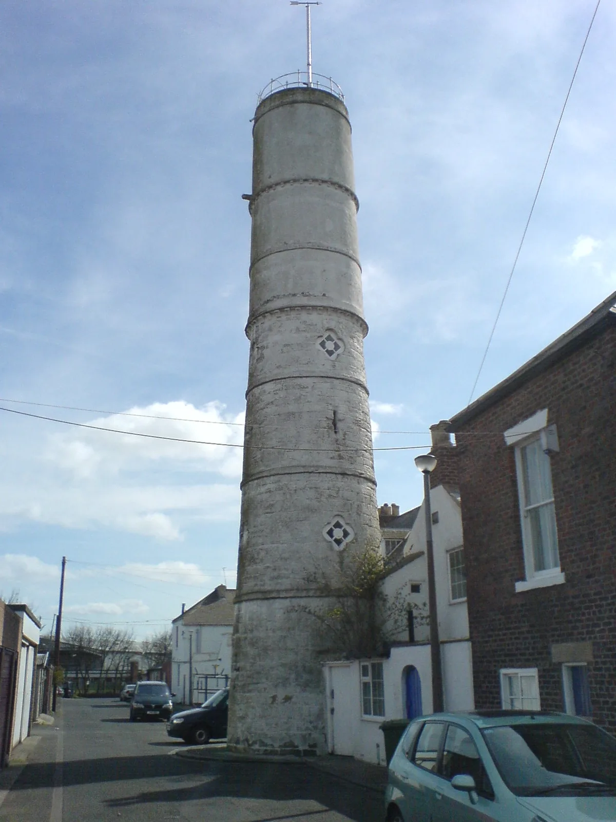
Blyth High Light
Lighthouses · 1.3 km

Ridley Stranded Boat
Public art & sculpture · 1.4 km

Blyth Harbour Wind Farm
Piers · 1.4 km

Frameworks
Galleries · 1.4 km
Hippodrome Cinema
Theatres · 1.4 km
Nearby
📷 3Other places · North East England
HMS H41
HMS H41 in England North East, United Kingdom.
📷 3Public art & sculpture · North East England
Spirit of the Staithes
Spirit of the Staithes — a public art in scotland-lowlands, United Kingdom.
📷 7Hotels · North East England
The Commissioners Quay Inn
The Commissioners Quay Inn — a hotel in scotland lowlands.
📷 3Theatres · North East England
West's Palace
West's Palace in England North East, United Kingdom.
📷 4Harbours & ports · North East England
Blyth Lifeboat Station
Blyth Lifeboat Station in England North East, United Kingdom.
📷 4Harbours & ports · North East England
North Blyth
North Blyth in England North East, United Kingdom.
Where to eat & stay near Blyth Offshore Wind Farm
Places to stay
📷 7Hotels · North East England
The Commissioners Quay Inn
The Commissioners Quay Inn — a hotel in scotland lowlands.
 📷 5
📷 5 📷 5
📷 5Caravan parks · North East England
Old Hartley Caravan Club
Old Hartley Caravan Club — a caravan park in scotland lowlands.
 📷 5
📷 5B&Bs · North East England
York House Hotel
York House Hotel — a bed-and-breakfast in scotland lowlands.
 📷 5
📷 5Caravan parks · North East England
Ellington Caravan Park
Ellington Caravan Park — a caravan park in scotland lowlands.
 📷 5
📷 5Hotels · North East England
The Grand Hotel
The Grand Hotel — a hotel in scotland lowlands.
Places to eat & drink
 📷 3
📷 3Historic pubs · North East England
The Kings Arms
The Kings Arms — Historic pub — listed building or notable heritage status.
 📷 5
📷 5 📷 5
📷 5Historic pubs · North East England
Border Minstrel
Border Minstrel in Scotland Lowlands, United Kingdom.
 📷 5
📷 5Historic pubs · North East England
The Kirkpatrick
The Kirkpatrick in England North East, United Kingdom.
 📷 5
📷 5Historic pubs · North East England
The Scotia Public House
The Scotia Public House in England North East, United Kingdom.
 📷 5
📷 5Cafés · North East England
Caffè Nero
Caffè Nero — a café in scotland lowlands. Cuisine: coffee shop. Brand: Caffè Nero.
More places in this region
 📷 3
📷 3Farms (open to visitors) · North East England
Milecastle 38
Milecastle 38 in England North East, United Kingdom.
 📷 5
📷 5Farms (open to visitors) · North East England
Mowhaugh
Mowhaugh in England North East, United Kingdom.
 📷 4
📷 4Farms (open to visitors) · North East England
Milecastle 34
Milecastle 34 in England North East, United Kingdom.
 📷 3
📷 3Farms (open to visitors) · North East England
Phoenix Row
Phoenix Row in England North East, United Kingdom.
Frequently asked questions
- Where is Blyth Offshore Wind Farm?
- Blyth Offshore Wind Farm is in North-East England, United Kingdom (postcode NE24 2AS), in the parish of Blyth.
- What is Blyth Offshore Wind Farm?
- Blyth Offshore Wind Farm in England North East, United Kingdom.
- How do I get to Blyth Offshore Wind Farm?
- The nearest railway station is Newsham, about 4.3 km away. Drivers can use postcode NE24 2AS.
- When was Blyth Offshore Wind Farm built?
- Built or established in 2000.
- Who owns Blyth Offshore Wind Farm?
- Blyth Offshore Wind Farm is owned by E.ON<br/>Shell Renewables<br/>NUON<br/>Border Wind.
- Is Blyth Offshore Wind Farm a protected site?
- Yes — Blyth Offshore Wind Farm is part of the Northumberland Shore SSSI Site of Special Scientific Interest and the Northumbria Coast Ramsar wetland.
- How do I get to Blyth Offshore Wind Farm?
- The nearest railway station is Newsham, about 4.3 km away. Drivers can navigate to postcode NE24 2AS.