
Memorials & monuments · East Midlands
Blofield Monument, Approximately 6 Metres North Of North Aisle Of Church Of St Mary
In or near Isham.
Blofield Monument, Approximately 6 Metres North Of North Aisle Of Church Of St Mary — Grade II listed building-listed memorial in england-west-midlands, United Kingdom.

David Dixon — CC BY-SA 2.0 via Wikimedia Commons licence

Plan your visit
- Typical visit
- 15 min–45 min
- Nearest railway station
- Wicksteed Park · 3.0 km
- Free entry
- Dog-friendly
Getting there & planning your visit
To visit the Blofield Monument, you can reach the nearest railway station, Wicksteed Park, which is approximately 3 km away. The postcode for the location is NN15 5LU, and entry to the monument is free.
About
Blofield Monument, Approximately 6 Metres North Of North Aisle Of Church Of St Mary is a Grade II listed building-listed memorial in england-west-midlands, United Kingdom, registered on the National Heritage List for England (NHLE entry 1052089). Listed status protects buildings and structures of special architectural or historic interest. See the linked Wikipedia article for further details.
Photo gallery
Heritage listing
Details BURTON LATIMER SP9075 CHURCH STREET 1337-0/21/16 (South side) Blofield monument,approx.6m.N of N aisle of Church of St.Mary GV II Headstone. Mid C18. Limestone. 2 round-headed and shouldered inscription panels, surmounted by 3 winged cherubs' head and a segmental pediment in relief. Inscriptions worn so as to be indecipherable. Listing NGR: SP9031675032 Legacy The contents of this record have been generated from a legacy data system. Legacy System number: 230970 Legacy System: LBS
From the Historic England List Entry under OGL v3.
Protected designations
- Site of Special Scientific Interest: Upper Nene Valley Gravel Pits SSSI
Designations sourced from Natural England open data under OGL v3.
Place summary
Blofield Monument is a Grade II listed memorial located approximately 6 metres north of the north aisle of the Church of St Mary in Burton Latimer, West Midlands. Its designation reflects its historical significance within the parish.
AI-generated from the structured facts on this page (operator, designation, listing, era). Not a substitute for visiting.
- Coordinates
- 52.3659, -0.6750
- District
- North Northamptonshire
- Parish
- Burton Latimer
- Postcode
- NN15 5LU
- Parliamentary constituency
- Kettering
- Nearest railway station
- Wicksteed Park — 3 km
Sources
- wikidata: Q26303897 (CC0)
Other places nearby

Church of St Mary the Virgin
Historic churches · 0.0 km

Burton Latimer
Museums · 0.2 km
Ohio Cinema
Theatres · 0.3 km
Burton Latimer War Memorial
Memorials & monuments · 0.4 km
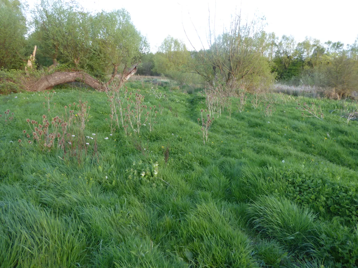
Southfield Farm Marsh
Wildlife reserves · 2.0 km

Isham
Villages · 2.1 km

Isham
Towns & cities · 2.4 km

Church of Saint Botolph
Historic churches · 2.5 km

Barton Seagrave Castle
Literary houses · 2.6 km

Barton Seagrave Castle
Castles · 2.7 km
Orangery At Barton Seagrave Hall
Historic houses · 2.8 km

Cranford
Villages · 2.8 km
Nearby
📷 3Historic churches · East Midlands
Church of St Mary the Virgin
Church of St Mary the Virgin — church in Burton Latimer, Northamptonshire, England, UK.
📷 5Museums · East Midlands
Burton Latimer
Burton Latimer is a town in North Northamptonshire, England, approximately 3.1 miles (5.0 km) southeast of Kettering and 4.5 miles north of Wellingborough. At the 2021 census, its population was 10,44
📷 5Theatres · East Midlands
Ohio Cinema
Ohio Cinema — a cinema heritage in england-west-midlands, United Kingdom.
📷 3Memorials & monuments · East Midlands
Burton Latimer War Memorial
Burton Latimer War Memorial — Grade II listed building-listed memorial in england-west-midlands, United Kingdom.
📷 5Wildlife reserves · East Midlands
Southfield Farm Marsh
Southfield Farm Marsh — nature reserve in the United Kingdom.
📷 5Where to eat & stay near Blofield Monument, Approximately 6 Metres North Of North Aisle Of Church Of St Mary
Places to stay
 📷 5
📷 5Campsites · East Midlands
Wicksteed Park Camping
Wicksteed Park Camping — a campsite in england west midlands.
 📷 5
📷 5 📷 5
📷 5 📷 7
📷 7Hotels · East Midlands
The Hind Hotel
The Hind Hotel — a hotel in england west midlands.
 📷 5
📷 5 📷 5
📷 5Places to eat & drink
 📷 5
📷 5Historic pubs · East Midlands
67 and 69 High Street
67 and 69 High Street in England East, United Kingdom.
 📷 5
📷 5Historic pubs · East Midlands
The Bell Inn Public House
The Bell Inn Public House in England East, United Kingdom.
📷 5Historic pubs · East Midlands
Mulso Arms Public House And Barns Attached To North West And South West
Mulso Arms Public House And Barns Attached To North West And South West in England East, United Kingdom.
 📷 5
📷 5Historic pubs · East Midlands
Hare And Hounds Public House
Hare And Hounds Public House in England East, United Kingdom.
 📷 5
📷 5Historic pubs · East Midlands
Fox And Hounds Public House
Fox And Hounds Public House in England East, United Kingdom.
 📷 5
📷 5More memorials in this region
 📷 5
📷 5Memorials & monuments · East Midlands
Bainton Buttercross
Bainton Buttercross is a memorial in the United Kingdom.
 📷 5
📷 5Memorials & monuments · East Midlands
clock tower and war memorial
clock tower and war memorial is a memorial in the United Kingdom.
 📷 5
📷 5Memorials & monuments · East Midlands
John Clare Memorial
John Clare Memorial is a memorial in the United Kingdom.
 📷 5
📷 5Memorials & monuments · East Midlands
The Butter Cross
The Butter Cross is a memorial in the United Kingdom.
Frequently asked questions
- Where is Blofield Monument, Approximately 6 Metres North Of North Aisle Of Church Of St Mary?
- Blofield Monument, Approximately 6 Metres North Of North Aisle Of Church Of St Mary is in the East Midlands, United Kingdom (postcode NN15 5LU), in the parish of Burton Latimer.
- What is Blofield Monument, Approximately 6 Metres North Of North Aisle Of Church Of St Mary?
- Blofield Monument, Approximately 6 Metres North Of North Aisle Of Church Of St Mary — Grade II listed building-listed memorial in england-west-midlands, United Kingdom.
- How do I get to Blofield Monument, Approximately 6 Metres North Of North Aisle Of Church Of St Mary?
- The nearest railway station is Wicksteed Park, about 3.0 km away. The nearest town is Isham. Drivers can use postcode NN15 5LU.
- Is Blofield Monument, Approximately 6 Metres North Of North Aisle Of Church Of St Mary a listed building?
- Blofield Monument, Approximately 6 Metres North Of North Aisle Of Church Of St Mary is officially recognised as Grade II listed building listed.
- Is Blofield Monument, Approximately 6 Metres North Of North Aisle Of Church Of St Mary a protected site?
- Yes — Blofield Monument, Approximately 6 Metres North Of North Aisle Of Church Of St Mary is part of the Upper Nene Valley Gravel Pits SSSI Site of Special Scientific Interest.
- Is Blofield Monument, Approximately 6 Metres North Of North Aisle Of Church Of St Mary free to visit?
- Yes, Blofield Monument, Approximately 6 Metres North Of North Aisle Of Church Of St Mary is free to enter.
- How do I get to Blofield Monument, Approximately 6 Metres North Of North Aisle Of Church Of St Mary?
- The nearest railway station is Wicksteed Park, about 3.0 km away. Drivers can navigate to postcode NN15 5LU.