
Historic houses · East of England
Blackshore Mill
In or near Wangford.
Blackshore Mill — a Grade II-listed historic house in england-east, United Kingdom.

Michael New — CC BY-SA 2.0 via Wikimedia Commons licence

Plan your visit
- Typical visit
- 1 h–2 h
- Nearest railway station
- Blythburgh · 3.9 km
- Family-friendly
- Limited wheelchair access
Getting there & planning your visit
To visit Blackshore Mill, the nearest railway station is Blythburgh, located 3.9 km away. The postcode for sat-nav is IP18 6TA. Please note that wheelchair accessibility is limited.
About
Blackshore Mill is a Grade II-listed building in england-east, United Kingdom. Grade II status is conferred by Historic England (or Cadw, Historic Environment Scotland or NIEA equivalents) on buildings of exceptional national interest. See the linked Wikipedia article for full historical and architectural details.
Photo gallery
Protected designations
- Site of Special Scientific Interest: Minsmere-Walberswick Heaths and Marshes SSSI
- National Nature Reserve: SUFFOLK COAST
- Area of Outstanding Natural Beauty: Suffolk Coast & Heaths
- Ramsar wetland: Minsmere-Walberswick
Designations sourced from Natural England open data under OGL v3.
From the Wikipedia article
Blackshore Mill or Blackshore Windpump is a Grade II listed water-pumping tower mill at Reydon, Suffolk, England which has been conserved.
Excerpt from Wikipedia under CC BY-SA 4.0. See the source article linked in Sources below.
Background
History
Blackshore Mill, constructed around 1890 by Robert Martin, the Beccles millwright, was built after he secured the contract for its construction by outbidding Simon Nunn of Wenhaston. The mill operated for approximately four years before it was damaged when the windshaft broke at the poll end, causing the sails to be blown off. It remained in disrepair for many years until restoration efforts began in 2002 to preserve the historic structure.
Description
Blackshore Mill is a three-storey tower mill. It had a boat-shaped cap winded by a fantail. The four Patent sails were carried on a cast-iron windshaft. The tower is about 26 ft high and all machinery is of cast iron.
Sourced from Wikipedia under CC BY-SA 4.0.
- Coordinates
- 52.3249, 1.6540
- County
- Suffolk
- District
- East Suffolk
- Parish
- Southwold
- Postcode
- IP18 6TA
- Parliamentary constituency
- Suffolk Coastal
- Nearest railway station
- Blythburgh — 3.9 km
Sources
- wikidata: Q4923356 (CC0)
- wikipedia: Blackshore Mill, Reydon (CC BY-SA 4.0)
Other places nearby

Southwold Railway Trust
Museums · 1.0 km
Southwold Railway Steamworks
Natural landmarks · 1.1 km
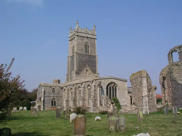
St Andrew's Church, Walberswick
Historic churches · 1.2 km

Fiddle Pole (Monkey Pole)
Memorials & monuments · 1.3 km

Walberswick
Villages · 1.3 km

The Parish Lantern Art Gallery
Galleries · 1.4 km
Walberswick Village Sign
Public art & sculpture · 1.4 km

Electric Picture Palace
Cinemas · 1.5 km

Southwold Electric Picture Palace
Theatres · 1.5 km

Southwold Camping and Caravan Site
Campsites · 1.6 km

Southwold Town Sign
Memorials & monuments · 1.6 km

Sutherland House
Hotels · 1.6 km
Nearby
📷 3Museums · East of England
Southwold Railway Trust
Southwold Railway Trust — a museum in england-east, United Kingdom.
📷 3Natural landmarks · East of England
Southwold Railway Steamworks
Southwold Railway Steamworks — a other in england-east, United Kingdom.
📷 5Historic churches · East of England
St Andrew's Church, Walberswick
St Andrew's Church, Walberswick — church in Walberswick, Suffolk, England, UK.
📷 3Memorials & monuments · East of England
Fiddle Pole (Monkey Pole)
Fiddle Pole (Monkey Pole) — a memorial in england-east, United Kingdom.
📷 5📷 3Galleries · East of England
The Parish Lantern Art Gallery
The Parish Lantern Art Gallery — a gallery in england-east, United Kingdom.
Where to eat & stay near Blackshore Mill
Places to stay
📷 5Campsites · East of England
Southwold Camping and Caravan Site
Southwold Camping and Caravan Site — a campsite in england east.
📷 5 📷 5
📷 5Caravan parks · East of England
Walberswick Caravan Site
Walberswick Caravan Site — a caravan park in england east.
 📷 5
📷 5 📷 5
📷 5 📷 5
📷 5Caravan parks · East of England
Jubilee Certified Site
Jubilee Certified Site — a caravan park in england east.
Places to eat & drink
 📷 5
📷 5 📷 5
📷 5Historic pubs · East of England
Cherry Tree Public House
Cherry Tree Public House in England East, United Kingdom.
 📷 6
📷 6Historic pubs · East of England
The Swan, Peasenhall
The Swan, Peasenhall in England East, United Kingdom.
 📷 5
📷 5Historic pubs · East of England
Huntingfield Arms
Huntingfield Arms in England East, United Kingdom.
 📷 7
📷 7Historic pubs · East of England
The Parrot And Punchbowl Public House
The Parrot And Punchbowl Public House in England East, United Kingdom.
 📷 5
📷 5Historic pubs · East of England
Crown And Anchor Public House
Crown And Anchor Public House in England East, United Kingdom.
More historic houses in this region
 📷 5
📷 5Historic houses · East of England
41 and 41a, Broad Street
41 and 41a, Broad Street — Grade II* listed house in Ely, East Cambridgeshire, England, UK.
 📷 5
📷 5Historic houses · East of England
Abbey Gate House
Abbey Gate House — house in St Albans, Hertfordshire, England, UK.
 📷 5
📷 5Historic houses · East of England
Abbey House
Abbey House — house in Cambridge, Cambridgeshire, England, UK.
.jpg?width=1200) 📷 5
📷 5Historic houses · East of England
Amores Including Outbuildings
Amores Including Outbuildings — architectural structure in Hertford, East Hertfordshire, England, UK.
Frequently asked questions
- Where is Blackshore Mill?
- Blackshore Mill is in Suffolk, East of England, United Kingdom (postcode IP18 6TA), in the parish of Southwold.
- What is Blackshore Mill?
- Blackshore Mill — a Grade II-listed historic house in england-east, United Kingdom.
- How do I get to Blackshore Mill?
- The nearest railway station is Blythburgh, about 3.9 km away. The nearest town is Wangford. Drivers can use postcode IP18 6TA.
- Who owns Blackshore Mill?
- Blackshore Mill is owned by Private.
- Is Blackshore Mill a listed building?
- Blackshore Mill is officially recognised as Grade II listed.
- Is Blackshore Mill a protected site?
- Yes — Blackshore Mill is part of the Minsmere-Walberswick Heaths and Marshes SSSI Site of Special Scientific Interest and the SUFFOLK COAST National Nature Reserve.
- How do I get to Blackshore Mill?
- The nearest railway station is Blythburgh, about 3.9 km away. Drivers can navigate to postcode IP18 6TA.