Mountains & hills · Mid Wales
Black Mountain South Top
In or near Longtown.
Black Mountain South Top — Named summit at 637 m.

Wikimedia Commons contributors — see linked file page for photographer and licence licence
Plan your visit
- Typical visit
- 3 h–8 h
- Best time of year
- Late spring – early autumn (May–Oct)
- Free entry
- Dog-friendly
About
Black Mountain South Top is a named summit in the United Kingdom. Wikidata describes it as: "Named summit at 637 m.". Coordinates: 51.9840°, -3.0685°.
Photo gallery
Protected designations
- Site of Special Scientific Interest: Black Mountains SSSI
- Site of Special Scientific Interest: River Wye SSSI
Designations sourced from Natural England open data under OGL v3.
From the Wikipedia article
Black Mountain South Top is a top of Black Mountain in the Black Mountains range that spreads across parts of Powys and Monmouthshire in southeast Wales. It is a top which falls exactly on the Welsh-English border, straddling Powys and Herefordshire. The Offa's Dyke Path passes over the summit. The top is an undistinguished heathery bump on Hatterall Ridge. The summit is marked by a small pile of stones.
Excerpt from Wikipedia under CC BY-SA 4.0. See the source article linked in Sources below.
- Coordinates
- 51.9840, -3.0685
- District
- Herefordshire, County of
- Parish
- Llanveynoe
- Postcode
- HR2 0NJ
- Parliamentary constituency
- Hereford and South Herefordshire
Sources
- osm: n9764940168 (ODbL)
- wikipedia: Black Mountain South Top (CC BY-SA 4.0)
- commons: Blackmount.JPG (CC BY-SA 4.0)
Other places nearby

Hatterrall Ridge
Abbeys & priories · 0.0 km

Capel-y-Ffin Welsh Baptist Church
Historic churches · 1.4 km

Capel-y-ffin
National parks · 1.5 km

Pen-y-Garn Fawr
Mountains & hills · 1.6 km

The Monastery Church, Capel-y-Ffin
Abbeys & priories · 1.7 km

Father Ignatius
Memorials & monuments · 1.7 km

'Our Lady of Llanthony'
Public art & sculpture · 1.8 km
Capel-y-ffin Monastery
Abbeys & priories · 1.8 km

Glynfach Castle Placename
Literary houses · 1.8 km

Grange Pony Trekking
Campsites · 1.9 km
Grange Trekking Centre
Natural landmarks · 1.9 km

Molly's Waterfall
Waterfalls · 2.0 km
Nearby
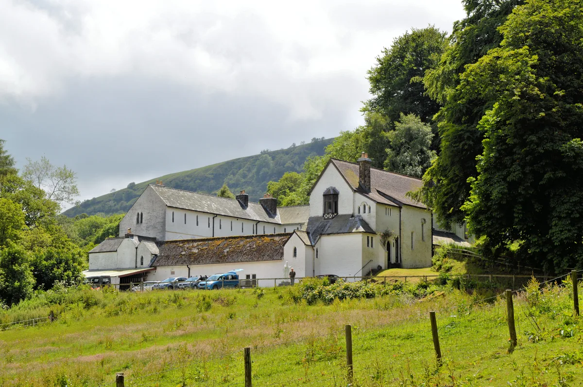
📷 4📷 5Historic churches · Mid Wales
Capel-y-Ffin Welsh Baptist Church
Capel-y-Ffin Welsh Baptist Church — Grade II listed building-listed church in wales-south, United Kingdom.
📷 4📷 3Mountains & hills · Mid Wales
Pen-y-Garn Fawr
Pen-y-Garn Fawr — a mountain in wales-south, United Kingdom, 616 m.
📷 3Abbeys & priories · Mid Wales
The Monastery Church, Capel-y-Ffin
The Monastery Church, Capel-y-Ffin — a abbey in wales-south, United Kingdom.
📷 3Memorials & monuments · Mid Wales
Father Ignatius
Father Ignatius — a memorial in wales-south, United Kingdom.
Where to eat & stay near Black Mountain South Top
Places to stay
📷 5Campsites · Mid Wales
Grange Pony Trekking
Grange Pony Trekking — a campsite in wales south.
 📷 5
📷 5 📷 5
📷 5 📷 5📷 5
 📷 4
📷 4Campsites · Mid Wales
Newcourt Farm Campsite
Newcourt Farm Campsite — a campsite in wales mid.
Places to eat & drink
 📷 5
📷 5Historic pubs · South Wales
Cornewall Arms
Cornewall Arms in Wales South, United Kingdom.
 📷 4
📷 4 📷 5
📷 5Historic pubs · South Wales
Skirrid Mountain Inn
Skirrid Mountain Inn — Historic pub — listed building or notable heritage status.
 📷 7
📷 7 📷 5
📷 5
Restaurants · South Wales
The Walnut Tree
The Walnut Tree — a restaurant in wales south.
More mountains in this region
 📷 3
📷 3 📷 3
📷 3 📷 3
📷 3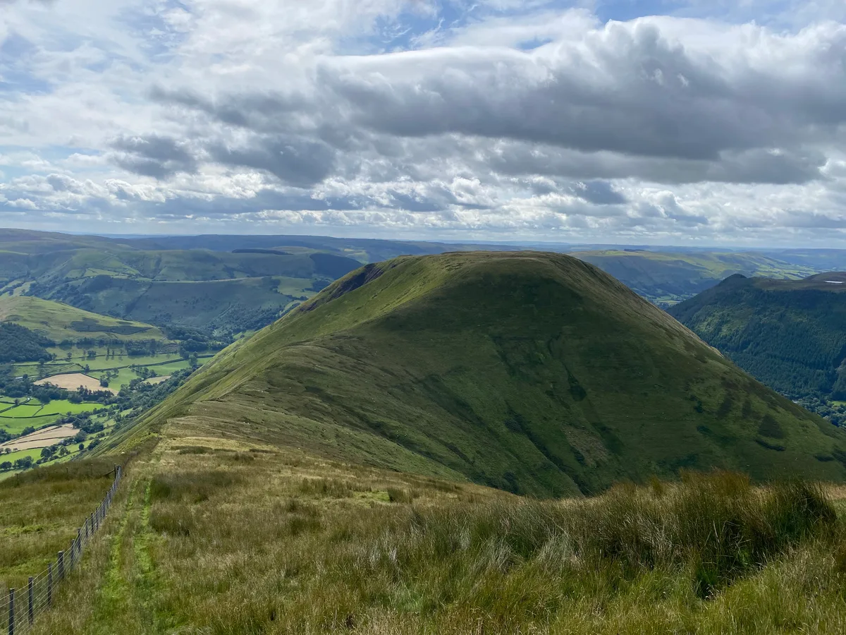 📷 3
📷 3Frequently asked questions
- Where is Black Mountain South Top?
- Black Mountain South Top is in South Wales, United Kingdom (postcode HR2 0NJ), in the parish of Llanveynoe.
- What is Black Mountain South Top?
- Black Mountain South Top — Named summit at 637 m.
- How do I get to Black Mountain South Top?
- Drivers can use postcode HR2 0NJ.
- Is Black Mountain South Top a protected site?
- Yes — Black Mountain South Top is part of the Black Mountains SSSI Site of Special Scientific Interest and the River Wye SSSI Site of Special Scientific Interest.
- Is Black Mountain South Top free to visit?
- Yes, Black Mountain South Top is free to enter.
- How do I get to Black Mountain South Top?
- Drivers can navigate to postcode HR2 0NJ. It sits within the Hereford and South Herefordshire parliamentary constituency.