Reservoirs & lochs · West Midlands
Bittell Reservoirs
In or near Barnt Green.
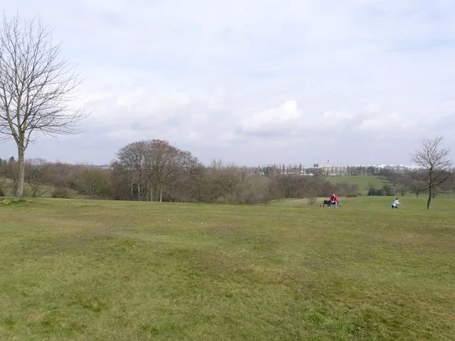
The Bittell Reservoirs (grid reference SP017748) are located in Worcestershire between Barnt Green to the south and the Birmingham district of Longbridge to the north. They consist of the Upper (Upper

Dave Thompson — CC BY-SA 2.0 via Wikimedia Commons licence
Plan your visit
- Typical visit
- 1 h–2.5 h
- Nearest railway station
- Barnt Green · 1.7 km
- Free entry
- Dog-friendly
Getting there & planning your visit
To visit Bittell Reservoirs, the nearest railway station is Barnt Green, located 1.7 km away. The postcode for sat-nav is B45 8BL, and entry to the reservoirs is free.
About
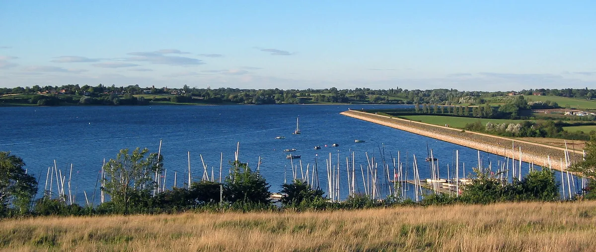
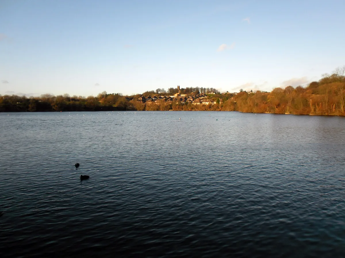
The Bittell Reservoirs (grid reference SP017748) are located in Worcestershire between Barnt Green to the south and the Birmingham district of Longbridge to the north. They consist of the Upper (Upper Bittell) and Lower (Lower Bittell) reservoir. They were built to feed the Worcester and Birmingham Canal, which was finished in the 1790s, however, the reservoir was not completed until 1837. The 'Upper' reservoir is to ensure that the level of the canal is kept sufficiently high, even in times of drought. The 'Lower' reservoir(s) are compensatory reservoirs to ensure that the local area does not become parched in dry times. The "Upper" reservoir can be seen as a form of insurance. A dried up, i.e. unusable, canal would have been disastrous for the owners of the canal as well as the artisans and tradesmen who relied upon it for a living. The irony of the reservoir is the length of time it took to build: only 6 years after it was finished the Birmingham & Gloucester railway was built alongside, mitigating the economic reasoning behind the large investment. The reservoirs are quite obscure nowadays, however they are used actively. Today one can fish in several places, especially on the lower reservoirs. The upper reservoir is used for sailing and windsurfing, and is the home of the Barnt Green Sailing Club. The reservoir is also used by 1st Kings Norton Sea Scout Troop who occupy a large boathouse on the south east shore. The Upper reservoir is also used for open water swimming…
Photo gallery
Protected designations
- Site of Special Scientific Interest: Bittell Reservoirs SSSI
Designations sourced from Natural England open data under OGL v3.
From the Wikipedia article
The Bittell Reservoirs (grid reference SP017748) are located in Worcestershire between Barnt Green to the south and the Birmingham district of Longbridge to the north. They consist of the Upper (Upper Bittell) and Lower (Lower Bittell) reservoir. They were built to feed the Worcester and Birmingham Canal, which was finished in the 1790s, however, the reservoir was not completed until 1837. The 'Upper' reservoir is to ensure that the level of the canal is kept sufficiently high, even in times of drought. The 'Lower' reservoir(s) are compensatory reservoirs to ensure that the local area does not become parched in dry times. The "Upper" reservoir can be seen as a form of insurance. A dried up, i.e. unusable, canal would have been disastrous for the owners of the canal as well as the artisans and tradesmen who relied upon it for a living. The irony of the reservoir is the length of time it took to build: only 6 years after it was finished the Birmingham & Gloucester railway was built alongside, mitigating the economic reasoning behind the large investment. The reservoirs are quite obscure nowadays, however they are used actively. Today one can fish in several places, especially on the lower reservoirs. The upper reservoir is used for sailing and windsurfing, and is the home of the Barnt Green Sailing Club. The reservoir is also used by 1st Kings Norton Sea Scout Troop who occupy a large boathouse on the south east shore. The Upper reservoir is also used for open water swimming in the summer months by the local triathlon club. One bank of the reservoir is inaccessible because it is a Site of Special Scientific Interest (SSSI). During the early 20th century, the bird life of the reservoirs was regularly recorded by the West Midland Bird Club, long before such site-monitoring became commonplace. They were also visited regularly by a young Bill Oddie. The Telegraph (Wednesday 15 November 2017 page 32) reported that during draining of Upper Bittell they found 500 critically…
Excerpt from Wikipedia under CC BY-SA 4.0. See the source article linked in Sources below.
- Coordinates
- 52.3710, -1.9740
- County
- Worcestershire
- District
- Bromsgrove
- Parish
- Alvechurch
- Postcode
- B45 8BL
- Parliamentary constituency
- Bromsgrove
- Nearest railway station
- Barnt Green — 1.7 km
Sources
- wikipedia: Bittell Reservoirs (CC BY-SA 4.0)
Other places nearby
.jpg?width=1200)
Cofton Hall
Historic houses · 0.9 km

Hopwood
Villages · 1.1 km
%2C_22_Kendal_End_Road%2C_Barnt_Green_-_geograph.org.uk_-_2792350.jpg?width=1200)
The Barnt Green Inn
Historic pubs · 1.4 km
Barnt Green Inn
Historic houses · 1.4 km

Cofton Hackett
Villages · 1.6 km

Cofton Reservoir
Reservoirs & lochs · 1.6 km

Callow Hill Road
Historic bridges · 1.7 km

Bridge Over Birmingham And Worcester Canal (Number 69) Worcester And Birmingham Canal, Bridge At Lea End Lane
Historic bridges · 1.8 km

Bilberry Hill
Mountains & hills · 2.0 km

Grovely Dingle
Forests & woodlands · 2.0 km

Barnt Green
Towns & cities · 2.1 km
Cofton Park
Parks · 2.1 km
Nearby
📷 3Historic houses · West Midlands
Cofton Hall
Cofton Hall — country house in Worcestershire, England, UK.
📷 5📷 3Historic pubs · West Midlands
The Barnt Green Inn
The Barnt Green Inn — Historic pub — listed building or notable heritage status.
📷 3Historic houses · West Midlands
Barnt Green Inn
Barnt Green Inn — pub in Barnt Green, United Kingdom.
📷 5📷 3Reservoirs & lochs · West Midlands
Cofton Reservoir
Cofton Reservoir — lake in the United Kingdom.
Where to eat & stay near Bittell Reservoirs
Places to stay
 📷 5
📷 5Hostels · West Midlands
Stable Block at Blackwell Court
Stable Block at Blackwell Court — a hostel in england west midlands.
📷 5Campsites · West Midlands
Roberts Podded Village
Roberts Podded Village — a campsite in england west midlands.
📷 5Hostels · West Midlands
Blackwell Court Manor House
Blackwell Court Manor House — a hostel in england west midlands.
📷 5Campsites · West Midlands
Blackwell Adventure Outdoor Activity Centre
Blackwell Adventure Outdoor Activity Centre — a campsite in england west midlands.
 📷 5
📷 5Caravan parks · West Midlands
Caravan Club Chapel Lane
Caravan Club Chapel Lane — a caravan park in england west midlands.
 📷 5
📷 5Places to eat & drink
📷 3Historic pubs · West Midlands
The Barnt Green Inn
The Barnt Green Inn — Historic pub — listed building or notable heritage status.
 📷 5
📷 5Historic pubs · West Midlands
The Black Horse
The Black Horse — Historic pub — listed building or notable heritage status.
 📷 3
📷 3Historic pubs · West Midlands
The Great Stone
The Great Stone — Historic pub — listed building or notable heritage status.
 📷 3
📷 3Historic pubs · West Midlands
The Crabmill
The Crabmill — Historic pub — listed building or notable heritage status.
 📷 5
📷 5Historic pubs · West Midlands
The British Oak
The British Oak — Historic pub — listed building or notable heritage status.
 📷 7
📷 7Historic pubs · West Midlands
Golden Lion Public House
Golden Lion Public House in England West Midlands, United Kingdom.
More places in this region
 📷 3
📷 3Reservoirs & lochs · West Midlands
Blithfield Reservoir
Blithfield Reservoir — reservoir in the United Kingdom.
 📷 3
📷 3Reservoirs & lochs · West Midlands
Blithfield Reservoir Walks
Blithfield Reservoir Walks — a other in england-east-midlands, United Kingdom.
 Flagship📷 3
Reservoirs & lochs · West Midlands
Draycote Water
Draycote Water — reservoir in the United Kingdom.
 Flagship📷 3
Reservoirs & lochs · West Midlands
Netherton Reservoir
Netherton Reservoir — reservoir in West Midlands, England, UK.
Frequently asked questions
- Where is Bittell Reservoirs?
- Bittell Reservoirs is in Worcestershire, the West Midlands, United Kingdom (postcode B45 8BL), in the parish of Alvechurch.
- What is Bittell Reservoirs?
- The Bittell Reservoirs (grid reference SP017748) are located in Worcestershire between Barnt Green to the south and the Birmingham district of Longbridge to the north. They consist of the Upper (Upper
- How do I get to Bittell Reservoirs?
- The nearest railway station is Barnt Green, about 1.7 km away. Drivers can use postcode B45 8BL.
- Is Bittell Reservoirs a protected site?
- Yes — Bittell Reservoirs is part of the Bittell Reservoirs SSSI Site of Special Scientific Interest.
- Is Bittell Reservoirs free to visit?
- Yes, Bittell Reservoirs is free to enter.
- How do I get to Bittell Reservoirs?
- The nearest railway station is Barnt Green, about 1.7 km away. Drivers can navigate to postcode B45 8BL.