Mountains & hills · Scottish Islands
Birka Vird
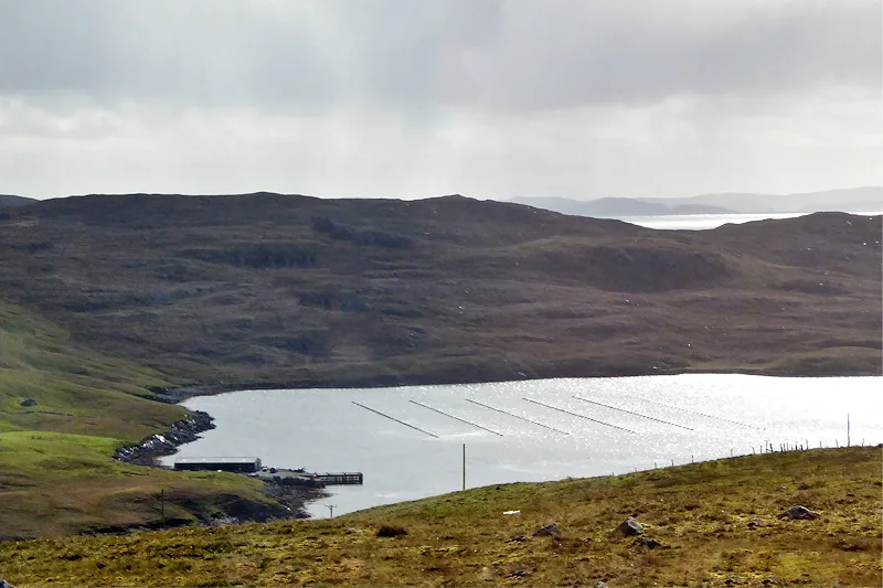
Birka Vird — a hill or mountain in scotland islands.

Rude Health — CC BY-SA 2.0 via Wikimedia Commons licence
Plan your visit
- Typical visit
- 3 h–8 h
- Best time of year
- Late spring – early autumn (May–Oct)
About
A British hill or mountain, named on Ordnance Survey maps and walked by hill-baggers. Birka Vird is a named hill or mountain in scotland islands, recorded in the GeoNames UK gazetteer. British landmarks of this type are typically marked on Ordnance Survey maps and recorded in the national gazetteer for cartographic and navigational reference. Coordinates and feature classification are sourced from the GeoNames open dataset.
Photo gallery
Place summary
Birka Vird is a mountain located in the Scottish Islands. It is known for its rugged terrain and natural beauty, attracting outdoor enthusiasts and hikers. Visitors can expect a challenging ascent with rewarding views of the surrounding landscape. The area offers opportunities for various outdoor activities, making it a notable destination for those seeking adventure in the Scottish wilderness.
AI-generated from the structured facts on this page (operator, designation, listing, era). Not a substitute for visiting.
- Coordinates
- 60.4546, -1.4280
Sources
- manual: geonames-12611735 (CC BY 4.0)
Other places nearby
Loading nearby places…
Nearby
📷 5Mountains & hills · Scottish Islands
Birka Vird
Birka Vird — mountain in scotland islands. Elevation: 120 m.
 📷 3
📷 3Vineyards · Scottish Islands
Gunnister
Gunnister in Orkney + Shetland, United Kingdom.
 📷 5
📷 5Mountains & hills · Scottish Islands
Soolmis Vird
Soolmis Vird — a hill or mountain in scotland islands.
📷 5Mountains & hills · Scottish Islands
Soolmis Vird
Soolmis Vird — mountain in scotland islands. Elevation: 133 m.
 📷 3
📷 3Mountains & hills · Scottish Islands
Hamar Voe
Hamar Voe — bay on North Mainland, Shetland Islands, Scotland, UK.
 📷 5
📷 5Mountains & hills · Scottish Islands
The Hamars of Burraland
The Hamars of Burraland — mountain in scotland islands. Elevation: 122 m.
Where to eat & stay near Birka Vird
Places to stay
 📷 5
📷 5Caravan parks · Scottish Islands
Braewick Caravan Park
Braewick Caravan Park — a caravan park in scotland islands.
 📷 5
📷 5Hostels · Scottish Islands
The Sail Loft
The Sail Loft — a hostel in scotland islands.
 📷 5
📷 5Campsites · Scottish Islands
Burravoe Pier Trust Campsite
Burravoe Pier Trust Campsite — a campsite in scotland islands.
 📷 5
📷 5Hostels · Scottish Islands
Wind Lodge Bod
Wind Lodge Bod — a hostel in scotland islands.


More mountains in this region
 📷 3
📷 3Mountains & hills · Scottish Islands
Aikerness Bay
Aikerness Bay — bay in Orkney Islands, Scotland, UK.
 📷 3
📷 3Mountains & hills · Scottish Islands
Aith Hope
Aith Hope — bay in Orkney Islands, Scotland, UK.

Mountains & hills · Scottish Islands
Aith Voe
Aith Voe — bay on West Mainland, Shetland Islands, Scotland, UK.
 📷 3
📷 3Mountains & hills · Scottish Islands
Aith Voe
Aith Voe — bay on South Mainland, Shetland Islands, Scotland, UK.
Frequently asked questions
- Where is Birka Vird?
- Birka Vird is in the Scottish Islands, United Kingdom.
- What is Birka Vird?
- Birka Vird — a hill or mountain in scotland islands.
- How do I get to Birka Vird?
- Its coordinates are 60.4546°, -1.4280°.