
Towns & cities · East Midlands
Billinghay
Billinghay — village and civil parish in North Kesteven, Lincolnshire, United Kingdom.

Wikimedia Commons contributors — see linked file page for photographer and licence licence

Plan your visit
- Typical visit
- 3 h–6 h
- Nearest railway station
- Ruskington · 7.9 km
- Free entry
- Family-friendly
- Dog-friendly
Getting there & planning your visit
To visit Billinghay, the nearest railway station is Ruskington, which is 7.9 km away. The postcode for Billinghay is LN4 4ED. Entry to the town is free.
About
Billinghay is a town, city, village or settlement in the United Kingdom. Recent population estimates put it at around 1,808 people. Wikidata describes it as: "village and civil parish in North Kesteven, Lincolnshire, United Kingdom". Coordinates: 53.0792°, -0.2811°.
Photo gallery
From the Wikipedia article
Billinghay is a village and civil parish in the North Kesteven district of Lincolnshire, England. The village is situated approximately 7 miles (11 km) north-east from Sleaford, and lies on the B1189 Walcott road near its junction with the A153. Just south of the village towards Sleaford is North Kyme. According to the 2001 census the parish had a population of 1,808, increasing to 2,190 at the 2011 census, increasing to 2,203 at the 2021 census. The settlement is mentioned in the Domesday Book. The name originates from a Saxon name for a fishery. The topography in ancient times would have been that of a small settlement on a gravel mound surrounded by marsh which was flooded in winter. After the draining of the fens in the late 18th century the area became rich agricultural land as it is today. Billinghay parish church is an Anglican church dedicated to St Michael and All Angels. It dates from the 12th, 13th, 14th and 15th centuries, with some later additions, and parts of it have been rebuilt. It is a Grade I listed structure. The parish is part of the Carr Dyke group of parishes, which also includes churches at Martin, North Kyme, South Kyme and Walcott. After the phased closure of Lafford High School due to falling pupil numbers between 2008 and 2010, Billinghay Primary School remains the only school in the village. It is a voluntary controlled Church of England school, which has close ties with the Church of England, but responsibility for employing staff and maintaining the building remains with the local authority. In 1986 village was twinned with Ballon, in the Sarthe department of France.
Excerpt from Wikipedia under CC BY-SA 4.0. See the source article linked in Sources below.
- Coordinates
- 53.0792, -0.2811
- County
- Lincolnshire
- District
- North Kesteven
- Parish
- Billinghay
- Postcode
- LN4 4ED
- Parliamentary constituency
- Sleaford and North Hykeham
- Population
- 1,808
- Nearest railway station
- Ruskington — 7.9 km
Sources
- wikidata: Q628445 (CC0)
- wikipedia: Billinghay (CC BY-SA 4.0)
- commons: St Michael and All Angels, Billinghay - geograph.org.uk - 104772.jpg (CC BY-SA 4.0)
Other places nearby

Billinghay War Memorial
Memorials & monuments · 0.3 km

North Kyme War Memorial
Memorials & monuments · 2.2 km

North Kyme
Historic churches · 2.2 km

North Kyme Market Cross
Historic houses · 2.3 km

Walcott War Memorial
Memorials & monuments · 2.7 km
Walcott, Lincolnshire
Historic churches · 2.7 km

Walcott
Villages · 2.7 km

Catley Priory
Abbeys & priories · 3.4 km
Royal Oak Mobile Home Park
Caravan parks · 4.5 km

Timberland, Lincolnshire
Historic churches · 4.8 km

Timberland
Villages · 4.9 km

Kyme Priory
Historic churches · 5.4 km
Billinghay is a town in Lincolnshire, located within the East Midlands region. Visitors can explore notable sites such as Kyme Priory and the historic Kyme Tower. The area also offers opportunities to see RAF Metheringham and the local war memorial.
At a glance
- Population
- 1,808
- Administrative county
- Lincolnshire
- Constituency
- Sleaford and North Hykeham
- Top categories near here
Things to see in Billinghay
26 attractions within 12 km — showing the 24 most editorially-significant. Full guide: things to do in Billinghay →
 📷 5
📷 5Archaeological sites · East Midlands
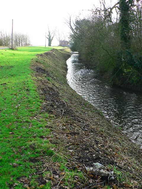
Car Dyke at Linwood Hall
Car Dyke at Linwood Hall — archaeological site in Blankney, North Kesteven, England, UK.
 📷 3
📷 3Museums · East Midlands
Metheringham Airfield Visitor Centre
Metheringham Airfield Visitor Centre — a museum in East Midlands, United Kingdom.
 📷 3
📷 3Castles · East Midlands
Kyme Tower
Kyme Tower — a castle in East Midlands, United Kingdom.
📷 3Historic houses · East Midlands
North Kyme Market Cross
North Kyme Market Cross — a Grade II-listed historic house in england-east-midlands, United Kingdom.
📷 3Memorials & monuments · East Midlands
Billinghay War Memorial
Billinghay War Memorial — Grade II listed building-listed memorial in england-east-midlands, United Kingdom.
 📷 3
📷 3Memorials & monuments · East Midlands
Martin War Memorial
Martin War Memorial — Grade II listed building-listed memorial in england-east-midlands, United Kingdom.
📷 3Memorials & monuments · East Midlands
Walcott War Memorial
Walcott War Memorial — Grade II listed building-listed memorial in england-east-midlands, United Kingdom.
📷 3Memorials & monuments · East Midlands
North Kyme War Memorial
North Kyme War Memorial — Grade II listed building-listed memorial in england-east-midlands, United Kingdom.
 📷 3
📷 3Memorials & monuments · East Midlands
Chapel Hill War Memorial
Chapel Hill War Memorial — Grade II listed building-listed memorial in england-east-midlands, United Kingdom.
 📷 5
📷 5 📷 5
📷 5Other places · East Midlands
Dogdyke Pumping Station
Dogdyke Pumping Station — a other in england-east-midlands, United Kingdom.
 📷 5
📷 5 📷 5
📷 5Museums · East Midlands
RAF Metheringham
RAF Metheringham — a museum in england-east-midlands, United Kingdom.
📷 5Historic churches · East Midlands
Kyme Priory
Kyme Priory was a priory in South Kyme, Lincolnshire, England. What remains of the buildings are now part of Saint Mary and All Saints Church. The Augustinian Priory of Kyme was founded by Philip of K
📷 5Historic churches · East Midlands
North Kyme
North Kyme is a village and civil parish in the North Kesteven district of Lincolnshire, England. The civil parish had a population of 431 at the 2011 census. It is situated on the A153 road, and 16
📷 5Historic churches · East Midlands
Timberland, Lincolnshire
Timberland is a village in the North Kesteven district of Lincolnshire, England. The population of the civil parish (including Thorpe Tilney) at the 2011 census was 578. It is situated 12 miles (19 k
📷 5Historic churches · East Midlands
Walcott, Lincolnshire
Walcott, Lincolnshire — a church in england-east-midlands, United Kingdom.
 📷 5
📷 5Campsites · East Midlands
Riverview Caravan Park
Riverview Caravan Park — a campsite in england east midlands.
 📷 3
📷 3Campsites · East Midlands
Bailey Bridge Farm
Bailey Bridge Farm — a campsite in england east midlands.
 📷 5
📷 5Caravan parks · East Midlands
Tattershall Lakes
Tattershall Lakes — a caravan park in england east midlands. Brand: Away Resorts.
📷 5📷 5 📷 5
📷 5 📷 5
📷 5Nearby
📷 3Memorials & monuments · East Midlands
Billinghay War Memorial
Billinghay War Memorial — Grade II listed building-listed memorial in england-east-midlands, United Kingdom.
📷 3Memorials & monuments · East Midlands
North Kyme War Memorial
North Kyme War Memorial — Grade II listed building-listed memorial in england-east-midlands, United Kingdom.
📷 5Historic churches · East Midlands
North Kyme
North Kyme is a village and civil parish in the North Kesteven district of Lincolnshire, England. The civil parish had a population of 431 at the 2011 census. It is situated on the A153 road, and 16
📷 3Historic houses · East Midlands
North Kyme Market Cross
North Kyme Market Cross — a Grade II-listed historic house in england-east-midlands, United Kingdom.
📷 3Memorials & monuments · East Midlands
Walcott War Memorial
Walcott War Memorial — Grade II listed building-listed memorial in england-east-midlands, United Kingdom.
📷 5Historic churches · East Midlands
Walcott, Lincolnshire
Walcott, Lincolnshire — a church in england-east-midlands, United Kingdom.
Where to eat & stay near Billinghay
Places to stay
Caravan parks · East Midlands
Royal Oak Mobile Home Park
Royal Oak Mobile Home Park — a caravan park in england east midlands.
📷 5Campsites · East Midlands
Riverview Caravan Park
Riverview Caravan Park — a campsite in england east midlands.
📷 5Caravan parks · East Midlands
Tattershall Lakes
Tattershall Lakes — a caravan park in england east midlands. Brand: Away Resorts.
 📷 5
📷 5Campsites · East Midlands
Willow Holt C. & C.
Willow Holt C. & C. — a campsite in england east midlands.
 📷 5
📷 5Campsites · East Midlands
Freedom Camping Club
Freedom Camping Club — a campsite in england east midlands.
 📷 5
📷 5Caravan parks · East Midlands
Petwood Caravan Park
Petwood Caravan Park — a caravan park in england east midlands.
Places to eat & drink
 📷 5
📷 5Historic pubs · East Midlands
Fortescue Arms And Coach House
Fortescue Arms And Coach House in England East, United Kingdom.
 📷 5
📷 5Historic pubs · East Midlands
Abbey Lodge Inn
Abbey Lodge Inn in England East, United Kingdom.
 📷 5
📷 5Historic pubs · East Midlands
Lea Gate Public House
Lea Gate Public House in England East, United Kingdom.
 📷 5
📷 5Historic pubs · East Midlands
Star And Garter Public House
Star And Garter Public House in England East, United Kingdom.
 📷 5
📷 5Historic pubs · East Midlands
Nag's Head Public House
Nag's Head Public House in England East, United Kingdom.
 📷 7
📷 7Historic pubs · East Midlands
The Marquis Of Granby Public House And Attached Outbuildings
The Marquis Of Granby Public House And Attached Outbuildings in England East, United Kingdom.
More towns in this region
 📷 5
📷 5 📷 5
📷 5Towns & cities · East Midlands
Marholm
Marholm — village and civil parish in Cambridgeshire, UK.
 📷 5
📷 5Towns & cities · East Midlands
Thornhaugh
Thornhaugh — village and civil parish in Cambridgeshire, UK.
 Flagship📷 4
Towns & cities · East Midlands
Austerfield
Austerfield — village and civil parish in South Yorkshire, England, UK.
Frequently asked questions
- Where is Billinghay?
- Billinghay is in Lincolnshire, the East Midlands, United Kingdom (postcode LN4 4ED), in the parish of Billinghay.
- What is Billinghay?
- Billinghay — village and civil parish in North Kesteven, Lincolnshire, United Kingdom.
- How do I get to Billinghay?
- The nearest railway station is Ruskington, about 7.9 km away. Drivers can use postcode LN4 4ED.
- Is Billinghay free to visit?
- Yes, Billinghay is free to enter.
- How do I get to Billinghay?
- The nearest railway station is Ruskington, about 7.9 km away. Drivers can navigate to postcode LN4 4ED.