
Natural landmarks · South East England
Belmont Prep School
In or near Effingham.
Belmont Prep School — a school heritage in england-south-east, United Kingdom.

Tansy Forrest-Takano — CC BY-SA 2.0 via Wikimedia Commons licence

Plan your visit
- Typical visit
- 1 h–2 h
- Nearest railway station
- Gomshall · 4.2 km
- Free entry
- Dog-friendly
About
Belmont Prep School is a school heritage located in england-south-east, United Kingdom. Catalogued from Wikidata's UK heritage register; see the Wikipedia article for further historical and visitor details.
Photo gallery
Protected designations
- Site of Special Scientific Interest: Leith Hill SSSI
- Area of Outstanding Natural Beauty: Surrey Hills
Designations sourced from Natural England open data under OGL v3.
Place summary
Belmont Prep School is located in South-East England. The school provides education for younger students, focusing on a well-rounded curriculum. It is notable for its commitment to academic excellence and personal development.
AI-generated from the structured facts on this page (operator, designation, listing, era). Not a substitute for visiting.
Background
History
Belmont School was founded in 1880 in Blackheath, London. It subsequently moved to the village of Westcott, Surrey and, in the mid-1950s, under the tenure of headmaster Frank Sharples, it moved to its current location at Holmbury St Mary. The current site is a former country house, called Feldemore. It was built for Edwin Waterhouse, co-founder of the accountancy practice of Price Waterhouse and was designed by the architects, George Tunstal Redmayne and Alfred Waterhouse. Before being sold to the owners of the school, the house had been requisitioned by the British Army during the Second World War and, following the end of hostilities, it was leased for ten years by the Admiralty.…
Sourced from Wikipedia under CC BY-SA 4.0.
- Coordinates
- 51.1891, -0.4060
- County
- Surrey
- District
- Mole Valley
- Parish
- Abinger
- Postcode
- RH5 6DS
- Parliamentary constituency
- Dorking and Horley
- Established
- 1880
- Nearest railway station
- Gomshall — 4.2 km
Sources
- wikidata: Q4884407 (CC0)
- wikipedia: Belmont School, Surrey (CC BY-SA 4.0)
Other places nearby

Holmbury St Mary
Villages · 0.4 km
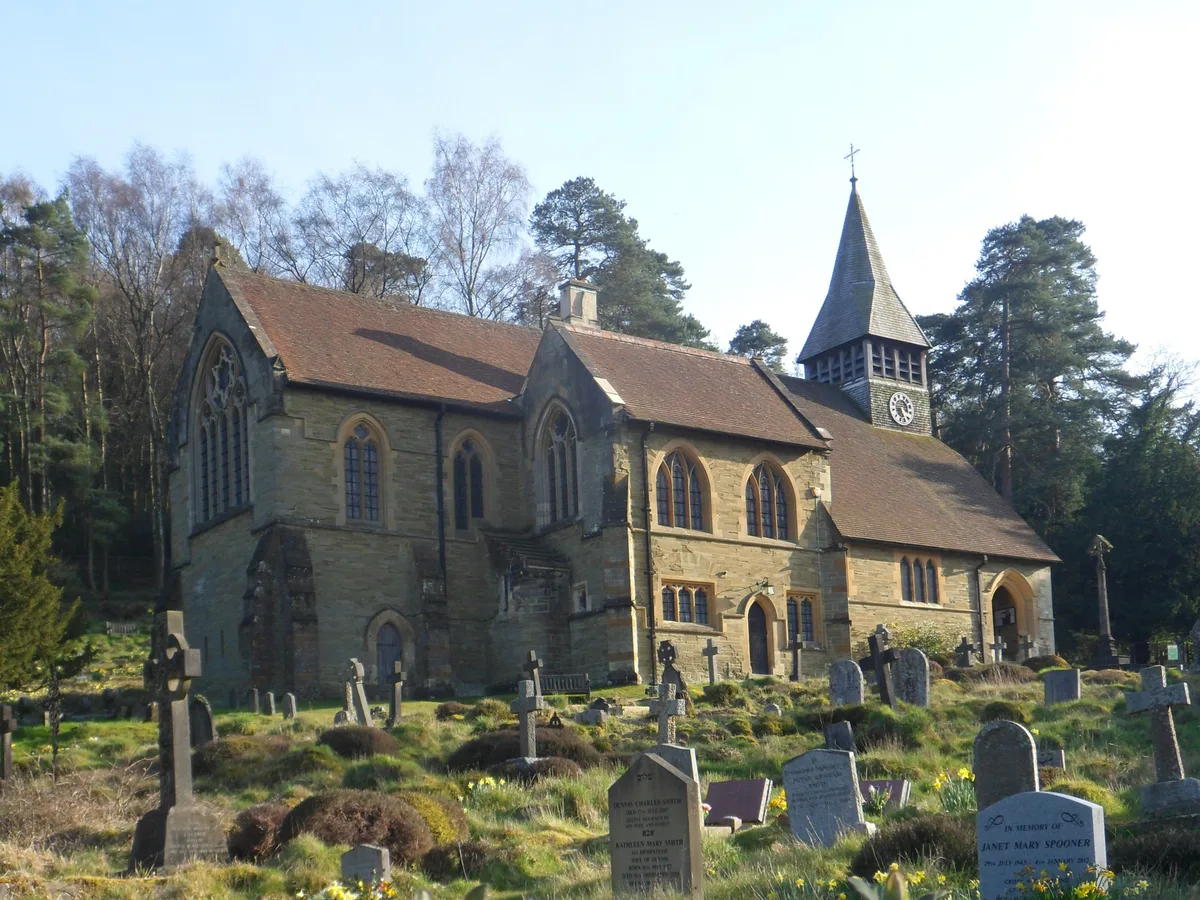
St Mary The Virgins Church
Historic churches · 0.5 km

Hill Fort at Felday
Hill forts · 0.7 km

Large Univallate Hillfort at Felday
Vineyards · 0.7 km

Au Natural
Mountain bike trails · 0.8 km
Tumnus Strikes Back
Mountain bike trails · 1.0 km
Tumnus Strikes Back
Mountain bike trails · 1.0 km

Telegraph Row
Mountain bike trails · 1.0 km
Telegraph Row
Mountain bike trails · 1.0 km

Pasture Wood - Hurt Wood to Leith Hill
Mountain bike trails · 1.0 km
Mutiny
Mountain bike trails · 1.0 km

Woodhouse Copse
Historic houses · 1.1 km
Nearby
📷 5📷 5Historic churches · South East England
St Mary The Virgins Church
St Mary The Virgins Church — church in Borough of Guildford, Surrey, England, UK.
📷 5Hill forts · South East England
Hill Fort at Felday
Hill Fort at Felday — a hill fort in england-south-east, United Kingdom.
📷 5Vineyards · South East England
Large Univallate Hillfort at Felday
Large Univallate Hillfort at Felday — a UK vineyard in england south east, producing English or Welsh wine from cool-climate grape varieties.
📷 5📷 5Mountain bike trails · South East England
Tumnus Strikes Back
Tumnus Strikes Back — a mtb trail in england south east.
Where to eat & stay near Belmont Prep School
Places to stay
📷 5Hostels · South East England
Hurtwood Hideout
Hurtwood Hideout — a hostel in england south east.
 📷 5
📷 5 📷 5
📷 5 📷 7
📷 7 📷 5
📷 5 📷 5
📷 5Campsites · South East England
Bentley Copse Activity Centre
Bentley Copse Activity Centre — a campsite in england south east.
Places to eat & drink
 📷 5
📷 5Historic pubs · South East England
The Old School Public House
The Old School Public House in England South East, United Kingdom.
 📷 5
📷 5Historic pubs · South East England
The Scarlett Arms Public House
The Scarlett Arms Public House in England South East, United Kingdom.
 📷 7
📷 7 📷 7
📷 7Historic pubs · South East England
Duke Of Wellington Public House
Duke Of Wellington Public House in England South East, United Kingdom.
 📷 7
📷 7Historic pubs · South East England
The Bulls Head Public House
The Bulls Head Public House in England South East, United Kingdom.
 📷 5
📷 5Historic pubs · South East England
The Windsor Castle Public House
The Windsor Castle Public House in England South East, United Kingdom.
More natural landmarks in this region
 📷 5
📷 5Natural landmarks · South East England
Queen Victoria Statue
Queen Victoria Statue — Public artwork (statue) by Victor Ferdinand Franz Eugen Gustaf Adolf Constantin Friedrich of Hohenlohe-Langenburg.
 📷 5
📷 5Natural landmarks · South East England
Silent Pool
Silent Pool — lake in the United Kingdom.
 📷 5
📷 5Natural landmarks · South East England
Thomas & Jane Holloway Statue
Thomas & Jane Holloway Statue — Public artwork (statue) by Victor Ferdinand Franz Eugen Gustaf Adolf Constantin Friedrich of Hohenlohe-Langenburg.
 📷 5
📷 5Natural landmarks · South East England
Polesden Lacey
Polesden Lacey — a other in england-london, United Kingdom.
Frequently asked questions
- Where is Belmont Prep School?
- Belmont Prep School is in Surrey, South-East England, United Kingdom (postcode RH5 6DS), in the parish of Abinger.
- What is Belmont Prep School?
- Belmont Prep School — a school heritage in england-south-east, United Kingdom.
- How do I get to Belmont Prep School?
- The nearest railway station is Gomshall, about 4.2 km away. Drivers can use postcode RH5 6DS.
- When was Belmont Prep School built?
- Built or established in 1880.
- Is Belmont Prep School a protected site?
- Yes — Belmont Prep School is part of the Leith Hill SSSI Site of Special Scientific Interest and the Surrey Hills National Landscape (AONB).
- Is Belmont Prep School free to visit?
- Yes, Belmont Prep School is free to enter.
- How do I get to Belmont Prep School?
- The nearest railway station is Gomshall, about 4.2 km away. Drivers can navigate to postcode RH5 6DS.