Natural landmarks · Scottish Highlands
Beinn Spionnaidh
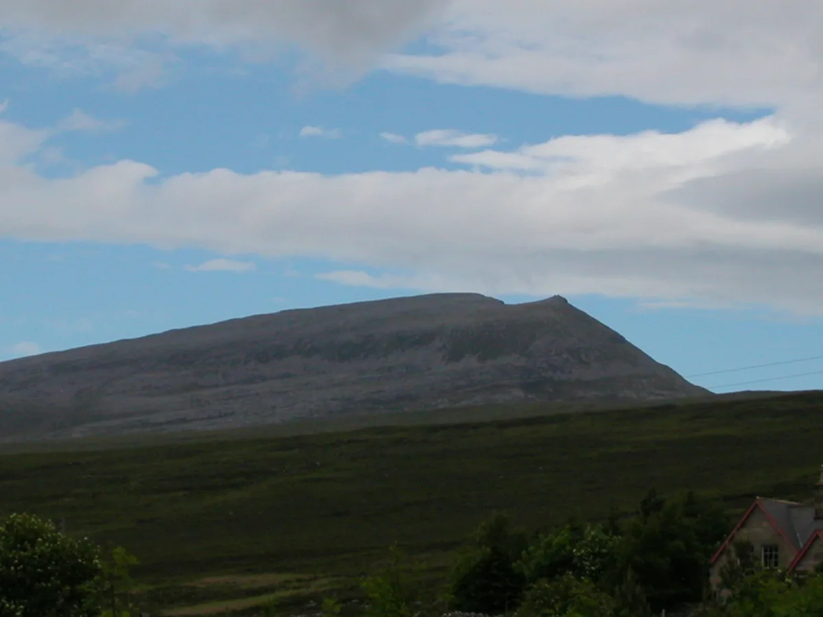
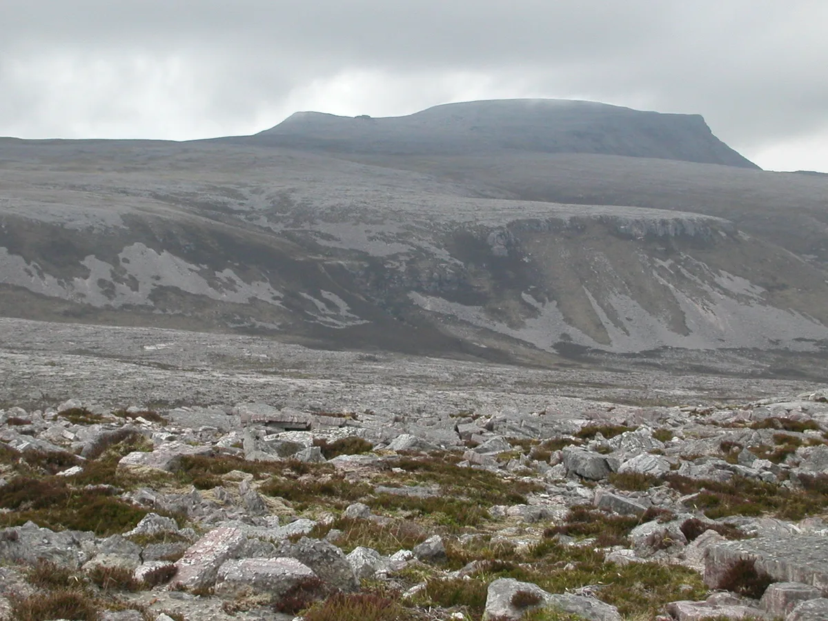
Beinn Spionnaidh — 773m high mountain in Highland, Scotland, UK.

Wikimedia Commons contributors — see linked file page for photographer and licence licence
Plan your visit
- Typical visit
- 1 h–2 h
- Free entry
- Dog-friendly
About
Beinn Spionnaidh is a named natural landmark in the United Kingdom. Wikidata describes it as: "773m high mountain in Highland, Scotland, UK". Coordinates: 58.4730°, -4.8105°.
Photo gallery
From the Wikipedia article
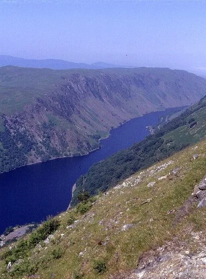
Beinn Spionnaidh is a mountain of 773m in Sutherland at the northwestern tip of the Scottish Highlands, making it the most northerly mountain in Scotland and Great Britain. It is a Corbett located west of Loch Eriboll and northeast of Cranstackie and Foinaven. It is like its neighbours in that the top, a 1 km long whaleback running southwest to northeast, is covered with loose, broken quartzite. A steep spur to the northwest, Cioch Mhor, provides one route to the top, and good views of the Kyle of Durness; the gentler slope to the southeast is tiring due to the loose rock on the upper section.
Excerpt from Wikipedia under CC BY-SA 4.0. See the source article linked in Sources below.
- Coordinates
- 58.4730, -4.8105
- Address
- Assynt, Scotland
Sources
- wikidata: Q3398053 (CC0)
- wikipedia: Beinn Spionnaidh (CC BY-SA 4.0)
- commons: Beinn Spionnaidh from Loch Eriboll.jpg (CC BY-SA 4.0)
Other places nearby
Loading nearby places…
Nearby
 📷 3
📷 3Mountains & hills · Scottish Highlands
Beinn Spionnaidh
Beinn Spionnaidh — Named summit at 773 m.
 📷 3
📷 3Mountains & hills · Scottish Highlands
Cranstackie
Cranstackie — Named summit at 801 m.
 📷 3
📷 3Natural landmarks · Scottish Highlands
Cranstackie
Cranstackie — 801m high mountain in Highland, Scotland, UK.
 📷 5
📷 5Mountains & hills · Scottish Highlands
Meall nan Cra
Meall nan Cra — a hill or mountain in scotland highlands.
 📷 5
📷 5Historic bridges · Scottish Islands
Bridge, Drochaid Mhor
Bridge, Drochaid Mhor — category B listed building-listed bridge in scotland-islands, United Kingdom.
 📷 5
📷 5Historic bridges · Scottish Highlands
Bridge, Polla
Bridge, Polla — category C listed building-listed bridge in scotland-highlands, United Kingdom.
Where to eat & stay near Beinn Spionnaidh
Places to stay
 📷 5
📷 5Caravan parks · Scottish Highlands
Choraidh Croft
Choraidh Croft — a caravan park in scotland highlands.
 📷 5
📷 5Caravan parks · Scottish Islands
Balnakeil Motorhome Stopover
Balnakeil Motorhome Stopover — a caravan park in scotland islands.
 📷 5
📷 5Hostels · Scottish Islands
Lazy Crofter Bunkhouse/Hostel
Lazy Crofter Bunkhouse/Hostel — a hostel in scotland islands.
📷 5Hostels · Scottish Islands
Lazy Crofter
Lazy Crofter — a hostel in scotland islands.
 📷 5
📷 5Hostels · Scottish Islands
Durness Youth Hostel
Durness Youth Hostel — a hostel in scotland islands.
 📷 5
📷 5Campsites · Scottish Islands
Sango Sands
Sango Sands — a campsite in scotland islands.
More natural landmarks in this region
 Flagship📷 3
Natural landmarks · Scottish Highlands
Dunalastair Water
Dunalastair Water — lake in Perth and Kinross, Scotland, UK, on the River Tummel.
 Flagship📷 3
Natural landmarks · Scottish Highlands
Loch Arkaig
Loch Arkaig — lake in Highland, Scotland, UK, outflows east to River Arkaig.
 Flagship📷 3
Natural landmarks · Scottish Highlands
Loch Assynt
Loch Assynt — lake in Highland, Scotland, UK, outflows to the River Inver and Loch na Garbh Uidhe.
 Flagship📷 3
Natural landmarks · Scottish Highlands
Loch Awe
Loch Awe — lake in Argyll and Bute, Scotland, UK, outflows to the River Awe.
Frequently asked questions
- Where is Beinn Spionnaidh?
- Beinn Spionnaidh is in the Scottish Highlands, United Kingdom.
- What is Beinn Spionnaidh?
- Beinn Spionnaidh — 773m high mountain in Highland, Scotland, UK.
- How do I get to Beinn Spionnaidh?
- Its coordinates are 58.4730°, -4.8105°.
- Is Beinn Spionnaidh free to visit?
- Yes, Beinn Spionnaidh is free to enter.