Mountains & hills · Scottish Highlands
Beinn na h-Eaglaise
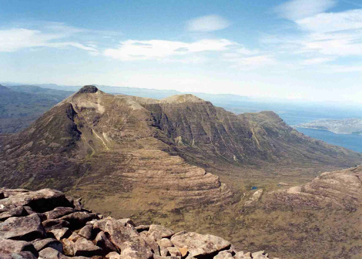
Beinn na h-Eaglaise — mountain in scotland highlands. Elevation: 737 m.

Julian Paren — CC BY-SA 2.0 via Wikimedia Commons licence
Plan your visit
- Typical visit
- 3 h–8 h
- Best time of year
- Late spring – early autumn (May–Oct)
About
Beinn na h-Eaglaise is a mountain located in scotland highlands. Elevation: 737 m. A named British peak recorded in OpenStreetMap. Peaks are typically named on Ordnance Survey 1:50k mapping.
Photo gallery
Place summary
Beinn na h-Eaglaise is a mountain located in the Scottish Highlands. It is known for its rugged terrain and scenic views typical of the region. Visitors can expect a challenging hike, with opportunities to experience the natural beauty of the Highlands. The area is popular among walkers and outdoor enthusiasts.
AI-generated from the structured facts on this page (operator, designation, listing, era). Not a substitute for visiting.
- Coordinates
- 57.5141, -5.4948
Sources
- osm: n2130099846 (ODbL)
Other places nearby
Loading nearby places…
Nearby
 📷 4
📷 4Mountains & hills · Scottish Highlands
Beinn na h-Eaglaise
Beinn na h-Eaglaise in Scotland Islands, United Kingdom.
 📷 5
📷 5Lakes · Scottish Highlands
Loch an Eoin
Loch an Eoin — a lake in scotland highlands.
 📷 5
📷 5Waterfalls · Scottish Highlands
Eas an Ruaig
Eas an Ruaig — waterfall in scotland highlands.
 📷 3
📷 3Mountains & hills · Scottish Highlands
Creagan Dubh Toll nam Biast
Creagan Dubh Toll nam Biast — a mountain in scotland-highlands, United Kingdom.
 📷 3
📷 3Natural landmarks · Scottish Highlands
Beinn Damh
Beinn Damh — mountain in Highland, Scotland, UK.
 📷 3
📷 3Mountains & hills · Scottish Highlands
Beinn Damh
Beinn Damh — Named summit at 903 m.
Where to eat & stay near Beinn na h-Eaglaise
Places to stay
 📷 5
📷 5Campsites · Scottish Highlands
Torridon Camp Site
Torridon Camp Site — a campsite in scotland highlands.
 📷 5
📷 5Hostels · Scottish Highlands
Torridon Youth Hostel
Torridon Youth Hostel — a hostel in scotland highlands.
 📷 5
📷 5Campsites · Scottish Highlands
Shieldaig Camping and Cabins
Shieldaig Camping and Cabins — a campsite in scotland highlands.
 📷 5
📷 5Campsites · Scottish Highlands
The Wee Campsite
The Wee Campsite — a campsite in scotland highlands.
📷 5Hotels · Scottish Highlands
Pathend Bed and Breakfast
Pathend Bed and Breakfast — a hotel in scotland highlands.
 📷 5
📷 5Hostels · Scottish Highlands
Gerry's Hostel
Gerry's Hostel — a hostel in scotland highlands.
More mountains in this region
 📷 3
📷 3Mountains & hills · Scottish Highlands
A' Bhuidheanach Bheag
A' Bhuidheanach Bheag — Named summit at 936 m.
 📷 3
📷 3Mountains & hills · Scottish Highlands
A' Chailleach
A' Chailleach — Named summit at 997 m.
 📷 3
📷 3Mountains & hills · Scottish Highlands
A' Chailleach
A' Chailleach — Named summit at 930 m.
 📷 3
📷 3Mountains & hills · Scottish Highlands
A' Chaoirnich
A' Chaoirnich — Named summit at 875 m.
Frequently asked questions
- Where is Beinn na h-Eaglaise?
- Beinn na h-Eaglaise is in the Scottish Highlands, United Kingdom.
- What is Beinn na h-Eaglaise?
- Beinn na h-Eaglaise — mountain in scotland highlands. Elevation: 737 m.
- How do I get to Beinn na h-Eaglaise?
- Its coordinates are 57.5141°, -5.4948°.