
Mountains & hills · Central Scotland
Beinn a' Chochuill
In or near Lochawe.
Beinn a' Chochuill — Named summit at 980 m.

Wikimedia Commons contributors — see linked file page for photographer and licence licence

Plan your visit
- Typical visit
- 3 h–8 h
- Best time of year
- Late spring – early autumn (May–Oct)
- Nearest railway station
- Loch Awe · 5.6 km
- Free entry
- Dog-friendly
About
Beinn a' Chochuill is a named summit in the United Kingdom. Wikidata describes it as: "Named summit at 980 m.". Coordinates: 56.4499°, -5.0694°.
Photo gallery
Official information
Beinn a' Chochuill is a mountain located in Scotland, known for its scenic views and hiking opportunities. Visitors can enjoy various trails leading to the summit, often combined with ascents of nearby peaks like Beinn Eunaich.
From the Wikipedia article
Beinn a' Chochuill (980 m) is a mountain in the Grampian Mountains of Scotland, located east of Loch Etive in Argyll and Bute. Somewhat hidden away by the Ben Cruachan range, it is usually climbed in conjunction with its neighbour Beinn Eunaich. It has a long summit ridge and offers views of the Cruachan range from its summit. The nearest village is Lochawe.
Excerpt from Wikipedia under CC BY-SA 4.0. See the source article linked in Sources below.
- Coordinates
- 56.4499, -5.0694
- Address
- Argyll and Bute, Scotland
- Nearest railway station
- Loch Awe — 5.6 km
Sources
- osm: n5077016253 (ODbL)
- wikipedia: Beinn a' Chochuill (CC BY-SA 4.0)
- commons: Beinn a' Chochuill - Flickr - Graham Grinner Lewis.jpg (CC BY-SA 4.0)
Other places nearby

Meall Voirlich
Mountains & hills · 2.0 km

Sron an Isean
Mountains & hills · 2.0 km

Meall Voirlich
Mountains & hills · 2.0 km

Stob Diamh - Sron An Isean
Mountains & hills · 2.0 km
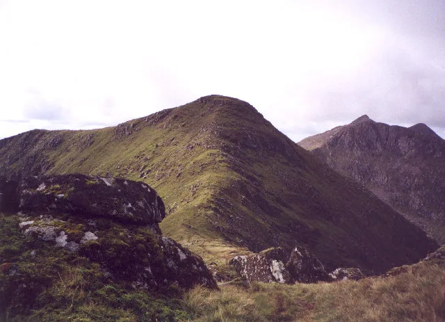
Stob Diamh
Mountains & hills · 2.5 km
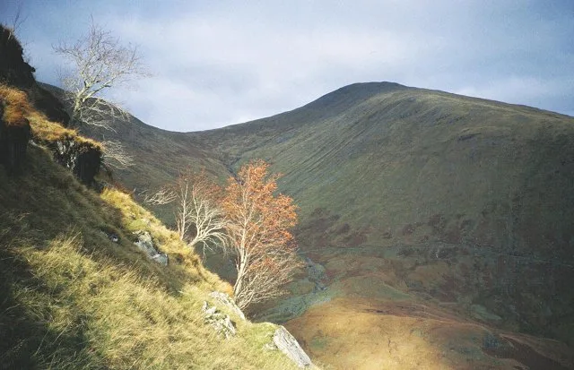
Beinn Eunaich
Mountains & hills · 2.6 km

Meall an Fheuraich
Mountains & hills · 2.8 km
Meall an Fheuraich
Mountains & hills · 2.9 km

Glen Kinglass
Gorges · 3.0 km
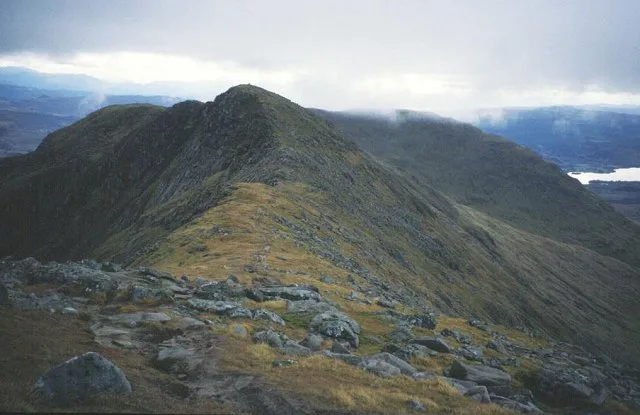
Stob Garbh
Mountains & hills · 3.0 km

Stob Diamh - Stob Garbh
Mountains & hills · 3.0 km

Drochaid Ghlas
Mountains & hills · 3.3 km
Nearby
📷 5Mountains & hills · Central Scotland
Meall Voirlich
Meall Voirlich — mountain in scotland highlands. Elevation: 561 m.
📷 5Mountains & hills · Central Scotland
Sron an Isean
Sron an Isean — a hill or mountain in scotland highlands.
📷 5Mountains & hills · Central Scotland
Meall Voirlich
Meall Voirlich — a hill or mountain in scotland highlands.
📷 3Mountains & hills · Central Scotland
Stob Diamh - Sron An Isean
Stob Diamh - Sron An Isean — a mountain in scotland-highlands, United Kingdom.
📷 3📷 3Where to eat & stay near Beinn a' Chochuill
Places to stay
 📷 7
📷 7Hotels · Central Scotland
Loch Awe Hotel
Loch Awe Hotel — a hotel in scotland highlands.
 📷 5
📷 5Hotels · Central Scotland
Ardanaiseig Hotel
Ardanaiseig Hotel — a hotel in scotland highlands.
 📷 5
📷 5Caravan parks · Central Scotland
Loch Awe Holiday Park
Loch Awe Holiday Park — a caravan park in scotland highlands.
 📷 5
📷 5 📷 5
📷 5Caravan parks · Central Scotland
Oban Camping & Caravanning Club Site
Oban Camping & Caravanning Club Site — a caravan park in scotland highlands.
 📷 5
📷 5Caravan parks · Central Scotland
Creagan Station Tourers Camper Site
Creagan Station Tourers Camper Site — a caravan park in scotland highlands.
Places to eat & drink
 📷 3
📷 3Historic pubs · Central Scotland
Ardbrecknish House
Ardbrecknish House — Historic pub — listed building or notable heritage status.
 📷 4
📷 4Historic pubs · Scottish Highlands
Clachaig Inn
Clachaig Inn in Scotland Islands, United Kingdom.
More mountains in this region
 📷 3
📷 3 📷 3
📷 3 📷 3
📷 3Mountains & hills · Central Scotland
An Caisteal
An Caisteal — Named summit at 995 m.
 📷 5
📷 5Frequently asked questions
- Where is Beinn a' Chochuill?
- Beinn a' Chochuill is in the Scottish Highlands, United Kingdom.
- What is Beinn a' Chochuill?
- Beinn a' Chochuill — Named summit at 980 m.
- How do I get to Beinn a' Chochuill?
- The nearest railway station is Loch Awe, about 5.6 km away. Its coordinates are 56.4499°, -5.0694°.
- Is Beinn a' Chochuill free to visit?
- Yes, Beinn a' Chochuill is free to enter.
- How do I get to Beinn a' Chochuill?
- The nearest railway station is Loch Awe, about 5.6 km away.