
Marinas · East of England
Beaumont Quay, Hamford Water: a 19th century quay and lime kiln
In or near Wix.
Beaumont Quay, Hamford Water: a 19th century quay and lime kiln — a marina in england east.

Bob Jones — CC BY-SA 2.0 via Wikimedia Commons licence

Plan your visit
- Typical visit
- 30 min–1 h
- Nearest railway station
- Thorpe-le-Soken · 2.9 km
About
Beaumont Quay, Hamford Water: a 19th century quay and lime kiln is a marina located in england east. A British marina providing moorings, fuel, chandlery and shore facilities for sail and motor craft. Most also welcome visiting boaters. quay in Essex, England, UK
Photo gallery
See it from the streetimagery from 2023
Imagery © Mapillary contributors, CC BY-SA 4.0
Protected designations
- Site of Special Scientific Interest: Hamford Water SSSI
- National Nature Reserve: HAMFORD WATER
- Ramsar wetland: Hamford Water
Designations sourced from Natural England open data under OGL v3.
Place summary
Beaumont Quay, located in the East of England, is a 19th century quay and lime kiln. This marina offers insights into the region's industrial past, particularly its limestone processing. The quay serves as a point of interest for those exploring the coastal landscape and maritime heritage of Hamford Water. Visitors can expect a tranquil setting with opportunities for boating and observing local wildlife.
AI-generated from the structured facts on this page (operator, designation, listing, era). Not a substitute for visiting.
- Coordinates
- 51.8716, 1.1793
- County
- Essex
- District
- Tendring
- Parish
- Beaumont-cum-Moze
- Postcode
- CO16 0BB
- Parliamentary constituency
- Clacton
- Nearest railway station
- Thorpe-le-Soken — 2.9 km
Sources
- wikidata: Q17666040 (CC0)
Other places nearby

Beaumont Cut
Canals · 0.0 km
Rose
Museums · 0.1 km

East Coast Distillery
Distilleries · 0.8 km
.jpg?width=1200)
Beaumont Hall
Historic houses · 1.2 km

Elm Farm Country Park
Caravan parks · 1.9 km

Thorpe le Soken Village Sign
Public art & sculpture · 2.0 km

Mill House B&B
B&Bs · 2.0 km

Thorpe le Soken
Villages · 2.0 km

Comarques
Gardens · 2.0 km
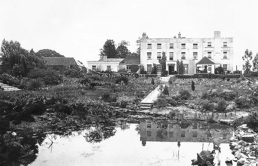
Thorpe Hall
Stately homes · 2.3 km

Skipper's Island
Forests & woodlands · 2.5 km

Grange Farm Campsite
Campsites · 2.6 km
Nearby
📷 3📷 5📷 3Distilleries · East of England
East Coast Distillery
East Coast Distillery — Whisky/spirit distillery.
📷 3Historic houses · East of England
Beaumont Hall
Beaumont Hall — house in Beaumont-cum-Moze, Essex, England, UK.
📷 5Caravan parks · East of England
Elm Farm Country Park
Elm Farm Country Park — a caravan park in england east.
📷 3Public art & sculpture · East of England
Thorpe le Soken Village Sign
Thorpe le Soken Village Sign — a public art in East of England, United Kingdom.
Where to eat & stay near Beaumont Quay, Hamford Water: a 19th century quay and lime kiln
Places to stay
📷 5Caravan parks · East of England
Elm Farm Country Park
Elm Farm Country Park — a caravan park in england east.
📷 6📷 5Campsites · East of England
Grange Farm Campsite
Grange Farm Campsite — a campsite in england east.
 📷 5
📷 5 📷 3
📷 3Caravan parks · East of England
Brokhowse
Brokhowse — a caravan park in england east.
 📷 5
📷 5Caravan parks · East of England
Homestead Lake
Homestead Lake — a caravan park in england east.
Places to eat & drink
 📷 7
📷 7Historic pubs · East of England
The Red Lion Public House
The Red Lion Public House in England East, United Kingdom.
 📷 5
📷 5Historic pubs · East of England
The Trafalgar Public House
The Trafalgar Public House in England East, United Kingdom.
 📷 7
📷 7Restaurants · East of England
The Creek
The Creek — a restaurant in england east.
 📷 5
📷 5Historic pubs · East of England
The British Flag Public House
The British Flag Public House in England East, United Kingdom.
 📷 5
📷 5 📷 5
📷 5Restaurants · East of England
Thai Up at the Quay
Thai Up at the Quay — a restaurant in england east.
More places in this region
 📷 5
📷 5 📷 5
📷 5 📷 5
📷 5 📷 5
📷 5Marinas · East of England
Port of Felixstowe
Port of Felixstowe — a marina in england east.
Frequently asked questions
- Where is Beaumont Quay, Hamford Water: a 19th century quay and lime kiln?
- Beaumont Quay, Hamford Water: a 19th century quay and lime kiln is in Essex, East of England, United Kingdom (postcode CO16 0BB), in the parish of Beaumont-cum-Moze.
- What is Beaumont Quay, Hamford Water: a 19th century quay and lime kiln?
- Beaumont Quay, Hamford Water: a 19th century quay and lime kiln — a marina in england east.
- How do I get to Beaumont Quay, Hamford Water: a 19th century quay and lime kiln?
- The nearest railway station is Thorpe-le-Soken, about 2.9 km away. The nearest town is Wix. Drivers can use postcode CO16 0BB.
- Is Beaumont Quay, Hamford Water: a 19th century quay and lime kiln a protected site?
- Yes — Beaumont Quay, Hamford Water: a 19th century quay and lime kiln is part of the Hamford Water SSSI Site of Special Scientific Interest and the HAMFORD WATER National Nature Reserve.
- How do I get to Beaumont Quay, Hamford Water: a 19th century quay and lime kiln?
- The nearest railway station is Thorpe-le-Soken, about 2.9 km away. Drivers can navigate to postcode CO16 0BB.